White Earth Bay in Mountrail County, North Dakota — The American Midwest (Upper Plains)
White Earth Bay
Lewis and Clark in North Dakota
Photographed by Barry Swackhamer, July 23, 2025
1. White Earth Bay Marker
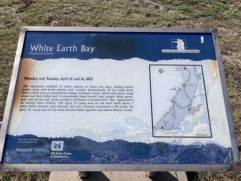
The expedition paddled 41 miles upriver in these two days, finding better water, large and fertile plains, and "woody' bottomlands. At the Little Knife River, Clark saw an Assiniboine Indian antelope corral, Above that point, large trees had been felled and "a remarkable large beaver" was caught. Many geese, teal, and ducks and "great numbers of Grouse or prairie hens" that "appeared to be mating" were evident. The April 15 camp was on the west bank about 7 miles above Sanish; just beyond. the river channel narrowed to 80 yards. On April 16, camp was on the west (south) bank opposite and above Beaver Creek.
Erected by US Army Corps of Engineers.
Topics and series. This historical marker is listed in this topic list: Exploration. In addition, it is included in the Lewis & Clark Expedition series list. A significant historical date for this entry is April 15, 1805.
Location. 48° 7.49′ N, 102° 43.735′ W. Marker is in White Earth Bay, North Dakota, in Mountrail County. It is at the intersection of C Street and A Street, on the right when traveling south on C Street. Touch for map. Touch for directions.

Regionally,
this page online
Other nearby markers. At least 4 other markers are within 13 miles of this marker, measured as the crow flies: Pe-Ri-Tska-Wa-Ku-Re (approx. 13 miles away); The Best of the West (approx. 13 miles away); Crow Flies High (approx. 13 miles away); Old Sanish Townsite (approx. 13 miles away).
Photographed by Barry Swackhamer, July 23, 2025
2. White Earth Bay Marker
Credits. This page was last revised on August 31, 2025. It was originally submitted on August 31, 2025, by Barry Swackhamer of Brentwood, California. This page has been viewed 71 times since then and 17 times this year. Photos: 1, 2. submitted on August 31, 2025, by Barry Swackhamer of Brentwood, California.
