North Loop in Minneapolis in Hennepin County, Minnesota — The American Midwest (Upper Plains)
Carriages, Crackers & Color TVs
Built: 1886, 1902
| — | Historic North Loop | — |
Photographed by McGhiever, June 23, 2024
1. Carriages, Crackers & Color TVs Marker
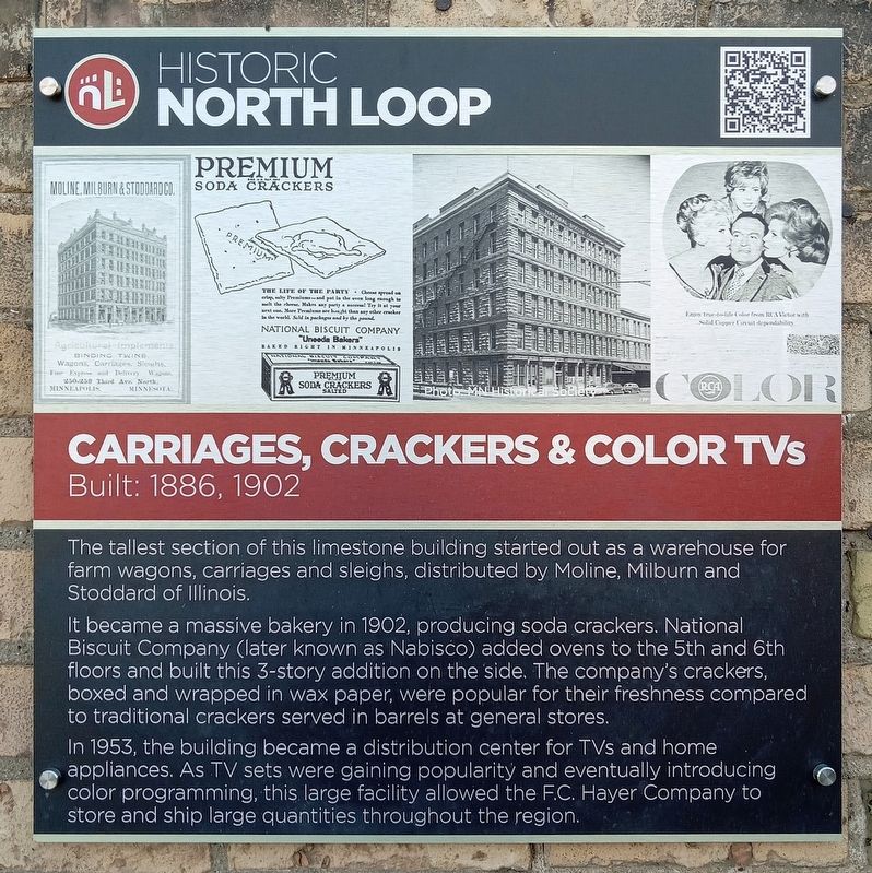
The tallest section of this limestone building started out as a warehouse for farm wagons, carriages and sleights, distributed by Moline, Milburn and Stoddard of Illinois.
It became a massive bakery in 1902, producing soda crackers. National Biscuit Company (later known as Nabisco) added ovens to the 5th and 6th floors and built this 3-story addition on the side. The company's crackers, boxed and wrapped in wax paper, were popular for their freshness compared to traditional crackers served in barrels at general stores.
In 1953, the building became a distribution center for TVs and home appliances. As TV sets were gaining popularity and eventually introducing color programming, this large facility allowed the F.C. Hayer Company to store and ship large quantities throughout the region.
Erected by North Loop Neighborhood Association.
Topics. This historical marker is listed in this topic list: Industry & Commerce. A significant historical year for this entry is 1886.
Location. 44° 59.049′ N, 93° 16.395′ W. Marker is in Minneapolis, Minnesota, in Hennepin County. It is in North Loop. It is at the intersection of
this page online

Regionally, this marker is in the Twin Cities Metropolitan Area. It is also in the American Midwest, in the Corn Belt, and in the Great River Road Region. Globally, it is in North America, the Western Hemisphere, the Western World, and the Anglosphere. Historically, it finds itself in what was once Rupert’s Land, the territory of the Mississippian Culture, and the Louisiana Purchase.
Other nearby markers. At least 8 other markers are within walking distance of this marker: Carriages to Cars (about 400 feet away, measured in a direct line); Windmills, Wagons and More (about 600 feet away); Buggy Assembly Plant (about 600 feet away); Streetcars, Groceries & Booze (about 600 feet away); Lutefisk Processing Plant (about 700 feet away); Washers & Tools (approx. 0.2 miles away); Wyman Building (approx. 0.2 miles away); Model T Assembly Plant (approx. ¼ mile away). Touch for a list and map

Photographed by McGhiever, June 23, 2024
2. Carriages, Crackers & Color TVs Marker (right) on the building's N. Traffic St. façade
Also see . . . Loop Back: From Carriages To Crackers To Color TVs (QR code on marker). (Submitted on September 1, 2025, by McGhiever of Minneapolis, Minnesota.)
Photographed by McGhiever, September 7, 2015
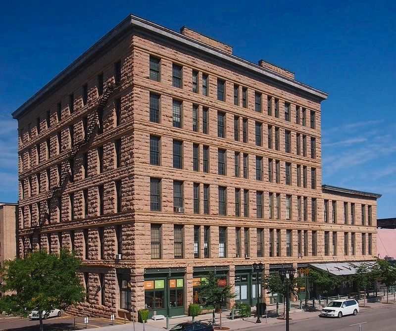
3. The building viewed from the south; the marker is around the corner on the far right
Credits. This page was last revised on September 1, 2025. It was originally submitted on September 1, 2025, by McGhiever of Minneapolis, Minnesota. This page has been viewed 83 times since then and 27 times this year. Photos: 1, 2, 3. submitted on September 1, 2025, by McGhiever of Minneapolis, Minnesota.
