Telluride in San Miguel County, Colorado — The American Mountains (Southwest)
Telluride
Photographed by Cosmos Mariner, July 18, 2025
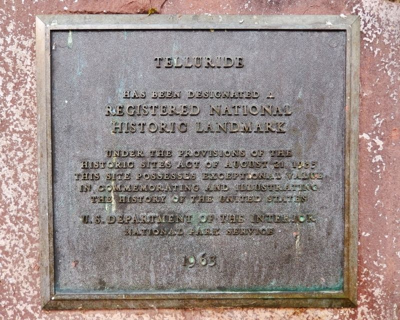
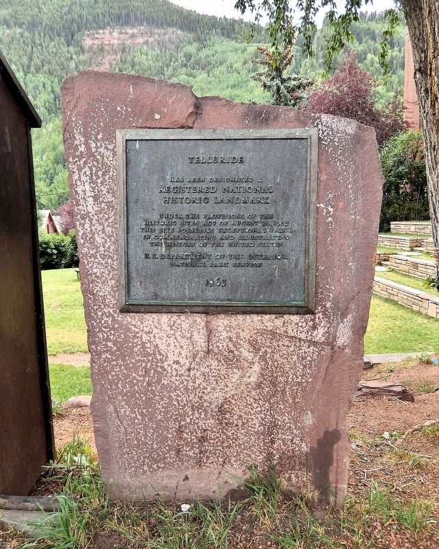
1. Telluride Marker
Registered National Historic Landmark
Under the provisions of the Historic Sites Act of August 21, 1935 this site possesses exceptional value in commemorating and illustrating the History of the United States.
National Park Service
1963
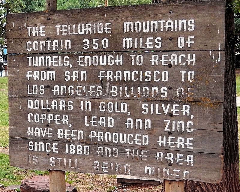
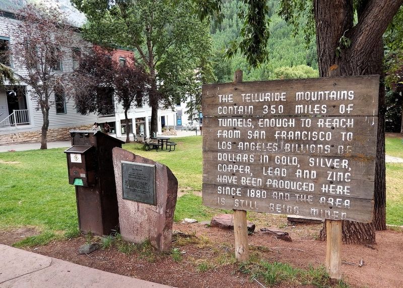
[adjacent signboard]
The Telluride mountains contain 350 miles of tunnels, enough to reach from San Francisco to Los Angeles. Billions of dollars in gold, silver, copper, lead and zinc have been produced here since 1880 and the area is still being mined.
Topics and series. This historical marker is listed in these topic lists: Architecture • Industry & Commerce • Railroads & Streetcars • Settlements & Settlers. In addition, it is included in the National Historic Landmarks, and the National Register of Historic Places (NRHP) series lists. A significant historical year for this entry is 1878.
Location. 37° 56.253′ N, 107° 48.776′ W. Marker is in Telluride, Colorado, in San Miguel County. It is at the intersection of West Colorado Avenue and Oak Street (now a pedestrian walkway), on the right when traveling east on West Colorado Avenue.
this page online

Regionally, this marker is in the Western Slope. It is also in the American Mountain West, on the Colorado Plateau, and at the Four Corners. Globally, it is in North America, the Rocky Mountains, the Western Hemisphere, the Western World, and the Anglosphere. Historically, it finds itself in what was once Mexico’s Alta California.
Other nearby markers. At least 8 other markers are within walking distance of this marker: Telluride's Founding (here, next to this marker); Transportation (a few steps from this marker); A Milestone in the History of Alternating Current (a few steps from this marker); New Sheridan Hotel (a few steps from this marker); Courthouse (within shouting distance of this marker); Colorado Centennial Project (within shouting distance of this marker); Tomboy Mine Office (within shouting distance of this marker); a different marker also named New Sheridan Hotel (within shouting distance
Photographed by Cosmos Mariner, July 18, 2025
2. Telluride Marker (adjacent signboard)
Regarding Telluride. National Register of Historic Places № 66000256 and Colorado State Register of Historic Places Site № 5SM.752.
From the National Register Nomination prepared by Christine Whitacre, 11/1985:
The Telluride National Historic Landmark District is nationally significant for its founding as a new settlement on America's western frontier; for its importance as a precious metal mining district; and for its architecture which, as a whole, represents a 19th century mining frontier “boom town.”
The Telluride NHL district's period of national significance is 1878-1913. Telluride's inception in 1878 was a direct result of silver discoveries made in the area in 1875. With the arrival of the railroad in 1890, the town gained prominence as the center of a major mining district. The district's contributing buildings include the New Sheridan Hotel, where William Jennings Bryan gave one of his “Cross of Gold” speeches; the Miners' Union Hospital Building constructed in 1902 by the Western Federation of Miners; and the Telluride Institute, whereengineers studied the first practical applications of alternating electrical current.Photographed by Cosmos Mariner, July 18, 20253. Telluride Marker
Included in the Telluride NHL district are several residential neighborhoods, a commercial main street, a warehouse area, a bordello “red-light” district, and Lone Tree Cemetery. The contributing buildings consist of single-family homes, business/retail establishments, saloons, warehouses, hotels, social/fraternal halls, two banks, two schools, two hospitals, two churches, one county courthouse, one jail, one train depot, and one theater.
Telluride's 20th century mining production never matched its 19th century mining boom, and the Sheridan Opera House built in 1913 marked the last major construction in the downtown area. In 1961 Telluride was declared a National Historic Landmark District. At the time of designation Telluride was the only Colorado mining town which had operated as such since 1876, the year of Colorado's statehood. Situated at the end of a box canyon, the town sits at 8,750 ft. and is flanked on three sides by mountains. Only one paved road leads into Telluride, Highway 145 from the west.
Until the development of the Telluride SkiArea, there was very little post-1920 construction in Telluride. The city's residential neighborhoods, with their small-scale Victorian homes, offer an excellent representation of life in a turn-of-the-century Colorado mining town. Telluride's main street also contains relatively few modern intrusions, and most of the street's historic architecture is well-preserved. In 1974 to protect the town's historic architecture from the new development pressures, Telluride adopted its Historic Preservation District Ordinance. The preservation ordinance provided for the review of all alterations, new construction and demolition within the district — providing a measure of control within the community for protecting its historic buildings.Photographed by Cosmos Mariner, July 18, 20254. Telluride Marker & adjacent signboardLooking south from West Colorado Avenue; Elks Park is in the background.
Related markers. Click here for a list of markers that are related to this marker. Telluride National Historic Landmark District
Also see . . .
1. Telluride Historic District (Wikipedia).
Excerpt: Telluride's history begins with the discovery of silver in the area in 1875, resulting in the creation of a large mining camp, which was incorporated in 1878. The city's importance as a mining center was cemented by the construction of a wagon road in 1882 and the arrival of the railroad in 1890, facilitating the transport of the mined ores to smelters further east. The arrival of the railroad also spurred a construction boom, resulting in much of the historic architecture seen in the city today.(Submitted on September 1, 2025, by Cosmos Mariner of Cape Canaveral, Florida.)
The historic district includes most of Colorado Avenue, which serves as the city's main commercial avenue. The city was laid out in a manner typical of other boom towns, with higher-end housing on the slope above the main street, and lower-class housing and industrial activities set below it, along with its red-light district, gambling saloons, and the city jail. Surviving along Colorado Street are several false front commercial buildings that survive from its early mining camp days.
2. Telluride Historic District (History Colorado).
Excerpt: Colorado Site № 5SM.752. The district encompasses most of the original town and is significant for its association with the settlement of the western frontier and the development of metal mining. The architecture of its approximately 300 contributing buildings is representative of 19th century western mining “boom town” construction. The property is associated with the Mining Industry in Colorado Multiple Property Submission.(Submitted on September 4, 2025, by Cosmos Mariner of Cape Canaveral, Florida.)
Credits. This page was last revised on August 25, 2026. It was originally submitted on September 1, 2025, by Cosmos Mariner of Cape Canaveral, Florida. This page has been viewed 112 times since then and 45 times this year. Photos: 1, 2, 3, 4. submitted on September 1, 2025, by Cosmos Mariner of Cape Canaveral, Florida.
