Garrison in McLean County, North Dakota — The American Midwest (Upper Plains)
A Blank Canvas
Lewis and Clark in North Dakota
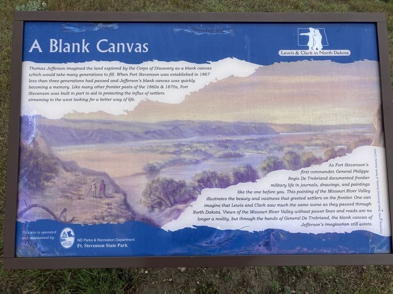
Photographed by Barry Swackhamer, July 23, 2025
1. A Blank Canvas Marker
As Fort Stevenson's first commander, General Phillippe Regis Denis de Keredern de Trobriand documented frontier military life in journals, drawings, and paintings like the one before you. This painting of the Missouri River Valley illustrates the beauty and vastness that created settlers on the frontier. One can imagine that Lewis and Clark saw much the same scene as they passed through North Dakota. Views of the Missouri River Valley without power lines and roads are not longer a reality, but through the hands of General De Trobriand, the blank canvas of Jefferson's imagination still exists.
Erected by North Dakota Parks and Recreation Department.
Topics.
this page online
Location. 47° 35.253′ N, 101° 25.295′ W. Marker is in Garrison, North Dakota, in McLean County. It can be reached from 41st Avenue NW near Scooter Drive. The marker is located in Fort Stevenson State Park in a grassy field bordered by Lake Sakakawea, near the south end of 41st Avenue NW. Touch for map. Marker is at or near this postal address: 1252A 41st Avenue NW, Garrison ND 58540, United States of America. Touch for directions.

Regionally, this marker is in the Mandan, Hidatsa, and Arikara Nation, in the Standing Rock Sioux Tribe, in the Drift Prairie, and on the Missouri Plateau. It is also in the American Lewis & Clark Corridor, on the prairies, and on the Northern Plains. Globally, it is in North America, the Western Hemisphere, the Western World, and the Anglosphere. Historically, it finds itself in what was once Rupert’s Land and also the Louisiana Purchase.
Other nearby markers. At least 8 other markers are within 6 miles of this marker, measured

Photographed by Barry Swackhamer, July 23, 2025
2. A Blank Canvas Marker
Credits. This page was last revised on September 4, 2025. It was originally submitted on September 4, 2025, by Barry Swackhamer of Brentwood, California. This page has been viewed 75 times since then and 19 times this year. Photos: 1, 2. submitted on September 4, 2025, by Barry Swackhamer of Brentwood, California.
