Manassas, Virginia — The American South (Mid-Atlantic)
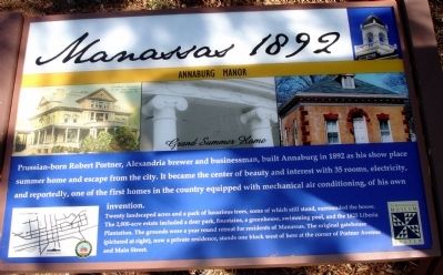
Manassas 1892
Annaburg Manor
| — | Grand Summer Home | — |
March 7, 2010
1. Manassas 1892 Marker
Twenty landscaped acres and a park of luxurious trees, some of which still stand, surrounded the house. The 2,000-acre estate included a deer park, fountains, a greenhouse, swimming pool, and the 1825 Liberia Plantation. The grounds were a year round retreat for residents of Manassas. The original gatehouse (pictured at right), now a private residence, stands one block west of here at the corner of Portner Avenue and Main Street.
Erected by Manassas Museum System, City of Manassas, Virginia.
Topics and series. This historical marker is listed in these topic lists: Architecture • Horticulture & Forestry • Industry & Commerce • Settlements & Settlers. In addition, it is included in the Virginia, City of Manassas series list. A significant historical year for this entry is 1892.
Location. 38° 45.305′ N,
this page online

Regionally, this marker is in the Washington Metropolitan Area and in Northern Virginia. It is also in the American South, specifically in the Upper South, and in the Mid-Atlantic. Globally, it is in North America, the Western Hemisphere, the Western World, and the Anglosphere. Historically, it finds itself in what was once the territory of the Mississippian Culture, one of the original Thirteen Colonies, one of the Confederate States of America, and the Antebellum South.
Other nearby markers. At least 8 other markers are within walking distance of this marker: Steam Locomotive Tire Fire Alarm – 1909 (approx. 0.2 miles away); Manassas 1850 (approx. 0.2 miles away); Manassas Presbyterian Church (approx. ¼ mile away); Albert Speiden (approx. ¼ mile away); Manassas 1862 (approx. ¼ mile away); Wartime Manassas (approx. ¼ mile away); Harry J. Parrish (approx. ¼ mile away); Manassas 1890 - 1900s
March 7, 2010
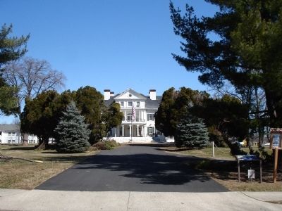
2. Manassas 1892 Marker
Another marker is no longer nearby. Katie Hooe House (was approx. 0.2 miles away but has been replaced with another marker now near it).
More about this marker. The lower left of the marker features a map of the city of Manassas with blue stars marking the locations of 9 Manassas Historic Signs.
Also see . . . Manassas Historic Signs Map Guide. (Submitted on March 8, 2010.)
March 7, 2010
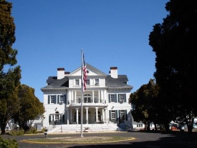
3. Annaburg Manor House
Credits. This page was last revised on July 14, 2026. It was originally submitted on March 8, 2010. This page has been viewed 2,176 times since then and 64 times this year. Photos: 1, 2, 3. submitted on March 8, 2010. • Craig Swain was the editor who published this page.
