
Port Dalhousie in St. Catharines in Niagara Region, Ontario — Central Canada (North America)
Port Dalhousie (Michigan Beach)
Photographed by Tim Boyd, November 18, 2024
1. Port Dalhousie (Michigan Beach) Marker
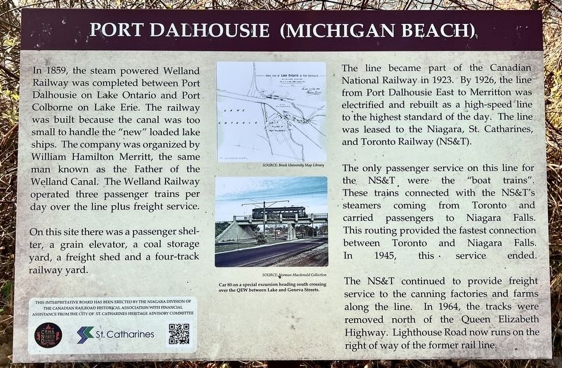
In 1859, the steam powered Welland Railway was completed between Port Dalhousie on Lake Ontario and Port Colborne on Lake Erie. The railway was built because the canal was too small to handle the "new" loaded lake ships. The company was organized by William Hamilton Merritt, the same man known as the Father of the Welland Canal. The Welland Railway operated three passenger trains per day over the line plus freight service.
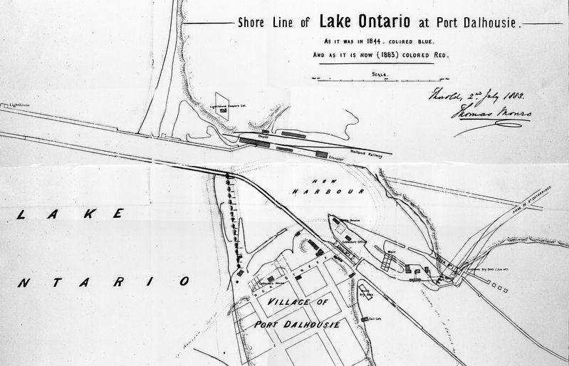
On this site there was a passenger shelter, a grain elevator, a coal storage yard, a freight shed and a four-track railway yard.
The line became part of the Canadian National Railway in 1923. By 1926, the line from Port Dalhousie East to Merritton was electrified and rebuilt as a high-speed line to the highest standard of the day. The line was leased to the Niagara, St. Catharines, and Toronto Railway (NS&T).
The only passenger service on this line for the NS&T were the "boat trains". These trains connected with the NS&T's steamers coming from Toronto and carried passengers to Niagara Falls. This routing provided the fastest connection between Toronto and Niagara Falls. In 1945, this service
this page online
The NS&T continued to provide freight service to the canning factories and farms along the line. In 1964, the tracks were removed north of the Queen Elizabeth Highway. Lighthouse Road now runs on the right of way of the former rail line.
Erected by CRHA Niagara Divison.
Topics and series. This historical marker is listed in this topic list: Railroads & Streetcars. In addition, it is included in the The Welland Canals series list. A significant historical year for this entry is 1859.
Location. 43° 12.121′ N, 79° 15.756′ W. Marker is in St. Catharines, Ontario, in Niagara Region. It is in Port Dalhousie. It is on Lighthouse Road half a kilometer north of Lakeshore Road, on the left when traveling north. The marker is on the Harbour Walkway Trail. Touch for map. Marker is at or near this postal address: 61 Lighthouse Rd, St Catharines ON L2N 7P4, Canada. Touch for directions.

Regionally, this marker is on Ontario’s Golden Horseshoe and in Niagara Canada. It is also in Central Canada. Globally, it is in North America, on the Great Lakes, in the Western Hemisphere, in the Western World, and in the Anglosphere.
Photographed by Kevin Westell, August 10, 2025
2. Port Dalhousie (Michigan Beach) - Marker in context
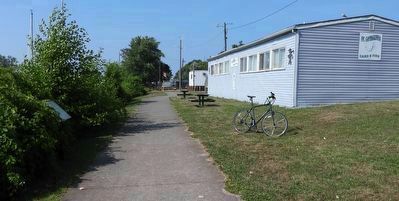
Photo faces north. The marker is adjacent to the paved walking/biking path, near the building for St. Catharines Game and Fish Association. The marker could be concealed by seasonal bushes!
Other nearby markers. At least 8 other markers are within walking distance of this marker: The Welland Canals Historical Fence (about 210 meters away, measured in a direct line); History on the Former Mill and Carpentry Shop of the Port Dalhousie Gate Yard (about 210 meters away); Barnesdale Streetcar Stop 1908 (about 240 meters away); Lock One of the Second Welland Canal (approx. 0.2 kilometers away); The Pull (approx. 0.2 kilometers away); Port Dalhousie and the Niagara St. Catharines and Toronto Railway (NS&T) (approx. 0.3 kilometers away); Murphy's Ship Chandlery circa 1885 (approx. 0.3 kilometers away); Murphy & Scott Ship Chandler 1885 (approx. 0.3 kilometers away). Touch for a list and map of all markers in St. Catharines.

Photographed by Tim Boyd, November 18, 2024
3. Port Dalhousie (Michigan Beach) Marker
4. Port Dalhousie, 1883
Photographed by Tim Boyd, November 18, 2024
5. Port Dalhousie, 2024
Credits. This page was last revised on February 25, 2026. It was originally submitted on November 21, 2024, by Tim Boyd of Hamilton, Ontario. This page has been viewed 162 times since then and 41 times this year. Last updated on September 5, 2025, by Kevin Westell of St. Catharines, Ontario. Photos: 1. submitted on November 21, 2024, by Tim Boyd of Hamilton, Ontario. 2. submitted on August 11, 2025, by Kevin Westell of St. Catharines, Ontario. 3, 4, 5. submitted on November 21, 2024, by Tim Boyd of Hamilton, Ontario. • Devry Becker Jones was the editor who published this page.
