Luverne in Crenshaw County, Alabama — The American South (East South Central)
Crenshaw County Training School
Crenshaw County

Photographed by Mark Hilton, September 7, 2025
1. Crenshaw County Training School Marker
Crenshaw County Training School (CCTS) was a predominantly Black school built in 1931 near Brookwood Street in Luverne. The last class to graduate from that location was in 1949 when the present building was constructed on Hall Avenue. The new building opened for the 1949-1950 school year and housed grades one through twelve, Between 1956 and 1965, several buildings were added including two classrooms, an agriculture and home economics building, a lunchroom, gymnasium, and football field. Students from feeder schools such as Brantley Junior High and Dozier Junior High also attended CCTS. In 1965, the school's name changed due to the stigma associated with the word "training." Because of its location on Hall Avenue, the school's name was changed to Hall Avenue High School for a short time. The city decided to rename the street to Woodford Avenue, so less than a year later the school became Woodford Avenue High School. The school closed at the end of the 1969- 1970 school year due to statewide integration. Former principals were Mr. W.J. Carroll and Mr. Gresham, 1931-1934; Mr. L.M. Campbell, 1934-1961; and
this page online
Listed in the Alabama Register of Landmarks and Heritage on August 24, 2022
Erected 2023 by by Crenshaw County Training School/Woodford Avenue High School Alumni and Friends.
Topics. This historical marker is listed in this topic list: Education. A significant historical date for this entry is August 24, 2022.
Location. 31° 42.273′ N, 86° 16.014′ W. Marker is in Luverne, Alabama, in Crenshaw County. It is on Vortec Drive west of Woodford Avenue, on the right when traveling west. Touch for map. Marker is at or near this postal address: 183 Vortec Dr, Luverne AL 36049, United States of America. Touch for directions.

Regionally, this marker is in the American South, specifically in the Deep South, and in the Black Belt. Globally, it is in North America, a Gulf of Mexico state, the Western Hemisphere, the Western World, and the Anglosphere. Historically, it finds itself in what was once New Spain, the territory of the Mississippian Culture, one of the Confederate States of America, and the Antebellum South.
Other nearby markers. At least 8 other markers are within 6 miles of this marker, measured as
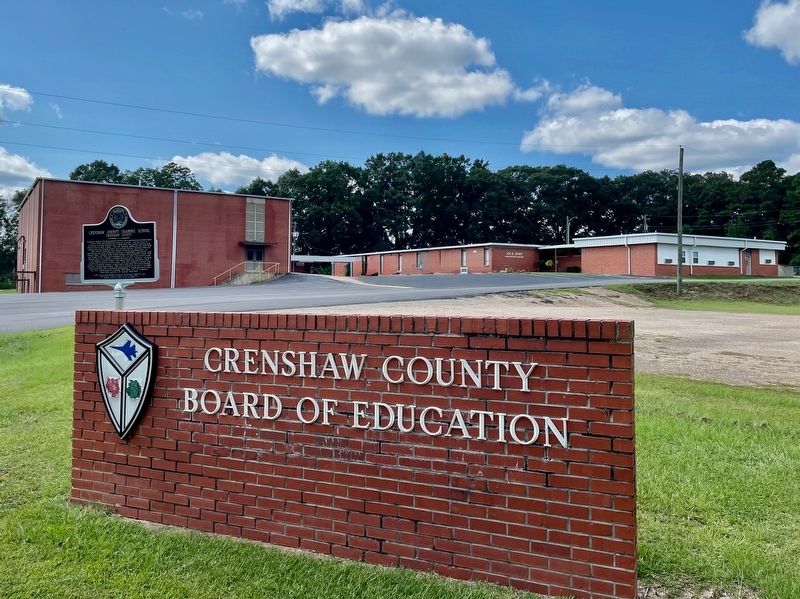
Photographed by Mark Hilton, September 7, 2025
2. Crenshaw County Training School Marker
Also see . . . Former all-Black school in Crenshaw County recognized as historical site - WTVM News Leader. (Submitted on September 8, 2025, by Mark Hilton of Montgomery, Alabama.)
Credits. This page was last revised on September 8, 2025. It was originally submitted on September 8, 2025, by Mark Hilton of Montgomery, Alabama. This page has been viewed 170 times since then and 71 times this year. Photos: 1, 2. submitted on September 8, 2025, by Mark Hilton of Montgomery, Alabama.
