Noble near Ludowici in Long County, Georgia — The American South (South Atlantic)
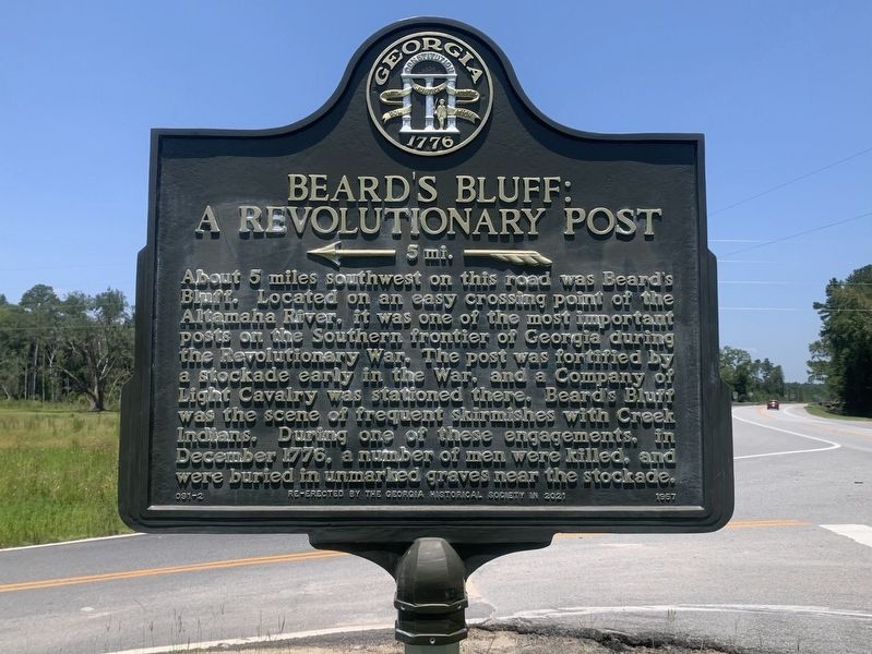
Beard's Bluff: A Revolutionary Post
>---5 mi.--->
Photographed by Tim Fillmon, July 22, 2025
1. Beard's Bluff A Revolutionary Post 5 mi. Marker
About 5 miles southwest on this Road was Beard´s Bluff. Located on an easy crossing point on the Altamaha River, it was one of the most important posts on the Southern frontier of Georgia during the Revolutionary War. The post was fortified by a stockade early in the War, and a Company of Light Calvary was stationed there. Beard´s Bluff was the scene of frequent skirmishes with Creek Indians. During one of these engagements, in December 1776, a number of men were killed, and were buried in unmarked graves near the stockade.
Re-erected by the Georgia Historical Society in 2021
Erected 1957 by Georgia Historical Commission. (Marker Number 091-2.)
Topics. This historical marker is listed in these topic lists: Forts and Castles • War, US Revolutionary. A significant historical month for this entry is December 1776.
Location. 31° 50.665′ N, 81° 55.744′ W. Marker is near Ludowici, Georgia, in Long County. It is in Noble. It is at the intersection of U.S. 25/301 and Beard's Bluff Road, on the left when traveling north on U.S. 25/301. Touch for map. Marker is in this post office area: Ludowici GA 31316, United States of America.
this page online

Regionally, this marker is on Georgia’s Coastal Plain. It is also in the American South and specifically in the Deep South. Globally, it is in North America, the Western Hemisphere, the Western World, and the Anglosphere. Historically, it finds itself in what was once New Spain, the territory of the Mississippian Culture, one of the original Thirteen Colonies, one of the Confederate States of America, and the Antebellum South.
Other nearby markers. At least 8 other markers are within 15 miles of this marker, measured as the crow flies: Jones Creek Baptist Church (approx. 9.2 miles away); Love's Chapel Primitive Baptist Church (approx. 9.6 miles away); Beards Creek Church (approx. 10.1 miles away); Gum Branch Baptist Church (approx. 12 miles away); Historic Roads And Indian Trails (approx. 12.7 miles away); Franklinia Altamaha (approx. 13.3 miles away); The Defense of the Altamaha Bridge (approx. 13.3 miles away); Long County Timeline Mural (approx. 14.3 miles away). Touch for a list and map of all markers in Ludowici.
More about this marker. This marker is a replacement for the original
Photographed by Tim Fillmon, July 22, 2025
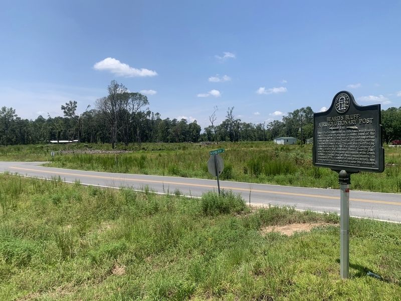
2. Beard's Bluff: A Revolutionary Post Marker
About 5 miles Southwest, on this Road, Beard´s Bluff, on the Altamaha River, was one of the most important posts on the Southern frontier of Georgia during the Revolutionary War.
The post was fortified by a stockade early in the War, and a Company of Light Horse was stationed there. Beard´s Bluff was the scene of frequent skirmishes with the Indians. During one of these engagements, in December, 1776, a number of men were killed, and were buried in unmarked graves near the stockade.
Also see . . . Beard's Bluff. (Submitted on September 8, 2025, by Tim Fillmon of Webster, Florida.)
Credits. This page was last revised on September 8, 2025. It was originally submitted on September 8, 2025, by Tim Fillmon of Webster, Florida. This page has been viewed 155 times since then and 50 times this year. Photos: 1, 2. submitted on September 8, 2025, by Tim Fillmon of Webster, Florida.
