Near Riverdale in McLean County, North Dakota — The American Midwest (Upper Plains)
Riverdale
Photographed by Barry Swackhamer, July 23, 2025
1. Riverdale Marker
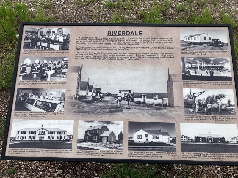
Captions: (top left) Riverdale's retail shops also included a drug store and soda fountain. 1949; (upper-middle left) Two men get a haircut in the barber shop installed in Riverdale's retail building. 1949; (lower-middle left) Four attendants stand behind the meat counter in the grocery store in Riverdale's retail building. 1949; (bottom center} This photograph from November 1949 shows the grade school and high school recently constructed on 3rd Street in Riverdale. (bottom row, middle left) A Type 2 residence nearing completion in June 1949 on 2nd Street in Riverdale.; (bottom row, middle right) This 1949 photograph shows a Type 22 house that was constructed on 3rd Street Riverdale.; (top right) A truck moving a pre-fabricated house turns onto 8th Street in Riverdale in September, 1949. (upper middle right) Riverdale's Recreation Building was equipped with bowling alley, 1949. (lower middle right) Riverdale's planners also included landscaping in their plans. This tree was transplanted to a front yard on 1st Street, 1950. (bottom right) The US Army Corps of Engineers' Administration Building still stands in middle of Riverdale's unique crescent-shaped layout. 1949.
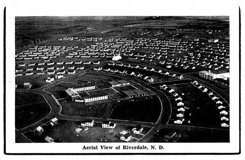
Centered around the project's administration building. Riverdale also contained a small business district, hospital, school, theater, and other community infrastructure.
The town was built quickly. Some of the structures were temporary and intended to support the extensive, but short- term construction needs of a major infrastructure project. These included contractors camps, staging areas of supplies, and maintenance facilities for equipment. Other buildings, included many homes, erected in the 1940s for the Garrison Dam project still stand in Riverdale
Erected by US Army Corps of Engineers.
Topics. This historical marker is listed in these topic lists: Industry & Commerce • Settlements & Settlers.
Location. 47° 29.503′ N,
this page online

Regionally, this marker is in the Mandan, Hidatsa, and Arikara Nation, in the Standing Rock Sioux Tribe, in the Drift Prairie, and on the Missouri Plateau. It is also in the American Lewis & Clark Corridor, on the prairies, and on the Northern Plains. Globally, it is in North America, the Western Hemisphere, the Western World, and the Anglosphere. Historically, it finds itself in what was once Rupert’s Land and also the Louisiana Purchase.
Other nearby markers. At least 8 other markers are within 3 miles of this marker, measured as the crow flies: The Spillway Bridge is often believed to be "the dam", (here, next to this marker); Taming the mighty Missouri by building the world's largest rolled earth dam of its time. (about 300 feet away, measured in a direct line); Growing out of the wheat fields and many have since returned.
Photographed by Barry Swackhamer, July 23, 2025
2. Riverdale Marker
Photographed by Unknown
3. Riverdale, N
Aerial view of Riverdalepost; postcard on eBay.
Credits. This page was last revised on September 10, 2025. It was originally submitted on September 10, 2025, by Barry Swackhamer of Brentwood, California. This page has been viewed 76 times since then and 23 times this year. Photos: 1, 2, 3. submitted on September 10, 2025, by Barry Swackhamer of Brentwood, California.
