Near Fultonham in Schoharie County, New York — The American Northeast (Mid-Atlantic)
Town of Fulton
Schoharie County
| — | Right in the Heart of New York State | — |
Photographed by Steve Stoessel, September 13, 2025
1. Town of Fulton Marker
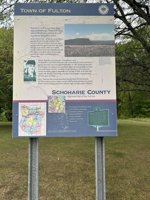
Founded in 1828 in a partition of the town of Middleburgh, Fulton is the largest town in the Schoharie County. It is rich in geological and cultural history.
In fact, Vroman's Nose - perhaps the most prominent geological features of the entire Schoharie Valley - is located in the town of Fulton. Much of its unique Pa geology resulted from glacial action more than 50,000 years ago. At the summit, visitors can see glacial scratches produced by stones protruding from the base of the glacier: as the glacier moved, the protruding rocks left their mark on the bedrock surface of Vroman's Nose.
Our Revolutionary Connection
The Upper Fort - one of three fortifications in the county during the American Revolution - figured prominently in the local waging of the hostilities. In 1780, warning shots were fired from the Upper Fort enabling the successful defense against the attacks by British and Indian forces under Johnson and Brant. In addition, Timothy Murphy, one of the heroes of the American Revolution, resided in Watsonville here in the town of Fulton. It was a shot from Murphy's rifle that killed General Fraser at the battle
this page online
Max V. Shaul State Park is located along Route 30 at the base öf Toe Pach Mountain and affords visitors a variety of outdoor activities including hiking, picnicking and camping) Stocked with bass, Looking Glass Pond is a draw for anglers and other outdoor enthusiasts.
[ Lower Inset ]
The topology of Vroman's Nose in the lown or Fulton creates unique atmospheric conditions. During World War II, Scientists used these conditions to test a new smoke screen
Topics. This historical marker is listed in these topic lists: Settlements & Settlers • War, US Revolutionary • War, World II. A significant historical year for this entry is 1828.
Location. 42° 33.508′ N, 74° 24.062′ W. Marker is near Fultonham, New York, in Schoharie County. It can be reached from the intersection of New York State Route 30 and Brouck Island Road, on the right when traveling south. Marker is at the northern end of the rest area. Touch for map. Marker is in this post office area: Middleburgh NY 12122, United States of America. Touch for directions.

Regionally, this marker is in

Photographed by Steve Stoessel, September 13, 2025
2. Town of Fulton Marker
Other nearby markers. At least 8 other markers are within 3 miles of this marker, measured as the crow flies: The Timothy Murphy Trail (about 300 feet away, measured in a direct line); Bouck's Island (about 400 feet away); Here Col. John Harper (approx. 0.4 miles away); Indian Trail (approx. 1.2 miles away); The Upper Fort 1777 (approx. 1.7 miles away); Timothy Murphy (approx. 1.7 miles away); Site of Upper Valley Fort (approx. 1.7 miles away); a different marker also named Indian Trail (approx. 2.4 miles away). Touch for a list and map of all markers in Fultonham.
Related marker. Click here for another marker that is related to this marker.
Credits. This page was last revised on September 14, 2025. It was originally submitted on September 13, 2025, by Steve Stoessel of Niskayuna, New York. This page has been viewed 559 times since then and 28 times this year. Photos: 1, 2. submitted on September 13, 2025, by Steve Stoessel of Niskayuna, New York.
