Near Harmon in Burleigh County, North Dakota — The American Midwest (Upper Plains)
Stone Shelter

Photographed by Barry Swackhamer, July 22, 2025
1. Stone Shelter Marker
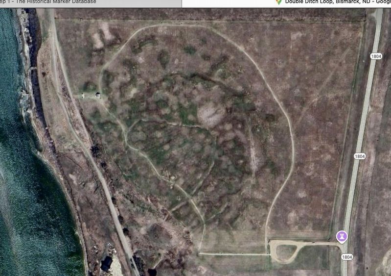
Captions: (bottom left) Workers gathering field stone; (top right) Plan of a stone shelter similar to this one. (bottom right) Aerial view of Double Ditch highlighting the stone shelter.
Today Double Ditch Indian Village State Historic Site is listed in the National Register of Historic Places
We ask you to help us preserve this site. Please take nothing but photographs. The past belongs to everyone, so please leave all artifacts here for the information they provide.
Erected by State Historical Society of North Dakota.
Topics. This historical marker is listed in this topic list: Charity & Public Work.
Location. 46° 56.186′ N, 100° 54.051′ W. Marker is near Harmon, North Dakota, in Burleigh County. It is on Double Ditch Loop 0.3 miles
this page online

Regionally, this marker is on the Missouri Plateau and in Greater Bismarck Area. It is also in the American Lewis & Clark Corridor, on the prairies, and on the Northern Plains. Globally, it is in North America, the Western Hemisphere, the Western World, and the Anglosphere. Historically, it finds itself in what was once Rupert’s Land and also the Louisiana Purchase.
Other nearby markers. At least 8 other markers are within walking distance of this marker: A different marker also named Stone Shelter (here, next to this marker); Double Ditch State Historic Site (here, next to this marker); Homes (about 300 feet away, measured in a direct line); Square Buttes (about 500 feet away); Archaeological Excavations in 1905 (about 600 feet away); Mandans and the Practice of Farming (about 600 feet away);

Photographed by Barry Swackhamer, July 22, 2025
2. Stone Shelter Marker
More about this marker. This marker has replaced an earlier marker also listed on Historical Marker Database. The text is similar.
Photographed by Barry Swackhamer, July 22, 2025
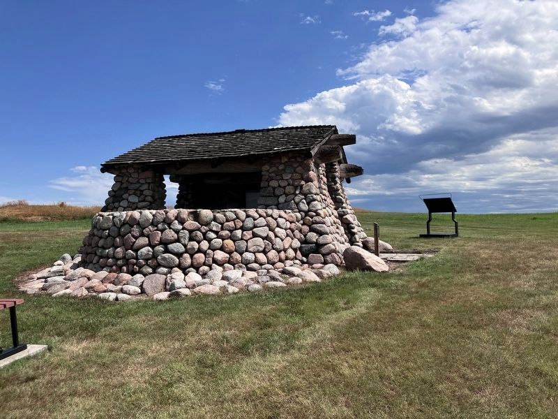
3. Stone Shelter and Marker in the background
Photographed by Goole Maps
4. Aerial view of Double Ditch Historic Site from Google Maps
Credits. This page was last revised on September 15, 2025. It was originally submitted on September 14, 2025, by Barry Swackhamer of Brentwood, California. This page has been viewed 64 times since then and 22 times this year. Photos: 1, 2, 3, 4. submitted on September 14, 2025, by Barry Swackhamer of Brentwood, California.
