Fort Gibson in Muskogee County, Oklahoma — The American South (West South Central)
Occupied by United States Army
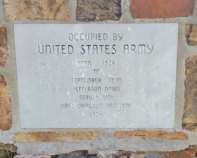
Photographed by James Hulse, September 11, 2025
1. Occupied by United States Army Marker
Topics. This historical marker is listed in this topic list: Forts and Castles. A significant historical month for this entry is April 1824.
Location. 35° 48.265′ N, 95° 15.341′ W. Marker is in Fort Gibson, Oklahoma, in Muskogee County. It is at the intersection of East Ash Avenue and Beauregard St, on the left when traveling north on East Ash Avenue. The marker is located on the grounds of Fort Gibson Historic Site. Touch for map. Marker is at or near this postal address: 301 E Ash Ave, Fort Gibson OK 74434, United States of America. Touch for directions.

Regionally, this marker is in the Muscogee Nation, specifically in the Cherokee Nation, and in Northeast Oklahoma—Green Country. It is also in the American South, specifically on the prairies, and on the Southern Plains. Globally, it is in North America, the Western Hemisphere, the Western World, and the Anglosphere. Historically, it finds itself in what was once the territory of the Mississippian Culture and also the Louisiana Purchase.
Other nearby markers. At least 8 other markers
this page online
Also see . . . Fort Gibson Historic Site. Oklahoma Historical Society
Built at the critical crossroads of the Three Forks where the Arkansas, Verdigris, and Grand Rivers converge south of the Ozark Plateau, Fort Gibson was key to river navigation. It also served as an outpost on the Texas Road connecting settled Missouri with the new country of Mexico after independence from Spain in 1820.(Submitted on September 15, 2025, by James Hulse of Medina, Texas.)
Fort Gibson was established in 1824 to keep the peace between the Osage and the Cherokee. It figured prominently in the Indian removals and was home to many of our nation’s leaders during the 1840s and 1850s. FortGibson served as a starting point for several military expeditions that explored the West. It was occupied through most of the Indian removal period, but then abandoned in 1857. The post was reactivated during the Civil War. It was renamed Fort Blunt and served as the Union headquarters in Indian Territory. The army stayed through the Reconstruction and Indian Wars periods, combating the problem of outlaws and squatters.Photographed by James Hulse, September 11, 20252. Occupied by United States Army Marker
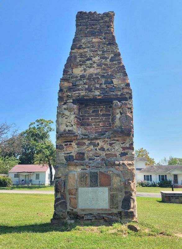

Photographed by James Hulse, September 11, 2025
3. Occupied by United States Army Marker
Credits. This page was last revised on September 15, 2025. It was originally submitted on September 14, 2025, by James Hulse of Medina, Texas. This page has been viewed 83 times since then and 22 times this year. Photos: 1, 2, 3. submitted on September 15, 2025, by James Hulse of Medina, Texas.
