Burgwindheim in Bamberg, Bavaria, Germany — Central Europe
Marter am Wallfahrtsweg
⎯⎯⎯
Wayside Pilgrimage Shrine
| — | Kulturhistorischer Rundweg Burgwindheim | — |
Photographed by Andrew Ruppenstein, September 2, 2025
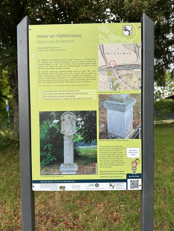
1. Marter am Wallfahrtsweg / Wayside Pilgrimage Shrine Marker

Bildstock aus der Barockzeit
Der Bildstock am Wallfahrtsweg hat seinen Ursprung in der Barockzeit. Ein Vorgänger des heutigen Bildstocks wurde als äußeres Zeichen der Volksfrömmigkeit im Jahr 1693 errichtet. Vom Erscheinungsbild dieses Vorläufers ist jedoch nur noch der Postamentswürfel mit seinen an den Kanten ausgerundeten Kassetten erhalten.
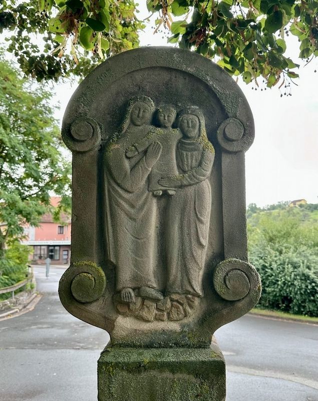
Die seinerzeit vollständig verwitterte Marter wurde im Jahre 1967 durch den Bildhauer Albin Schmittinger ersetzt. Der moderne Aufsatz besteht aus einem kantengefasten Schaft sowie einer zweiseitig oval angelegten, von Voluten umschlungenen Relieftafel. Die Frontseite zeigt den Schmerzensmann (der leidende, aber lebende Jesus Christus mit Wunden), die Rückseite eine Anna Selbdritt (Anna mit ihrer Tochter Maria und dem Jesuskind).
Die ursprüngliche Marter stammt aus der Barockzeit (1693).
Sie war mit der Zeit fast vollständig verwittert und musste ersetzt werden.
Auf der Vorderseite ist der leidende Jesus dargestellt.
Die Rückseite zeigt die Mutter von Maria (Anna), Maria selbst und das Jesuskind.
(English translation:)
Wayside pilgrimage shrine
A
this page online
The wayside shrine on the pilgrimage route dates back to the Baroque period. A predecessor of the current wayside shrine was erected in 1693 as an outward symbol of popular piety. However, all that remains of this predecessor's appearance is the cube-shaped pedestal with its rounded-edged panels.
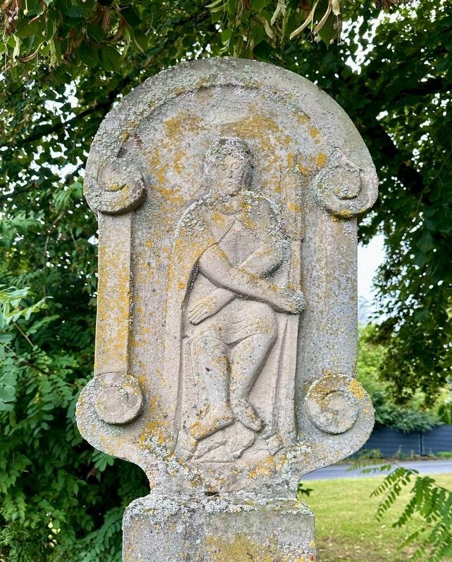
The martyrdom scene, which was completely weathered at the time, was replaced in 1967 by the sculptor Albin Schmittinger. The modern top consists of a beveled shaft and a relief panel on two sides, oval and surrounded by volutes. The front depicts the Man of Sorrows (the suffering but living Jesus Christ with wounds), while the back depicts St. Anne with her daughter Mary and the Christ Child.
The original martyrdom scene dates back to the Baroque period (1693).
It had almost completely weathered over time and had to be replaced.
The front depicts the suffering Jesus.
The reverse shows Mary’s mother (Anna), Mary herself and the baby Jesus.
(Marker Number 15.)
Topics. This historical marker is listed in this topic list: Religion & Religious Structures. A significant historical year for this entry is 1693.
Location. 49° 49.718′ N,
Photographed by Andrew Ruppenstein, September 2, 2025
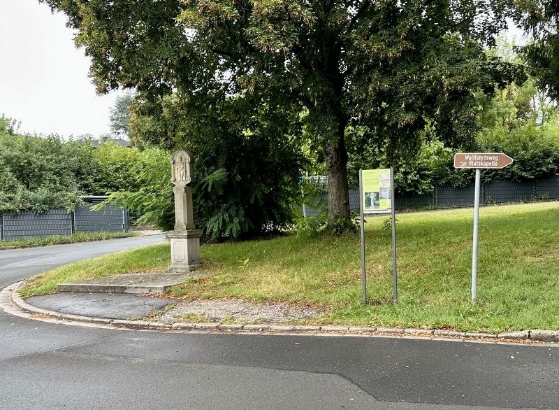
2. Marter am Wallfahrtsweg / Wayside Pilgrimage Shrine and Marker

Regionally, this marker is in German Franconia. Globally, it is in Europe, the European Union, Atlantic Europe, Central Europe, the Schengen Area, Western Europe, and the Western World. Historically, it finds itself in what was once the Holy Roman Empire and also the former West Germany.
Other nearby markers. At least 8 other markers are within walking distance of this marker: Obertorbrücke / Bridge “Obertorbrücke” (a few steps from this marker); Ebrachisches Richterhaus / Ebrach Magistrate’s House (about 180 meters away, measured in a direct line); Posthalterei / Posting Inn (about 180 meters away); Nonnenhof (about 180 meters away); Pfarrkirche St. Jakobus / St. James Parish Church (about 210 meters away); Ehem. Gasthof Zum Hirschen / Former Inn “Zum Hirschen” (about 240 meters away); Kath. Pfarrkiche St. Jakobus / Catholic Parish Church of St. Jakobus
Photographed by Andrew Ruppenstein, September 2, 2025
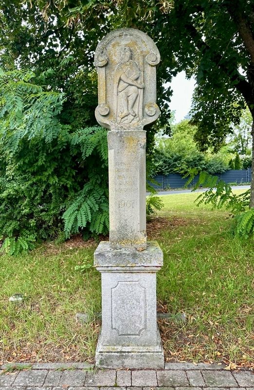
3. Bildstock / Wayside Pilgrimage Shrine
Also see . . . Wayside shrine "Pilgrimage route shrine” (Markt Burgwindheim). The QR code on the marker leads to a short summary of the marker plus an interactive map of all 18 stations on the Burgwindheim historical walking tour. (Submitted on September 15, 2025.)
Photographed by Andrew Ruppenstein, September 2, 2025
4. “Man of Sorrows”
Photographed by Andrew Ruppenstein, September 2, 2025
5. St. Anne, baby Jesus, and Mary
Credits. This page was last revised on September 15, 2025. It was originally submitted on September 15, 2025, by Andrew Ruppenstein of Lamorinda, California. This page has been viewed 83 times since then and 19 times this year. Photos: 1, 2, 3, 4, 5. submitted on September 15, 2025, by Andrew Ruppenstein of Lamorinda, California.
