Alturas in Modoc County, California — The American West (Pacific Coastal)
Nevada-California-Oregon Railway Passenger Depot
Photographed by Frank Gunshow Sanchez, 2025
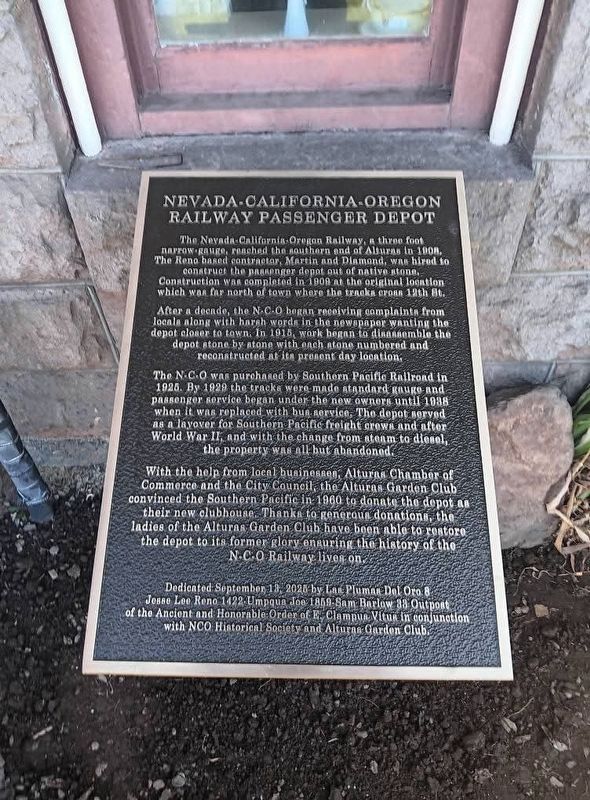
1. Nevada - California - Oregon Railway Passenger Depot Marker
After a decade, the N-C-O began receiving complaints from locals along with harsh words in the newspaper wanting the depot closer to town. In 1915, work began to disassemble the depot stone by stone with each stone numbered and reconstructed at its present day location.
The N-C-O was purchased by Southern Pacific Railroad in 1925. By 1929 the tracks were made standard gauge and passenger service began under the new owners until 1938 when it was replaced with bus service. The depot served as a layover for Southern Pacific freight crews and after World War II, and with the change from steam to diesel, the property was all but abandoned.
With the help from local businesses, Alturas Chamber of Commerce and the city council, The Alturas Garden Club convinced the Southern Pacific
this page online
Dedicated September 13, 2028 by Las Plumas Del Oro 8 Jesse Lee Reno 1422 Umpqua Joe 1859 - Sam Barlow 33 Outpost of the Ancient and Honorable Order of E. Clampus Vitus in conjunction with NCO Historical Society and Alturas Garden Club
Erected by Las Plumas Del Oro 8, Jesse Lee Reno 1422, Umpqua Joe 1859 - Sam Barlow 33 of The Ancient and Honorable Order of E Clampus Vitus in conjunction with NCO Historical Society and Alturas Garden Club.
Topics and series. This historical marker is listed in this topic list: Railroads & Streetcars. In addition, it is included in the E Clampus Vitus series list.
Location. 41° 29.2′ N, 120° 32.39′ W. Marker is in Alturas, California, in Modoc County. It is on N East Street, on the right when traveling north. Touch for map. Marker is at or near this postal address: 304 N East Street, Alturas CA 96101, United States
2025
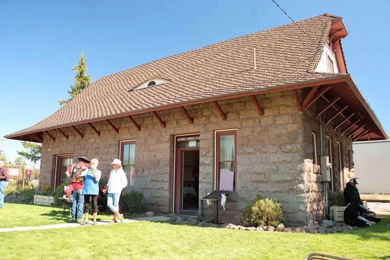
2. Nevada - California - Oregon Railway Passenger Depot and Marker

Regionally, this marker is on the Modoc Plateau and in the Shasta Cascade. It is also in the American Mountain West. Globally, it is in North America, on the Ring of Fire, on the Pacific Rim, in the Western Hemisphere, in the Western World, and in the Anglosphere. Historically, it finds itself in what was once New Spain and also Mexico’s Alta California.
Other nearby markers. At least 6 other markers are within 11 miles of this marker, measured as the crow flies: Sacred Heart Catholic Church (about 800 feet away, measured in a direct line); Lassen Trail - Pit River Ford (approx. 0.4 miles away); Working Farm Roots (approx. 2 miles away); Lassen Trail - Conical Rocks (approx. 7½ miles away); Chimney Rock (approx. 9.7 miles away); Lassen Trail - Rattlesnake Butte (approx. 11.1 miles away).

courtesy California State Library, circa 1911
3. Alturas Depot (original location, roughly 600 yards north of current location)
Credits. This page was last revised on September 18, 2025. It was originally submitted on September 16, 2025, by Frank Gunshow Sanchez of Hollister, California. This page has been viewed 93 times since then and 50 times this year. Photos: 1. submitted on September 16, 2025, by Frank Gunshow Sanchez of Hollister, California. 2. submitted on September 16, 2025. 3. submitted on September 18, 2025. • Andrew Ruppenstein was the editor who published this page.
