Bartlesville in Washington County, Oklahoma — The American South (West South Central)
Nellie Johnstone No. 1
The Discovery that Made History
Photographed by James Hulse, September 13, 2025
1. Nellie Johnstone No. 1 Marker
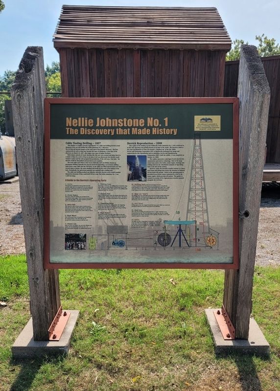
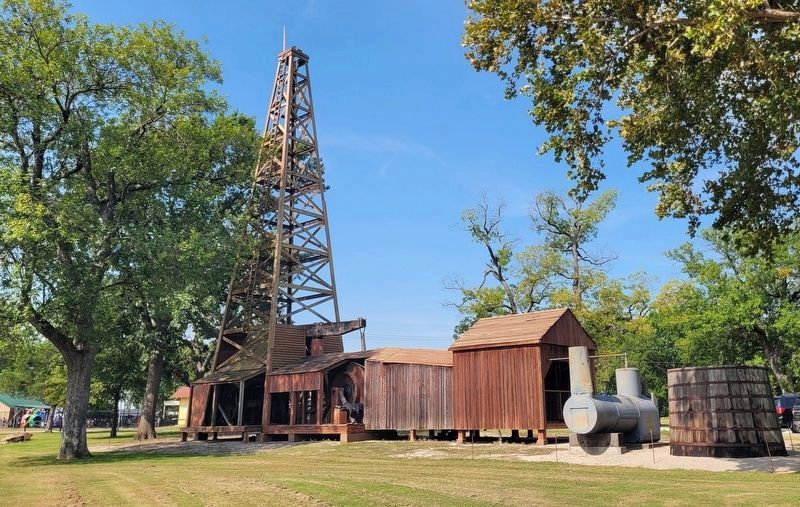
This display is a highly accurate reproduction of a cable tool drilling derrick nearly identical to the one that drilled the Nellie Johnstone No. 1 discovery.
The 82-foot tall derrick stands on the exact spot of the historic discovery - the first commercial oil well in what later became the state of Oklahoma. At the time of the discovery on March 25, 1897, this region was a part of Indian Territory.
Built almost entirely of wood, derricks like this one were erected and taken down in a matter of days by a crew of four to six men. If oil was discovered, the derrick would remain in place and the well prepared for production. If the well was a "dry hole," the derrick would be dissembled and moved to a new location.
The term cable tool refers to the way in which the well was drilled. Known as percussion drilling, basically the process involved suspending a set of heavy drilling tools from a rope cable into the well bore. As the cable was lifted and lowered a few feet several times a minute, the tools smashed and broke up the rock at the bottom of the hole. Periodically, the pulverized
this page online
The cable tool drilling method was effective, but slow. Derrick crews would consider themselves fortunate if they could drill 50 feet a day. The Nellie Johnstone No. 1 was 1,320 feet deep.
Derrick Reproduction - 2008
This replica of the drilling rig that drilled the Nellie Johnstone No. 1 well is believed to be the only operating and gushing derrick of its kind in the world. The derrick is built to the exact specifications of what was termed a "standard rig" of the late 1800s. Service and Technology Corporation (STC) of Bartlesville performed the design and engineering for this reproduction and its subsidiary, Service and Manufacturing Corporation (SMC), built the exhibit. It was completed on October 18, 2008.
The replica represents a marriage of early-day derrick construction and modern technology. Most of the large metal items such as the boiler, steam engine, bearings and drilling tools are the refurbished remnants of rigs dating back to the turn of the century.
However, under the derrick's wooden exterior is a heavy steel frame and pilings that secure the structure to bedrock
Photographed by James Hulse, September 13, 2025
2. Nellie Johnstone No. 1 Marker
A Guide to the Derrick's Operating Parts
1-Boiler
The derrick was operated by steam produced by this portable boiler that was transported to the site along with the derrick. Wood from nearby trees provided the fuel for the boiler's fire, and the Caney River furnished the necessary water.
2-Steam Engine
The power source for drilling was provided by this one-cylinder steam engine, which received steam through a pipe from the boiler. The engine typically operated at 60 to 120 revolutions per minute.
3-Drive Belt
This long belt, made of heavy canvas, transfers power from the drive sheave of the steam engine to the massive band wheel, the largest moving object on the derrick. Much of the belt was enclosed for worker safety as well as protection from the weather.
4-Band Wheel
This 2,600-pound wheel of laminated wood transforms the rotating motion of the drive belt into the up-and-down motion necessary to drill the well.
5-Pitman Arm
Made of a heavy oak timber, one end of the Pitman arm rotates with the band wheel while the other end alternately pushes and pulls the walking beam up and down.
6-Walking Beam
Measuring 24 feet long, the walking beam is basically a huge teeter-totter, traveling a distance of about three feet at each end. The rocking motion raises and lowers the drilling tools suspended inside the well bore.
7-Samson Post
Built to withstand great strain, the Samson post holds up the walking beam, allowing it to pivot at the center. The name is believed to have been taken from Samson, the strong man of the Bible.
8-Tempering Screw
Hooked to one end of the walking beam, the tempering screw was slowly turned by the driller as the well went deeper. This allowed the rope-suspended string of drilling tools to drop lower into the hole.
9-Rope Socket
A critical connection point, the rope socket was the link between the rope and heavy drilling tools. It was basically a tube into which the rope was inserted and held in place by back plaiting the rope.
10-Drilling Tools (Inside the well and cannot be seen here.)
A string of cylindrical tools all assisted in the drilling process. Normally the string consisted of a rope socket, a set of interlocking tools called "jars", a drill stem and a drill bit, which was basically a large chisel. Small amounts of water in the bottom of the well bore aided in drilling and removal of drill cuttings.
11-Rope (or "Line")
The drilling tools were suspended in the well bore by heavy, manila hemp rope, called drilling line. Having great elasticity, the rope would snap like a long rubber band with each stroke of the walking beam. This action boosted the effectiveness of the downhole tools.
12-Bull Wheel
Drilling rope or line was wrapped around this huge spool, which was wound and unwound as tools were lowered and raised in the well bore.
13-Sand Line
After a few feet of drilling, the pulverized rock or "sand" would have to be removed from the hole. First the drill string was pulled up, then the a bailing tool lowered to the bottom suspended on the sand line. Normally, several "trips" would be required to clean the hole.
14-Bailer
The bailer was like a long, slender bucket with a flap-like valve at one end. When lowered, the valve was open and could take in the slurry of pulverized materials and water. When raised, the valve closed and the contents were brought to the surface for inspection and disposal.
Erected by Service
Photographed by James Hulse, September 13, 2025
3. Reproduction of Nellie Johnstone No. 1 Well
Topics. This historical marker is listed in this topic list: Industry & Commerce. A significant historical date for this entry is March 25, 1897.
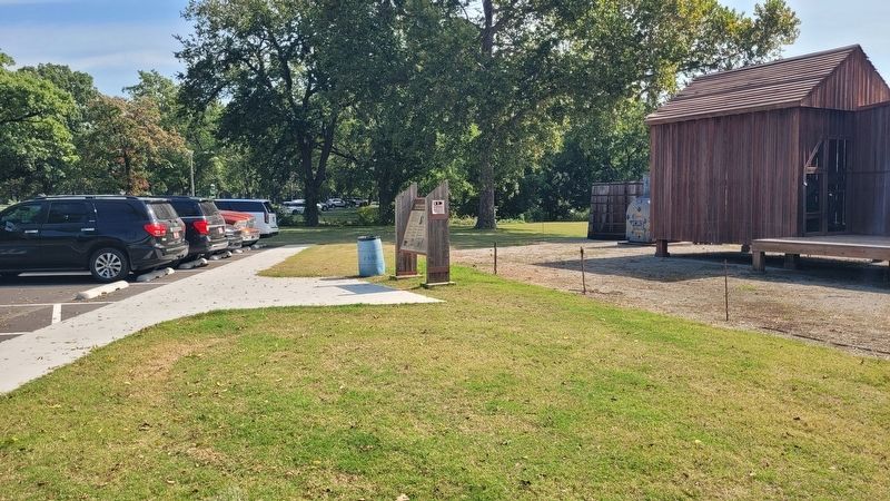
Location. 36° 45.355′ N, 95° 58.368′ W. Marker is in Bartlesville, Oklahoma, in Washington County. It is on North Cherokee Avenue 0.1 miles north of 1st Drive, on the right when traveling north. The marker is located at the Johnstone Park. Touch for map. Marker is at or near this postal address: 100 N Cherokee Ave, Bartlesville OK 74003, United States of America. Touch for directions.

Regionally, this marker is in the Cherokee Nation and in Northeast Oklahoma—Green Country. It is also in the American South, specifically in the Ozarks, on the prairies, and on the Southern Plains. Globally, it is in North America, the Western Hemisphere, the Western World, and the Anglosphere. Historically, it finds itself in what was once the territory of the Mississippian Culture and also the Louisiana Purchase.
Other nearby markers. At least 8 other markers are within walking distance of this marker: Fire Fighting Cannon (within shouting distance

Photographed by James Hulse, September 13, 2025
4. The first commercial oil well in Oklahoma completed April 15, 1897 (under granite stone)
Credits. This page was last revised on September 20, 2025. It was originally submitted on September 17, 2025, by James Hulse of Medina, Texas. This page has been viewed 90 times since then and 26 times this year. Photos: 1, 2, 3. submitted on September 17, 2025, by James Hulse of Medina, Texas. 4. submitted on September 20, 2025, by James Hulse of Medina, Texas.
