Burgwindheim in Bamberg, Bavaria, Germany — Central Europe
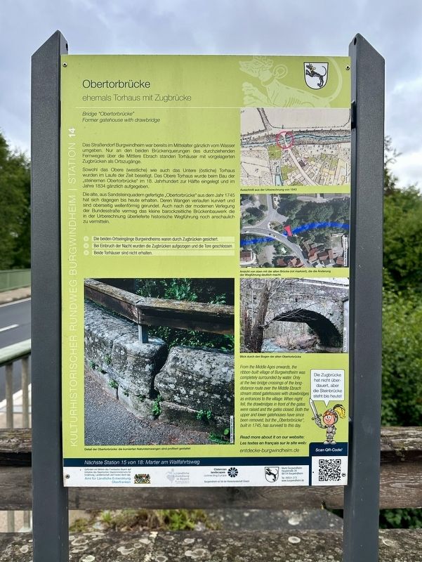
Obertorbrücke
⎯⎯⎯
Bridge “Obertorbrücke”
| — | Kulturhistorischer Rundweg Burgwindheim | — |
Photographed by Andrew Ruppenstein, September 2, 2025
1. Obertorbrücke / Bridge “Obertorbrücke” Marker

ehemals Torhaus mit Zugbrücke
Das Straßendorf Burgwindheim war bereits im Mittelalter gänzlich vom Wasser umgeben. Nur an den beiden Brückenquerungen des durchziehenden Fernweges über die Mittlere Ebrach standen Torhäuser mit vorgelagerten Zugbrücken als Ortszugänge.
Sowohl das Obere (westliche) wie auch das Untere (östliche) Torhaus wurden im Laufe der Zeit beseitigt. Das Obere Torhaus wurde beim Bau der steinernen Obertorbrücke" im 18. Jahrhundert zur Hälfte eingelegt und im Jahre 1834 gänzlich aufgegeben.
Die alte, aus Sandsteinquadern gefertigte „Obertorbrücke“ aus dem Jahr 1745 hat sich dagegen bis heute erhalten. Deren Wangen verlaufen kurviert und sind oberseitig wellenförmig gerundet. Auch nach der modernen Verlegung der Bundesstraße vermag das kleine barockzeitliche Brückenbauwerk die in der Urberechnung überlieferte historische Wegführung noch anschaulich zu vermitteln.
Die beiden Ortseingänge Burgwindheims waren durch Zugbrücken gesichert.
Bei Einbruch der Nacht wurden die Zugbrücken aufgezogen und die Tore geschlossen.
Beide Torhäuser sind nicht erhalten.
Bridge "Obertorbrücke"
Former
this page online
The village of Burgwindheim was already completely surrounded by water in the Middle Ages. Only at the two bridge crossings of the long-distance route over the Mittlere Ebrach River were gatehouses with drawbridges in front of them serving as entrances to the village.
Both the Upper (western) and the Lower (eastern) gatehouses were demolished over time. The Upper Gatehouse was partially submerged during the construction of the stone "Obertorbrücke" (Upper Gate Bridge) in the 18th century and was completely abandoned in 1834.
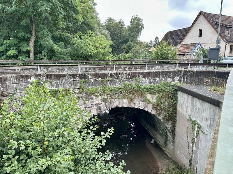
The old "Obertorbrücke" (Upper Gate Bridge), built from sandstone blocks in 1745, has survived to this day. Its flanks are curved and have a wave-like top. Even after the modern relocation of the federal highway, the small Baroque bridge still vividly conveys the historical route preserved in the original plan.
Burgwindheim's two entrances were secured by drawbridges.
At nightfall, the drawbridges were raised and the gates closed.
Both gatehouses have been lost.
(Marker Number 14.)
Topics. This historical marker is listed in this topic list: Bridges & Viaducts. A significant historical year for this entry is 1834.
Location. 49° 49.706′ N,
Photographed by Andrew Ruppenstein, September 2, 2025
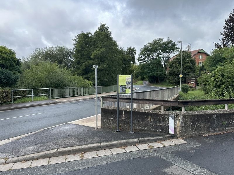
2. Obertorbrücke / Bridge “Obertorbrücke” Marker - wide view
The marker is visible here at the south end of the bridge.

Regionally, this marker is in German Franconia. Globally, it is in Europe, the European Union, Atlantic Europe, Central Europe, the Schengen Area, Western Europe, and the Western World. Historically, it finds itself in what was once the Holy Roman Empire and also the former West Germany.
Other nearby markers. At least 8 other markers are within walking distance of this marker: Marter am Wallfahrtsweg / Wayside Pilgrimage Shrine (a few steps from this marker); Ebrachisches Richterhaus / Ebrach Magistrate’s House (about 150 meters away, measured in a direct line); Posthalterei / Posting Inn (about 150 meters away); Nonnenhof (about 180 meters away); Pfarrkirche St. Jakobus / St. James Parish Church (about 180 meters away); Ehem. Gasthof Zum Hirschen / Former Inn “Zum Hirschen” (about 210 meters away); Kath. Pfarrkiche St. Jakobus / Catholic Parish Church of St. Jakobus
Photographed by Andrew Ruppenstein, September 2, 2025
3. Obertorbrücke / Bridge “Obertorbrücke” and marker
View of the bridge (with back of marker visible on the right)
Also see . . . “Obertorbrücke” Former gatehouse with drawbridge (Entdecke Burgwindheim). The QR code on the marker leads to this page, which summarizes the marker (in English). Includes an interactive map showing the 18 stations on the Burgwindheim historical walking tour. (Submitted on September 18, 2025.)
Credits. This page was last revised on September 18, 2025. It was originally submitted on September 18, 2025, by Andrew Ruppenstein of Lamorinda, California. This page has been viewed 67 times since then and 22 times this year. Photos: 1, 2, 3. submitted on September 18, 2025, by Andrew Ruppenstein of Lamorinda, California.
