
Near Chuckey in Greene County, Tennessee — The American South (East South Central)
Ebenezer Society

Photographed by Christina Potts, August 16, 2025
1. Ebenezer Society Marker
Formed in an early settlement on the Nolachucky River in 1792 with 3l members, the Ebenezer Society, now church, is the second oldest Methodist congregation in Tennessee. The land was donated by the Rev. Felix Earnest, which was part of the Earnest land grant of 1777. The first church building was constructed of logs. Several Western Conferences were held here beginning in 1795. Bishop Francis Asbury preached in the woods to over 1400 souls including 55 preachers. The cemetery contains the graves of early pioneers, enslaved persons, and American Revolutionary War soldiers.
Erected by Tennessee Historical Commission. (Marker Number IC27.)
Topics. This historical marker is listed in these topic lists: Religion & Religious Structures • Settlements & Settlers. A significant historical year for this entry is 1792.
Location. 36° 11.394′ N, 82° 41.585′ W. Marker is near Chuckey, Tennessee, in Greene County. It is on Earnest Road 0.1 miles north of Ebenezer Road, on the left when traveling north. Marker is located near the Ebenezer Methodist Church. Touch for map. Marker is at or near this postal address: 1715 Earnest
this page online

Regionally, this marker is in East Tennessee. It is also in the American South, specifically in the Upper South, in Appalachia, and specifically in Southern Appalachia. Globally, it is in North America, the Western Hemisphere, the Western World, and the Anglosphere. Historically, it finds itself in what was once the original Cherokee Nation, the territory of the Mississippian Culture, one of the Confederate States of America, the State of Franklin, and the Antebellum South.
Other nearby markers. At least 8 other markers are within 3 miles of this marker, measured as the crow flies: Edward Chalmers Huffaker (approx. 1.8 miles away); Davy Crockett’s Birthplace (approx. 2.2 miles away); Welcome to Davy Crockett Birthplace State Park (approx. 2.2 miles away); A Summary of the Life of Davy Crockett (approx. 2.2 miles away); The Real Likeness of David Crockett (approx. 2.2 miles away); Crockett’s Tennessee Westward Movement (approx. 2.2 miles away); Crockett (approx. 2.2 miles away); Eye-Witness to a Near Tragedy (approx. 2.3 miles away). Touch for a list and map
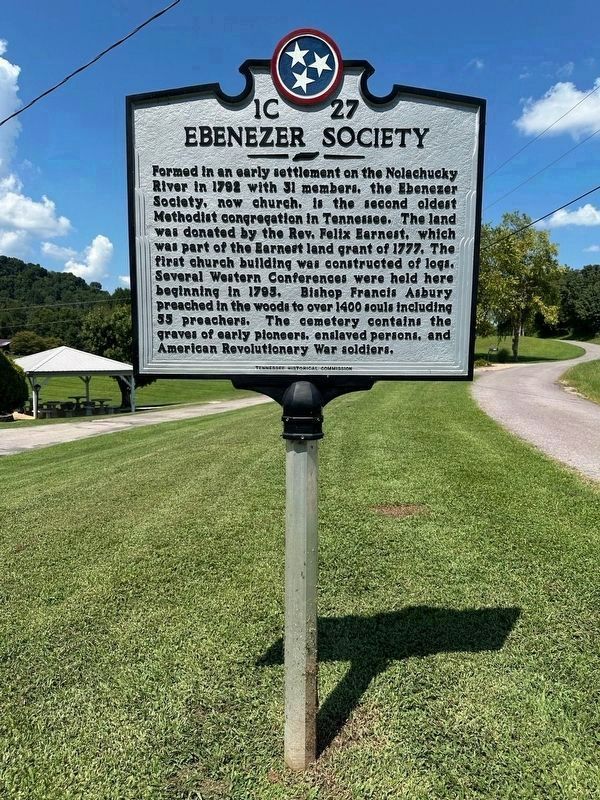
Photographed by Christina Potts, August 16, 2025
2. Ebenezer Society Marker
Another marker is no longer nearby. Ebenezer (was approx. 1.8 miles away but has been replaced with another marker now near it).
More about this marker. The marker was originally located in Chuckey, TN at the intersection of Chuckey Pike and Chuckey Hwy, on the left when traveling south on Chuckey Pike at the southeast corner of the intersection. Original coordinates were: 36°12.945′N, 82°41.27′W
However, the marker was hit by a car and damaged beyond repair. A new replacement marker was obtained. At this time, the marker text was updated and it was moved to the location near the Ebenezer Methodist Church.

Photographed by Christina Potts, August 16, 2025
3. Ebenezer Society Marker
The Ebenezer Society Marker is located near the Ebenezer Methodist Church and cemetery.
Credits. This page was last revised on September 20, 2025. It was originally submitted on September 20, 2025, by Christina Potts of Greeneville, Tennessee. This page has been viewed 118 times since then and 32 times this year. Photos: 1, 2, 3. submitted on September 20, 2025, by Christina Potts of Greeneville, Tennessee. • James Hulse was the editor who published this page.
