Bartlesville in Washington County, Oklahoma — The American South (West South Central)
Low-Water Dam Fueled Local Industry and Recreation
Photographed by James Hulse, September 13, 2025
1. Low-Water Dam Fueled Local Industry and Recreation Marker
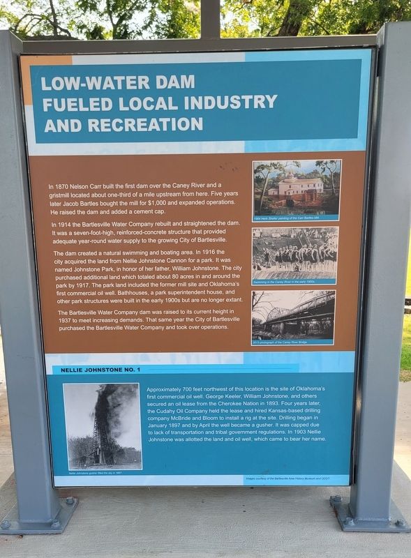
In 1914 the Bartlesville Water Company rebuilt and straightened the dam. It was a seven-foot-high, reinforced-concrete structure that provided adequate year-round water supply to the growing City of Bartlesville.
The dam created a natural swimming and boating area. In 1916 the city acquired the land from Nellie Johnstone Cannon for a park. It was named Johnstone Park, in honor of her father, William Johnstone. The city purchased additional land which totaled about 80 acres in and around the park by 1917. The park land included the former mill site and Oklahoma's first commercial oil well. Bathhouses, a park superintendent house, and other park structures were built in the early 1900s but are no longer extant.
The Bartlesville Water Company dam was raised to its current height in 1937 to meet increasing demands. That same year the City of Bartlesville purchased
this page online
Nellie Johnstone No. 1
Approximately 700 feet northwest of this location is the site of Oklahoma's first commercial oil well. George Keeler, William Johnstone, and others secured an oil lease from the Cherokee Nation in 1893. Four years later, the Cudahy Oil Company held the lease and hired Kansas-based drilling company McBride and Bloom to install a rig at the site. Drilling began in January 1897 and by April the well became a gusher. It was capped due to lack of transportation and tribal government regulations. In 1903 Nellie Johnstone was allotted the land and oil well, which came to bear her name.
Captions
(Photo #1) 1964 Herb Sheller painting of the Carr Bartles Mill.
(Photo #2) Swimming in the Caney River in the early 1900s.
(Photo #3) 2013 photograph of the Caney River Bridge.
(Photo #4) Nellie Johnstone gusher filled the sky in 1897.
Erected by Bartlesville Area History Museum and ODOT.
Topics. This historical marker is listed in this topic list: Bridges & Viaducts. A significant historical month for this entry is January 1897.
Location. 36° 45.228′ N, 95° 58.359′ W.

Photographed by James Hulse, September 13, 2025
2. The view of the markers from across the street

Regionally, this marker is in the Cherokee Nation and in Northeast Oklahoma—Green Country. It is also in the American South, specifically in the Ozarks, on the prairies, and on the Southern Plains. Globally, it is in North America, the Western Hemisphere, the Western World, and the Anglosphere. Historically, it finds itself in what was once the territory of the Mississippian Culture and also the Louisiana Purchase.
Other nearby markers. At least 8 other markers are within walking distance of this marker: Depression-Era New Deal Programs and Bridge Construction (here, next to this marker); Bridge Design Included Unique Engineering Features (here, next to this marker); Hulah Santa Fe Depot (about 600 feet away, measured in a direct line); Coffeyville Refinery (about 700 feet away); Nellie Johnstone No. 1 (about 800 feet away); Fire Fighting Cannon (approx. 0.2 miles away); Information (approx. 0.2 miles away); Building the City of Legends (approx. 0.3 miles away). Touch for a list and map of all markers in Bartlesville.
Credits. This page was last revised on September 21, 2025. It was originally submitted on September 21, 2025, by James Hulse of Medina, Texas. This page has been viewed 90 times since then and 48 times this year. Photos: 1, 2. submitted on September 21, 2025, by James Hulse of Medina, Texas.
