Pomeroy in Meigs County, Ohio — The American Midwest (Great Lakes)
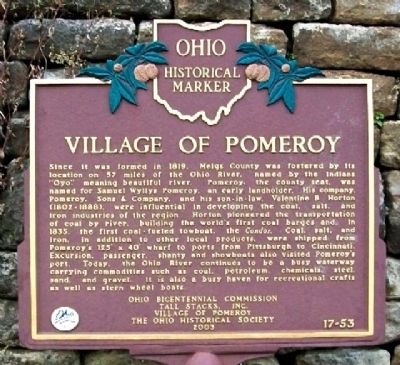
Village of Pomeroy
Since it was formed in 1819, Meigs County was fostered by its location on 57 miles of the Ohio River, named by the Indians"Oyo," meaning beautiful river. Pomeroy, the county seat, was named for Samuel Wyllys Pomeroy, an early landholder. His company, Pomeroy, Sons & Company, and his son-in-law, Valentine B. Horton (1802-1888), were influential in developing the coal, salt, and iron industries of the region. Horton pioneered the transportation of coal by river, building the world's first coal barges and, in 1835, the first coal-fueled towboat, the Condor. Coal, salt, and iron, in addition to other local products, were shipped from Pomeroy's 125' x 40' wharf to ports from Pittsburgh to Cincinnati. Excursion, passenger, shanty and showboats also visited Pomeroy's port. Today, the Ohio River continues to be a busy waterway carrying commodities such as coal, petroleum, chemicals, steel, sand, and gravel. It is also a busy haven for recreational crafts as well as stern wheel boats.
Erected 2003 by Ohio Bicentennial Commission, Tall Stacks, Inc., Village of Pomeroy, and The Ohio Historical Society. (Marker Number 17-53.)
Topics and series. This historical marker is listed in these topic lists: Industry & Commerce • Settlements & Settlers • Waterways & Vessels. In addition, it is included in the Ohio Historical Society / The Ohio History Connection series list. A significant historical year for this entry is 1819.
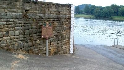
Location. 39° 1.633′ N, 82° 1.93′ W. Marker is in Pomeroy, Ohio, in Meigs County. Marker is along the wall adjacent to the Ohio River access ramp along Main Street, near Lynn Street. Touch for map. Marker is in this post office area: Pomeroy OH 45769, United States of America. Touch for directions.
Other nearby markers. At least 8 other markers are within 2 miles of this marker, measured as the crow flies. Morgan's Raid Route / Meigs County Courthouse (about 500 feet away, measured in a direct line); Spanish Cannon (about 500 feet away); Meigs County Civil War Memorial (about 600 feet away); Valentine Baxter Horton (approx. 0.3 miles away); Virgil A. Lewis (approx. half a mile away in West Virginia); The Three Sycamore Trees (approx. 1˝ miles away); Kerrs Run Colored School (approx. 1.6 miles away); Morgan’s Raid Route (approx. 1.6 miles away). Touch for a list and map of all markers in Pomeroy.
Also see . . .
1. Pomeroy, Ohio. (Submitted on March 10, 2010, by William Fischer, Jr. of Scranton, Pennsylvania.)
2. Ohio River. (Submitted on March 10, 2010, by William Fischer, Jr. of Scranton, Pennsylvania.)
Credits. This page was last revised on December 2, 2019. It was originally submitted on March 10, 2010, by William Fischer, Jr. of Scranton, Pennsylvania. This page has been viewed 1,123 times since then and 68 times this year. Photos: 1, 2. submitted on March 10, 2010, by William Fischer, Jr. of Scranton, Pennsylvania.

