Belk in Fayette County, Alabama — The American South (East South Central)
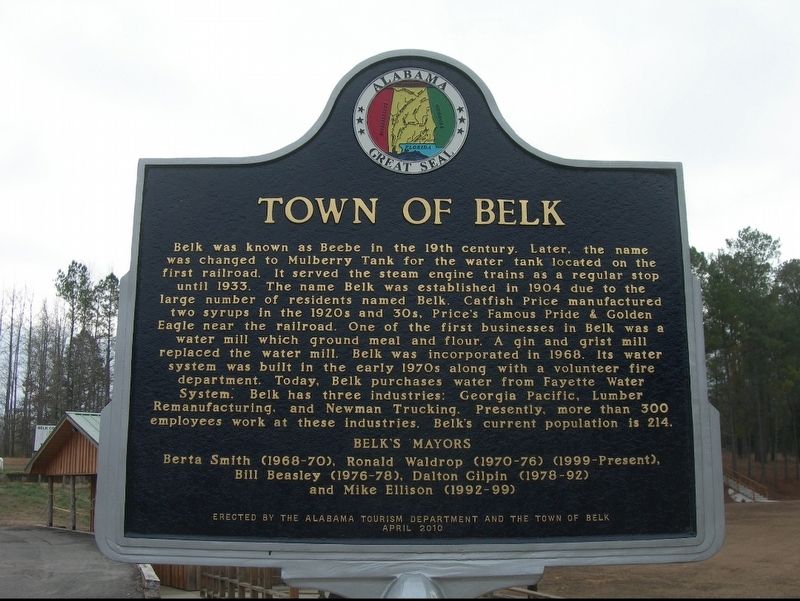
Town of Belk
⎯⎯⎯
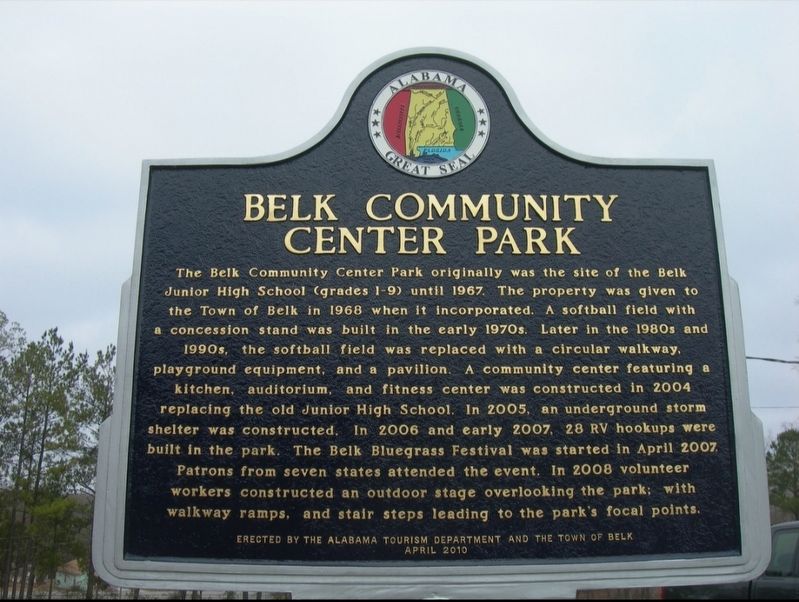
Belk Community Center Park
Photographed by Jimmy Emerson
1. Town of Belk Marker
Berta Smith (1968-70), Ronald Waldrop (1970-76) (1999-Present),
Bill Beasley (1976-78), Dalton Gilpin (1978-92)
and Mike Ellison (1992-99)
The Belk Community Center Park originally was the site of
this page online
Erected 2010 by Alabama Tourism Department and the Town of Belk.
Topics and series. This historical marker is listed in these topic lists: Industry & Commerce • Railroads & Streetcars. In addition, it is included in the Alabama Tourism Department series list. A significant historical year for this entry is 1904.
Location. 33° 38.442′ N,
Photographed by Jimmy Emerson, 2010
2. Town of Belk Marker

Regionally, this marker is in the American South and specifically in the Deep South. Globally, it is in North America, a Gulf of Mexico state, the Western Hemisphere, the Western World, and the Anglosphere. Historically, it finds itself in what was once the territory of the Mississippian Culture, one of the Confederate States of America, and the Antebellum South.
Other nearby markers. At least 8 other markers are within 10 miles of this marker, measured as the crow flies: History of Fayette (approx. 6.6 miles away); Roxy Theatre/ Fayette's Newspapers (approx. 6.6 miles away); In Memory of the Patriots of the American Revolution (approx. 6.6 miles away); Fayette World War II Memorial (approx. 6.6 miles away); United Daughters of the Confederacy Memorial (approx. 6.6 miles away); In Memory of the Soldiers of the Southern Confederacy (approx. 6.6 miles away); Shady Grove Missionary Baptist Church and Cemetery (approx. 8.7 miles away); Freeman Lake (approx. 9.4 miles away).
Credits. This page was last revised on September 27, 2025. It was originally submitted on September 24, 2025, by Jimmy Emerson of Dalton, Georgia. This page has been viewed 163 times since then and 77 times this year. Photos: 1, 2. submitted on September 24, 2025, by Jimmy Emerson of Dalton, Georgia. • James Hulse was the editor who published this page.
Editor’s want-list for this marker. A wide view photo of the marker and the surrounding area together in context. • Can you help?
