Marine on St. Croix in Washington County, Minnesota — The American Midwest (Upper Plains)
Marine
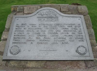
Photographed by Keith L, June 11, 2011
1. Marine Marker
In 1857 these millstones were installed at Marine in one of the early flour and grist mills of Minnesota Territory. Water from a stream south of this site was conveyed by a race or flume to furnish power for the overshot mill wheel. Later, rollers were installed for the finer grinding of wheat flour. Under various owners, the mill continued to operate until 1930.
Erected 1950 by the Minnesota Department of Highways, Roadside Development Division; Minnesota Historical Society.
Topics and series. This historical marker is listed in this topic list: Industry & Commerce. In addition, it is included in the Minnesota Historical Society series list. A significant historical year for this entry is 1857.
Location. 45° 11.882′ N, 92° 46.205′ W. Marker is in Marine on St. Croix, Minnesota, in Washington County. It can be reached from St. Croix Trail North (State Highway 95) south of Maple Street (County Road 4), on the left when traveling south. Marker is at a roadside parking area (Parker Street). Touch for map. Marker is at or near this postal address: 120 Judd Street, Marine on Saint Croix MN 55047, United States of America.
this page online

Regionally, this marker is in the Twin Cities Metropolitan Area. It is also in the American Midwest, in the Corn Belt, and in the Great River Road Region. Globally, it is in North America, the Western Hemisphere, the Western World, and the Anglosphere. Historically, it finds itself in what was once Rupert’s Land, the territory of the Mississippian Culture, and the Northwest Territory.
Other nearby markers. At least 8 other markers are within 2 miles of this marker, measured as the crow flies: A different marker also named Marine (within shouting distance of this marker); Marine Mill Site (about 300 feet away, measured in a direct line); Historic Marine on St. Croix (about 400 feet away); St. Croix National Scenic Riverway (about 400 feet away); Early Settler's Cabin (about 500 feet away); The Marine Township Hall (approx. 0.2 miles away); Wedge Hill (approx. 1.8 miles away); Lake Alice (approx. 1.8 miles away). Touch for a list and map of all markers in Marine on St. Croix.
Other markers no longer nearby. Boom, Then Bust (was about 400 feet away but has been replaced with another marker now
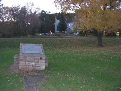
Photographed by Keith L, October 15, 2008
2. Marine Marker
Also see . . .
1. The City of Marine on St. Croix. City website homepage:
"Marine on St. Croix, founded as Marine Mills in 1839, was the site of the first commercial saw mill along the St. Croix River." (Submitted on March 11, 2010.)
2. Marine on St. Croix R.P.A. Minnesota Department of Transportation website entry:
"This lectern-style stone marker is located a few feet west of the parking area near the approximate center of the site. It is built of tan, random ashlar, roughly-cut limestone on a concrete footing." (Submitted on March 11, 2010.)
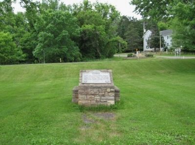
Photographed by Keith L, June 11, 2011
3. Marine Marker
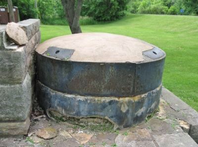
Photographed by Keith L, June 11, 2011
4. Millstones
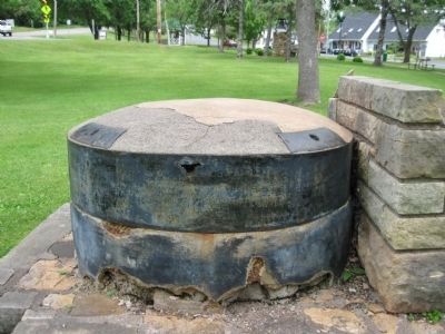
Photographed by Keith L, June 11, 2011
5. Millstones
Credits. This page was last revised on December 29, 2021. It was originally submitted on March 11, 2010, by Keith L of Wisconsin Rapids, Wisconsin. This page has been viewed 941 times since then and 16 times this year. Photos: 1. submitted on June 25, 2011, by Keith L of Wisconsin Rapids, Wisconsin. 2. submitted on March 11, 2010, by Keith L of Wisconsin Rapids, Wisconsin. 3, 4, 5. submitted on June 25, 2011, by Keith L of Wisconsin Rapids, Wisconsin. • Bill Pfingsten was the editor who published this page.
