Sanger in Oliver County, North Dakota — The American Midwest (Upper Plains)
Cross Ranch

Photographed by Barry Swackhamer, July 22, 2025
1. Cross Ranch Marker
Wednesday, October 24, 1804
Near this point, Lewis and Clark made their fist substantial contact with Mandan Indians (missing)
passed an oxbow island (present-day Painted Woods Lake). "One of the Grand Chiefs of the Mandan (missing)
Lodges hunting was discovered. A friendly encounter ensued. [T]his Chief met Chief of (missing)
occompanied us with great Cordiallity & serimony Smoked the pipe" Lewis later visited the (missing)
near Turtle Creek. The beauty of the bottom lands greatly impressed Clark, but, no game (missing)
covered 11 miles, camping on the east bank about 3 miles south of modern Washburn.
Sunday, August 17, 1806
After taking leave of the Knife River Indian villages, Lewis and Clare "proceeds on" downriver to a campsite the west bank near Hensler. With them came Big White, a Mandan chief, but Charbonneau, Sakkaewa, (?) the expedition papoose, Baptiste, stayed behind. Likewise, John Colter left the party to join trappers bound for the Rocky Mountains. The captains fired a salute as they embarked about 2 p.m. The stopped briefly at Fort Mandan. A strong southwest headwind showed travel
this page online
Erected by North Dakota Parks & Recreation.
Topics. This historical marker is listed in this topic list: Exploration. A significant historical date for this entry is October 24, 1804.
Location. 47° 11.085′ N, 100° 59.532′ W. Marker is in Sanger, North Dakota, in Oliver County. It can be reached from the intersection of 22nd Avenue SouthWest and 16th Street SouthWest, on the right when traveling south. The marker overlooks the Missouri River in Cross Ranch State Park. Touch for map. Marker is in this post office area: Center ND 58530, United States of America. Touch for directions.

Regionally, this marker is in the Standing Rock Sioux Tribe, on the Missouri Plateau, and in Greater Bismarck Area. It is also in the American Lewis & Clark Corridor, on the prairies, and on the Northern Plains. Globally, it is in North America, the Western Hemisphere, the Western World, and the Anglosphere. Historically, it finds itself in what was once Rupert’s Land and also the Louisiana Purchase.
Other nearby markers. At least 8 other markers are within 8 miles of this
Photographed by Barry Swackhamer, July 22, 2025
2. Cross Ranch Marker
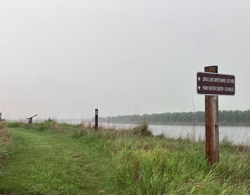
I didn't think the marker was 200 yards away; but there was a second markers further down the trail.
Credits. This page was last revised on September 27, 2025. It was originally submitted on September 27, 2025, by Barry Swackhamer of Brentwood, California. This page has been viewed 51 times since then and 25 times this year. Photos: 1, 2. submitted on September 27, 2025, by Barry Swackhamer of Brentwood, California.
