Boulder City in Clark County, Nevada — The American Mountains (Southwest)
Raise the Road on Columns & Deck
Journeys & Heroes
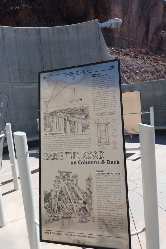
Photographed by Sandra Hughes Tidwell, September 9, 2025
1. Raise the Road on Columns & Deck Marker
Roadway Framing & Deck
This efficient bridge design that combines steel and concrete members does the same work as would an all-concrete bridge, but at a much lighter weight. It also eliminates many braces between columns that would clutter the clean look of the bridge.
An enormous concrete cap beam tops each pair of precast columns. Four pre-made steel box girders are connected between the concrete cap beams. The roadway deck slab spans across the girders. The deck slab and girders not only support the load of vehicles but also brace the tall concrete columns against wind and earthquake.
(Caption:)
Cross Section - Composite
Superstructure of Bridge
Tall Precast Columns
The 290-foot-high approach columns at the River Bridge were the world's tallest precast concrete columns at the time of their construction.
The contractor transported the ten-foot-tall precast concrete column segments by truck to the staging area of the cableway system. Crews attached temporary platforms to the sides of each segment for worker access when it arrived in its place on the bridge. These huge hollow "building blocks" were stacked up and firmly connected to form the paired approach columns standing on the canyon walls and the spandrel columns bearing on the twin-rib arch.
Efficient Construction Methods
To meet an aggressive construction schedule, the contractor premade many of the River Bridge parts while the foundations were being built. The fast-track construction method allowed premade components of the arch, column, and deck to be ready for installation the moment the contractor needed them. By making large structural parts at off-site work yards, the project needed fewer construction workers on the bridge. A giant cableway system spanning the canyon high above the River Bridge delivered the large structural
this page online
Concrete workers cast column segments nearby while excavators cut rock shelves into the steep canyon walls. When the foundations and the arch were finished, the column segments were ready to install. This process was economical and efficient.
Mike O'Callagan - Pat Tillman Memorial Bridge
Topics. This historical marker is listed in these topic lists: Architecture • Bridges & Viaducts.
Location. 36° 0.881′ N, 114° 44.674′ W. Marker is in Boulder City, Nevada, in Clark County. It is on Hoover Dam Access Road. Touch for map. Marker is at or near this postal address: 81 Hoover Dam Access Road, Boulder City NV 89005, United States of America. Touch for directions.

Regionally, this marker is in the Colorado River Valley, in the Mojave Desert, and in Greater Las Vegas. It is also in the American Southwest and in the Mountain West. Globally, it is in North America, the Western Hemisphere, the Western World, and the Anglosphere. Historically, it finds itself in what was once New Spain and also Mexico’s Alta California.
Other nearby markers. At least 8 other markers are within walking distance of this marker: Design the Dream with Science & Art (here, next to this marker); Enjoying the Ride with Celebration & Pride (here, next to this marker); Protecting the Place of Nature & History (here, next to this marker); Choose the Site for Crossing & Bridge (here, next to this marker); Span The Gap with Cables 7 Arch (here, next to this marker); Lay the Path with Cut & Fill (here, next to this marker); Clear the Way of Switchyard & Towers (here, next to this marker); Find Solid Ground with Surveys & Tests (within shouting distance of this marker). Touch for a list and map of all markers in Boulder City.
Credits. This page was last revised on September 28, 2025. It was originally submitted on September 27, 2025, by Sandra Hughes Tidwell of Killen, Alabama, USA. This page has been viewed 59 times since then and 25 times this year. Photo 1. submitted on September 27, 2025, by Sandra Hughes Tidwell of Killen, Alabama, USA. • Andrew Ruppenstein was the editor who published this page.
Editor’s want-list for this marker. A wide view photo of the marker and it’s surroundings showing its location. • Can you help?
