Boulder City in Clark County, Nevada — The American Mountains (Southwest)
Step by Step
Photographed by Sandra Hughes Tidwell, September 9, 2025
1. Step by Step Marker
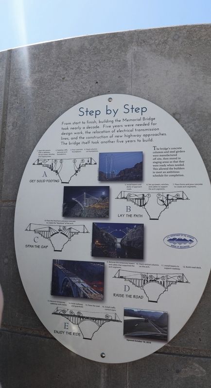
From start to finish, building the Memorial Bridge took nearly a decade. Five years were needed for design work, the relocation of the electrical transmission line, and the construction of new highway approaches. The bridge itself took another five years to build.
A
Get Solid Footing
1. Span the canyon with a cableway; set up cranes, winches, and staging area.
2. Stabilize cliffs; excavate arch foundations.
3. Pour concrete foundations.
4. Stack columns on foundations.
5. Install beams and decks of approach road.
6. Set up towers, winches, and cables to support the arch segments.
7. Place forms and pour concrete to create arch segments.
B
Lay the Path
7. Place forms and pour concrete to create arch segments.
C
Span the Gap
8. Placing the final form and pouring concrete to create the "keystone" of the arch.
D
9. Removing the temporary towers and cables that supported the arch segments.
10. Stack Vertical columns on the arch.
11. Install beams to support roadway.
12. Build road deck.
E
Enjoy the ride
13. Remove temporary cableway and cranes.
14. Build walkway and guardrails.
15. Pave the road.
16. Install traffic control signs.
Opened October 19, 2010
Topics. This historical marker is listed in this topic list: Bridges & Viaducts. A significant historical date for this entry is October 19, 2010.
Location. 36° 0.897′ N, 114° 44.745′ W. Marker is in Boulder City, Nevada, in Clark County. It is on Hoover Dam Access Road. Located at the Boulder Dam Bridge Parking Lot. Touch for map. Marker is at or near this postal address: 81 Hoover Dam Access Road, Boulder City NV 89005, United States of America. Touch for directions.

Regionally, this marker is in the Colorado River Valley, in the Mojave Desert, and in Greater Las Vegas. It is also in the American Southwest and in the Mountain West.
this page online
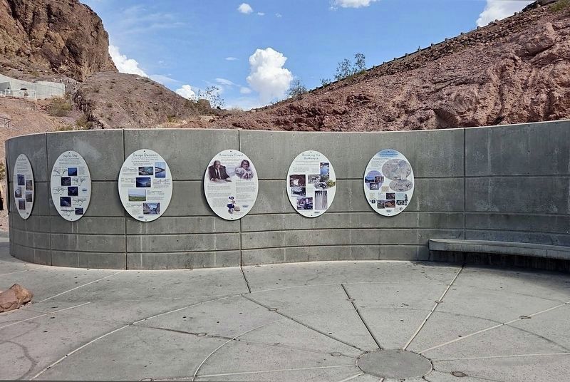
Other nearby markers. At least 8 other markers are within walking distance of this marker: Discover Hoover Dam (here, next to this marker); Worthy of the Neighborhood (here, next to this marker); For the Record (here, next to this marker); Breaking the Bottleneck (here, next to this marker); Design Decisions (here, next to this marker); America's Finest (here, next to this marker); Get Good Footing with Anchors & Foundations (about 300 feet away, measured in a direct line); Find Solid Ground with Surveys & Tests (about 300 feet away). Touch for a list and map of all markers in Boulder City.
Photographed by Craig Baker
2. Step by Step Marker
Photographed by Craig Baker
3. Step by Step Marker
Credits. This page was last revised on October 12, 2026. It was originally submitted on September 28, 2025, by Sandra Hughes Tidwell of Killen, Alabama, USA. This page has been viewed 63 times since then and 29 times this year. Photos: 1. submitted on September 28, 2025, by Sandra Hughes Tidwell of Killen, Alabama, USA. 2, 3. submitted on October 12, 2026, by Craig Baker of Sylmar, California. • Andrew Ruppenstein was the editor who published this page.
