Clarkston in Asotin County, Washington — The American West (Northwest)
Lewis and Clark

June 21, 2016
1. Lewis and Clark Marker
The text of the marker is on the reverse (Photo No. 2).
William Clark recorded in his
journal that on this date:
“I can observe at a distance...
a high ridge of thinly timbered
countrey the water of the
south fork is greenish blue,
the north as clear as crystial.”
Clark’s ‘south fork’, the Snake River, is visible from this marker. The Clearwater River, or "north" (fork), flows into the Snake River approximately 3/4 of a mile to the east of the marker.
Erected 1999 by Washington State Society Daughters of the American Revolution (WSSDAR).
Topics and series. This historical marker is listed in this topic list: Exploration. In addition, it is included in the Daughters of the American Revolution (DAR), and the Lewis & Clark Expedition series lists. A significant historical date for this entry is October 10, 1805.
Location. 46° 25.551′ N, 117° 2.989′ W. Marker is in Clarkston, Washington, in Asotin County. It is on Port Way, on the left when traveling east. The marker is in Granite Lake Park, on the south bank of the Snake River across from the probable first Lewis and Clark campsite. Touch for map. Marker is at or near this postal address: 850 Port Way, Clarkston
this page online

Regionally, this marker is in the Palouse. It is also in the American Mountain West and in the Lewis & Clark Corridor. Globally, it is in North America, on the Pacific Rim, in the Western Hemisphere, in the Western World, and in the Anglosphere.
Other nearby markers. At least 8 other markers are within walking distance of this marker: Granite Lake Park (within shouting distance of this marker); Lewis & Clark Almost Slept Here (about 300 feet away, measured in a direct line); Nimiipuu Homelands (approx. half a mile away); a different marker also named Lewis and Clark (approx. ¾ mile away in Idaho); Lewiston's Chinese Community (approx. 0.9 miles away in Idaho); Tsceminicum (approx. 0.9 miles away in Idaho); Firsts in Lewiston (approx. 0.9 miles away in Idaho); Kettenbach Building (approx. one mile away in Idaho). Touch for a list and map of all markers in Clarkston.
More about this marker. The marker is a 42 “ high shaft of Lake Superior green granite, their first Lewis & Clark marker in a series. The front of the marker displays the NSDAR insignia, the Lewis &

Photographed by Ann Shipley, March 23, 2022
2. Lewis and Clark Marker Reverse
Between September 1999 and October 2000, the Washington State Society Daughters of the American Revolution placed a series of four markers commemorating the Lewis and Clark Expedition in what is now Washington State. The markers are located in/near the cities of Ilwaco, Clarkston, Stevenson, and Burbank, Washington. Use the link in the Related Markers section below to view or map these four markers.
Regarding Lewis and Clark. Excerpt from Lewis & Clark Trail Heritage Foundation WA Chapter Newsletter, Nov 1999 edition:
In 1998 when Shirley (Mrs. Robert) Wagers became Regent of the Washington State Society, Daughters of the American Revolution, she chose as her history project the placement of special markers along the Lewis and Clark Trail in Washington State. She was authorized the use of the same marker design used by the Kansas State Society three years ago when they placed markers at Lewis and Clark campsites along the Missouri River on Kansas' eastern border. A reception for the dedication guests was held in the port office after the ceremonies. John Tresko of Tresko Monuments in Spokane faithfully followed the patterns of the original marker… In the beginning, the original sites for the markers in Washington had been planned in state parks, but activities in the parks are now on hold until changes are made for the bicentennial... . -submitted by Chapter Member Leota "Lee" King
The Captains wrote about the Indians and made lunar observations: "The Cho pun-nish or Pierced nose Indians are Stout likely men, handsom women, and verry dressey in their way, the dress of the men are a white Buffalow robe or Elk Skin dressed with Beeds which are generally white, Sea Shells - i e Mother of Pirl hung to ther hair and on a pice of otter Skin about their necks hair cerved in two parsels hanging forward over their Sholders, feathers, and different Coloured Paints which they find in their Countrey Generally white Green and light Blue. Some fiew were a Shirt of Dressed Skins and long legins, and Mockersons Painted, which appears to be their winter dress, with a plat of twisted grass about their necks."
Related markers.

2016
3. Lewis and Clark Marker Reverse
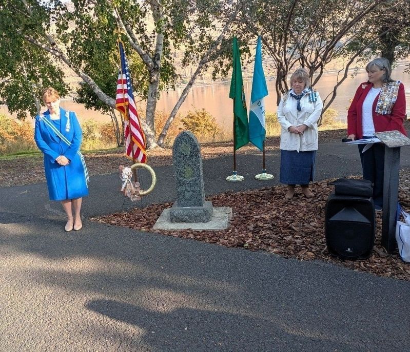
Courtesy of Washington State Society Daughters of the American Revolution, September 28, 2025
4. Honoring the 220th anniversary of the Expedition’s arrival in what is now Washington State
Pictured are State Regent Jacqueline Riddell, Native American Indians Committee State Chair person Suzanne Scuderi, and State Historian Carrie Venable Byrd.
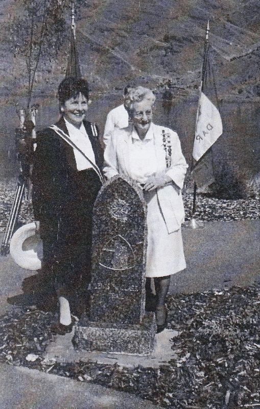
Courtesy of Washington State Society Daughters of the American Revolution., 1999
5. Lewis and Clark Marker dedication ceremony, State Regent Shirley Wagers, State Historian Leota King
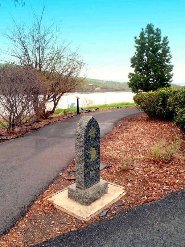
2016
6. Lewis and Clark Marker in context.
The Snake River is visible in the background.
Courtesy of Washington State Society Daughters of the American Revolution
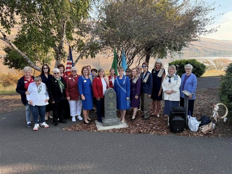
7. 220th Celebration
The Washington State Daughters of the American Revolution honoring the 220th anniversary of the Lewis and Clark Expedition’s arrival in what is now Washington State, near the current city of Clarkston, Washington (Sep-Nov, 1805).
Credits. This page was last revised on January 12, 2026. It was originally submitted on July 25, 2018, by Shirley A Stirling of Lacey, Washington. This page has been viewed 1,320 times since then and 259 times this year. Last updated on September 29, 2025, by Shirley A Stirling of Lacey, Washington. Photos: 1. submitted on July 25, 2018, by Shirley A Stirling of Lacey, Washington. 2. submitted on June 28, 2025, by Shirley A Stirling of Lacey, Washington. 3. submitted on July 25, 2018, by Shirley A Stirling of Lacey, Washington. 4. submitted on October 8, 2025, by Shirley A Stirling of Lacey, Washington. 5, 6. submitted on June 28, 2025, by Shirley A Stirling of Lacey, Washington. 7. submitted on January 4, 2026, by Shirley A Stirling of Lacey, Washington. • Devry Becker Jones was the editor who published this page.
