Midwest in Natrona County, Wyoming — The American West (Mountains)
Oil Boomtowns
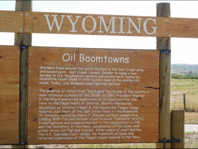
Photographed by Jimmy Emerson
1. Oil Boomtowns Marker
Wyoming
Workers from around the world flocked to the Salt Creek area, and boomtowns - Salt Creek, Lavoye, Snyder to name a few - sprang to life. Roughnecks worked and played hard, fueled by moonshine liquor made in stills tucked away in the nearby rim rocks. Today, only Midwest and Edgerton survive.
The promise of riches from "black gold" led to one of the country's most infamous scandals of the 1920s. In 1921, President Warren G. Harding transferred supervision of oil reserves from the Navy to the Department of Interior. Shortly thereafter, Secretary of Interior Albert B. Fall leased the Teapot Dome reserve, just south of the Salt Creek Field, to the Mammoth Oil Company, owned by Harry F. Sinclair, without competitive bidding. Both Fall and Sinclair stood to make "mammoth" profits. Investigations and prosecutions led to the resignations of Fall and the Secretary of the Navy, cancellation of the lease, and prison terms for Fall and Sinclair. After years of court battles, the U.S. Supreme Court voided the Mammoth oil lease and returned supervision of the Teapot Dome reserve to the Navy.
Erected 2025.
this page online
Topics. This historical marker is listed in this topic list: Industry & Commerce. A significant historical year for this entry is 1921.
Location. 43° 24.579′ N, 106° 16.194′ W. Marker is in Midwest, Wyoming, in Natrona County. It is on Wyoming Hwy 259 (Wyoming Route 259) near US Hwy 387 ( Route 387). Touch for map. Marker is in this post office area: Midwest WY 82643, United States of America. Touch for directions.

Regionally, this marker is in the Westward Expansion Trails Region and in Greater Casper. It is also in the American Mountain West. Globally, it is in North America, the Rocky Mountains, the Western Hemisphere, the Western World, and the Anglosphere.
Other nearby markers. At least 8 other markers are within 2 miles of this marker, measured as the crow flies: Salt Creek Oil Field (a few steps from this marker); a different marker also named Salt Creek Oil Field (a few steps from this marker); Gushers, (about 300 feet away, measured in a direct line); Oil Boom Towns (approx. 0.4 miles away); a different marker also named Salt Creek Oil Field (approx. 0.4 miles away); Society in an Oil Patch (approx. half a mile away);
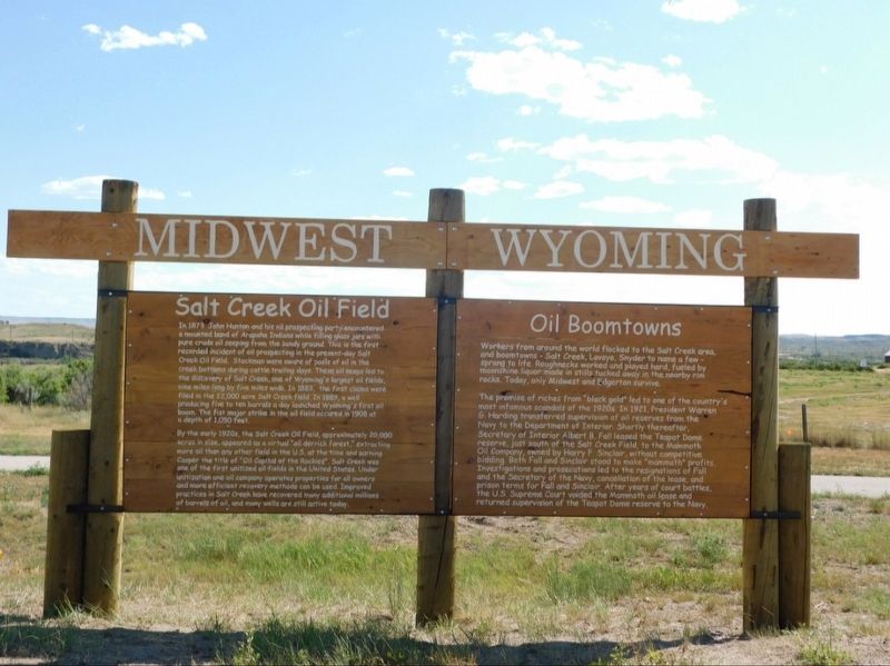
Photographed by Jimmy Emerson, July 8, 2025
2. Oil Boomtowns Marker
More about this marker. Located at the junction of US 387 and WY 259 where a previous marker with the same title but different text was located. The old marker as of Oct 2024 was located at the Salt Creek Museum in Midwest Wyoming.
Credits. This page was last revised on October 1, 2025. It was originally submitted on October 1, 2025, by Jimmy Emerson of Dalton, Georgia. This page has been viewed 57 times since then and 22 times this year. Photos: 1, 2. submitted on October 1, 2025, by Jimmy Emerson of Dalton, Georgia. • Andrew Ruppenstein was the editor who published this page.
