Near Gaffney in Cherokee County, South Carolina — The American South (South Atlantic)
A Bloodless Victory
Fort Thicketty
| — | The Liberty Trail S.C. | — |

Photographed by Mark Parker, October 5, 2025
1. A Bloodless Victory Marker
(Preface)
The Quaker Gun
Patriot Colonel Isaac Shelby and his men formed battle lines outside of Loyalist musket rang and pointed a Quaker Gun—a mock cannon—at Fort Thicketty. Shelby then demanded that Commander Patrick Moore surrender his garrison.
At dawn on Wednesday, July 26, 1780, Patriot Colonel Isaac Shelby arrayed his men around the base of Fort Thicketty. The blockhouse and parapets stood on a flat area no larger than a football field, surrounded by a firm palisade fence ringed with menacing abatis. Muskets poked through the fort's loopholes, intimidating the Patriot attackers, who had no cannon to break the fort's defenses.
Shelby sent Captain William Cocke to demand the surrender of Captain Patrick Moore's garrison. Moore replied that he would defend the place "to the last extremity." Shelby hoped to avoid unnecessary bloodletting on both sides. He knew that if it came to a firefight, his militia would have little chance of success. So he employed a clever tactic.
On the next hill, clearly visible from the fort, the Patriots rolled up what looked like a cannon. The assailants pretended to load and
this page online
Much to the Loyalist garrison's surprise and over their objections, Moore agreed to capitulate on condition that Shelby parole his men. If granted parole, the Loyalists had to promise not to fight for the British again. The terms were accepted, the fort was taken, and not a single shot was fired by either side.
(sidebar)
Patriot Colonel Isaac Shelby
Colonel Isaac Shelby led a combined force of local Spartan Regiment militiamen and 600 Overmountain Men against Fort Thicketty. These same forces later defeated British Major Patrick Ferguson's forces in the Battle of Kings Mountain, a significant Patriot victory, which earned Shelby a ceremonial sword and a pair of pistols. The Picture Art Collection / Alamy Stock Photo
Erected 2025

Photographed by Mark Parker, October 5, 2025
2. A Bloodless Victory Marker along the paved walkway
Topics. This historical marker is listed in these topic lists: Forts and Castles • War, US Revolutionary. A significant historical date for this entry is July 26, 1780.
Location. 34° 59.098′ N, 81° 42.747′ W. Marker is near Gaffney, South Carolina, in Cherokee County. It can be reached from State Road S-11-584 0.2 miles south of Goucher School Road, on the right when traveling south. Look for a gravel parking lot on your right. From there, take the paved walk down the trail to the fort remnants. Touch for map. Marker is at or near this postal address: 184 State Rd S-11-584, Gaffney SC 29340, United States of America. Touch for directions.

Regionally, this marker is in Upstate and in the Foothills. It is also in the American South, specifically in the Deep South, in Appalachia, and specifically in Southern Appalachia. Globally, it is in North America, the Western Hemisphere, the Western World, and the Anglosphere. Historically, it finds itself in what was once the original Cherokee Nation, the

Photographed by Mark Parker, October 5, 2025
3. Gravel parking lot off State Road S-11-584. Follow the paved trail to the marker
Other nearby markers. At least 8 other markers are within 5 miles of this marker, measured as the crow flies: A Loyalist Base (a few steps from this marker); Welcome to Fort Thicketty (within shouting distance of this marker); Thicketty Fort Project (within shouting distance of this marker); Road to Kings Mountain and Cowpens (within shouting distance of this marker); A Colonial Fortification (within shouting distance of this marker); Goucher Baptist Church (approx. 0.9 miles away); Whig Hill (approx. 3.7 miles away); Nuckolls-Jefferies House (approx. 4.9 miles away). Touch for a list and map of all markers in Gaffney.
Photographed by Mark Parker, October 5, 2025
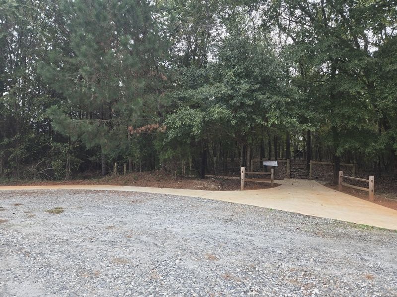
4. Start of the trail at the parking lot. Follow it to reach the marker.

Photographed by Mark Parker, October 5, 2025
5. Remains of Fort Thicketty
Credits. This page was last revised on October 10, 2025. It was originally submitted on October 5, 2025, by Mark Parker of Hickory, North Carolina. This page has been viewed 121 times since then and 69 times this year. Photos: 1, 2, 3, 4, 5. submitted on October 5, 2025, by Mark Parker of Hickory, North Carolina. • Bernard Fisher was the editor who published this page.
