Fort Yates in Sioux County, North Dakota — The American Midwest (Upper Plains)
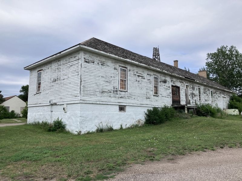
The Guardhouse
Native American Scenic Byway

Photographed by Barry Swackhamer, July 20, 2025
1. The Guardhouse Marker
Captions: (top center) 1897 Fort Yates Military Post on the Missouri River; (bottom left) The Guard House, Standing Rock Agency, Fort Yates, N.D,; (bottom right) Long Soldier Icon, 1880-1881, Soldiers fired into Sioux and captured Indians, Infantry, artillery and cavalry represented.
The Post's first structures were built from cottonwood logs sawn from the bottomland. By 1880 all these original buildings had deteriorated and were subsequently replaced with frame structures. The guardhouse derives from this second generation of construction. Apart from the loading dock on the back side and the curfew whistle on the roof, the guard house's exterior has remained essentially unchanged for over a hundred years. The jail cells were located in the basement and the barred windows of these cells can still be seen.
One of the reasons soldiers ended up in the guardhouse were due to visits in Winona. Alcohol was forbidden on the reservation and contact between the troops and Indians was discouraged because many of the troops were of "low
this page online
In "Operation Winona" off duty soldiers made nightly assaults on the town by ferry in the summer or on foot or by sleigh in the winter. At its peak, Winona was a lucrative business boasting two hotels, two stores, two restaurants and nine saloons. Fifty to a hundred women were imported to entertain in the saloons and work in the brothels. Small wonder that when the town's name was put to vote, "Devil's Colony" was selected.
Erected by America's Byways.
Topics. This historical marker is listed in these topic lists: Forts and Castles • Military.
Location. 46° 5.486′ N, 100° 37.804′ W. Marker is in Fort Yates, North Dakota, in Sioux County. It can be reached from Proposal Avenue near Cottonwood Street, on the left when traveling south. Touch for map. Marker is in this post office area: Fort Yates ND 58538, United States of

Photographed by Barry Swackhamer, July 20, 2025
2. The Guardhouse and Marker, on the right

Regionally, this marker is on the Missouri Plateau. It is also in the American Lewis & Clark Corridor, on the prairies, and on the Northern Plains. Globally, it is in North America, the Western Hemisphere, the Western World, and the Anglosphere. Historically, it finds itself in what was once Rupert’s Land and also the Louisiana Purchase.
Other nearby markers. At least 6 other markers are within 10 miles of this marker, measured as the crow flies: Fort Yates Military Life (here, next to this marker); Fort Yates (approx. 0.2 miles away); Standing Rock Monument (approx. 0.2 miles away); Lakota, Dakota & Dakota People (approx. 0.2 miles away); Tatanka Iyotake (approx. ¼ mile away); Langeliers Bay Recreation Area (approx. 10 miles away).
Another marker is no longer nearby. Sitting Bull (was approx. ¼ mile away but has been permanently removed).

Photographed by Barry Swackhamer, July 20, 2025
3. The Guardhouse and Markers
Photographed by Barry Swackhamer, July 20, 2025
4. The Guardhouse
Credits. This page was last revised on October 6, 2025. It was originally submitted on October 6, 2025, by Barry Swackhamer of Brentwood, California. This page has been viewed 73 times since then and 31 times this year. Photos: 1, 2, 3, 4. submitted on October 6, 2025, by Barry Swackhamer of Brentwood, California.
