Cheb, Karlovy Vary, Czechia — Central Europe (Bohemia)
Městský dům č. p. 353
⎯⎯⎯
Town house no. 353
Photographed by James Hulse, June 17, 2025
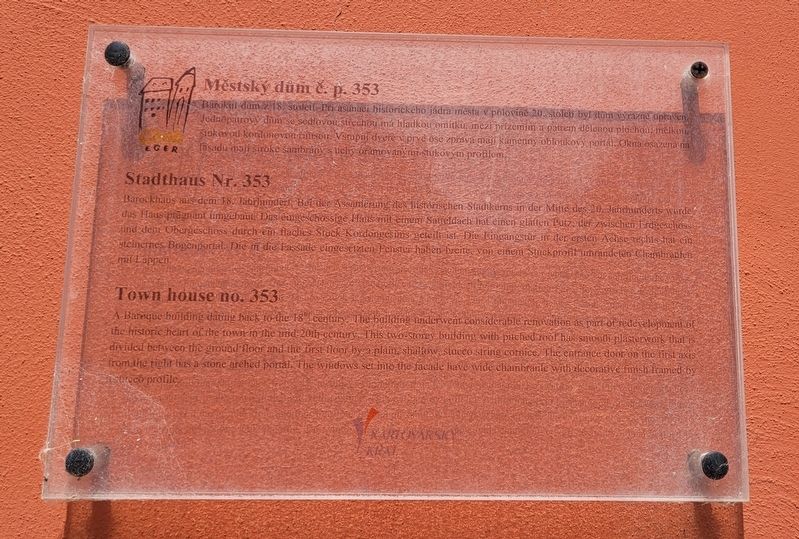
1. Městský dům č. p. 353 / Town house no. 353 Marker
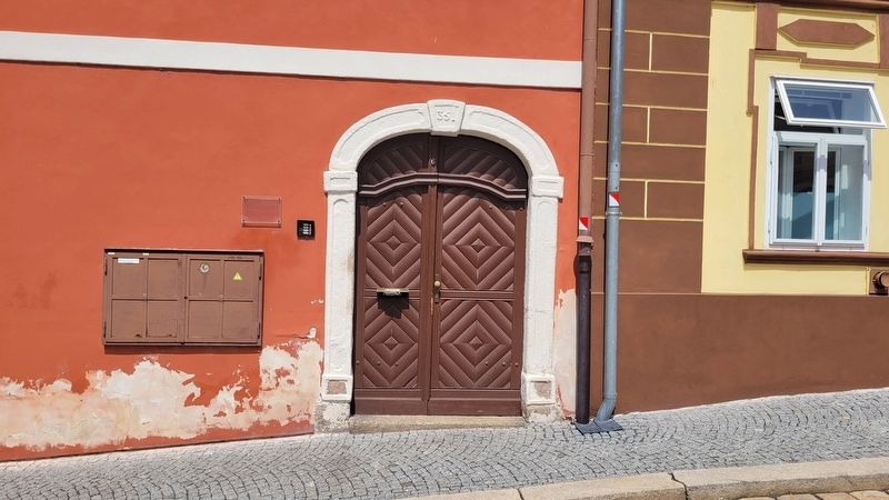
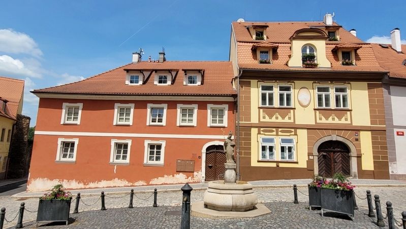
Barokní dům z 18. století. Při asanaci historického jádra města v polovině 20. století byl dům výrazně upraven. Jednopatrový dům se sedlovou střechou má hladkou omítku, mezi přízemím a patrem dělenou plochou, mělkou, štukovou kordonovou římsou. Vstupní dveře v první ose zprava mají kamenný obloukový portál. Okna osazená na fasádu mají široké šambrány s uchy, orámovanými štukovým profilem.
Stadthaus Nr. 353
Barockhaus aus dem 18. Jahrhundert. Bei der Assanierung des historischen Stadtkerns in der Mitte des 20. Jahrhunderts wurde das Haus prägnant umgebaut. Das eingeschossige Haus mit einem Satteldach hat einen glatten Putz, der zwischen Erdgeschoss und dem Obergeschoss durch ein flaches Stuck-Kordongesims geteilt ist. Die Eingangstür in der ersten Achse rechts hat ein steinernes Bogenportal. Die in die Fassade eingesetzten Fenster haben breite, von einem Stuckprofil umrandeten Chambranen mit Lappen.
Town house no. 353
A Baroque building dating back to the 18th century. The building underwent considerable renovation
this page online
Erected by Cheb Eger and Karlovarský.
Topics. This historical marker is listed in this topic list: Architecture.
Location. 50° 4.775′ N, 12° 21.995′ E. Marker is in Cheb, Karlovarský kraj ( Karlovy Vary). It is at the intersection of Ružový kopecek and Růžový kopeček, on the left when traveling east on Ružový kopecek. The marker is located at the entrance to the building. Touch for map. Marker is at or near this postal address: Ružový kopecek 7, Cheb, Karlovarský kraj 350 02, Czechia. Touch for directions.

Regionally, it is in Europe, the European Union, the Carpathian States, Central Europe, Eastern Europe, the Schengen Area,
Photographed by James Hulse, June 17, 2025
2. The entrance to the Town house no. 353 and Marker
Other nearby markers. At least 8 other markers are within walking distance of this marker: Městský dům č. p. 397 / Town house no. 397 (within shouting distance of this marker); Městský dům č. p. 77 / Town house no. 77 (about 120 meters away, measured in a direct line); Chebský Hrad / Cheb Castle (about 120 meters away); Historie Chebského hradu / Cheb Castle History (about 120 meters away); Městský dům č. p. 267 / Town house no. 267 (about 150 meters away); Městský dům č. p. 266 / Town house no. 266 (about 180 meters away); Bombarda, 15. Století / Bombard, 15th Century (about 210 meters away); Purkrabí a Zlovolný Duch / Burgrave and the Malevolent Ghost (about 210 meters away). Touch for a list and map of all markers in Cheb.
Photographed by James Hulse, June 17, 2025
3. The view of the Town house from the street
Credits. This page was last revised on October 26, 2025. It was originally submitted on October 6, 2025, by James Hulse of Medina, Texas. This page has been viewed 48 times since then and 14 times this year. Photos: 1, 2, 3. submitted on October 6, 2025, by James Hulse of Medina, Texas.
