Cheb, Karlovy Vary, Czechia — Central Europe (Bohemia)
Městský dům č. p. 77
⎯⎯⎯
Town house no. 77
Photographed by James Hulse, June 17, 2025
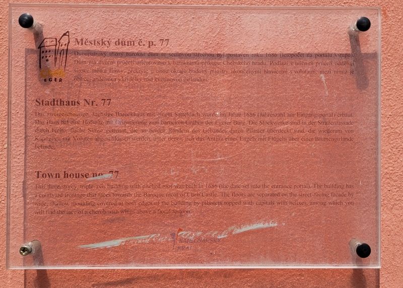
1. Městský dům č. p. 77 / Town house no. 77 Marker
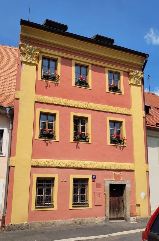
Dvoupatrový tříosý barokní dům se sedlovou střechou byl postaven roku 1686 (letopočet na portálu vstupu). Dům má dvorní průčelí orientováno k baroknímu příkopu Chebského hradu. Podlaží v uličním průčelí oddělují široké mělké římsy, překryté u obou okrajů budovy pilastry ukončenými hlavicemis volutami, mezi nimiž je obličej andělíčka s křidélky nad květinovou girlandou.
Stadthaus Nr. 77
Das zweigeschossige, 3achsige Barockhaus mit einem Satteldach wurde im Jahre 1686 (Jahreszahl am Eingangsportal) erbaut. Das Haus hat eine Hofseite mit Orientierung zum barocken Graben der Egerer Burg. Die Stockwerke sind in der Straßenfassade durch breite, flache Simse getrennt, die an beiden Rändern des Gebäudes durch Pilaster überdeckt sind, die wiederum von Kapitellen mit Voluten abgeschlossen werden, unter denen sich das Antlitz eines Engels mit Flügeln über einer Blumengirlande befindet.
Town house no. 77
This three-storey, triple-axis building with pitched roof was built in 1686
this page online
Erected by Cheb Eger and Karlovarský.
Topics. This historical marker is listed in this topic list: Architecture. A significant historical year for this entry is 1686.
Location. 50° 4.832′ N, 12° 21.979′ E. Marker is in Cheb, Karlovarský kraj ( Karlovy Vary). It is at the intersection of Dobrovského and Trčky z Lípy, on the right when traveling west on Dobrovského. The marker is located at the entrance to the building. Touch for map. Marker is at or near this postal address: Dobrovského 17, Cheb, Karlovarský kraj 350 02, Czechia. Touch for directions.

Regionally, it is in Europe, the European Union, the Carpathian States, Central Europe, Eastern Europe, the Schengen Area, and the Western World. Historically, it finds itself in what was once
Photographed by James Hulse, June 17, 2025
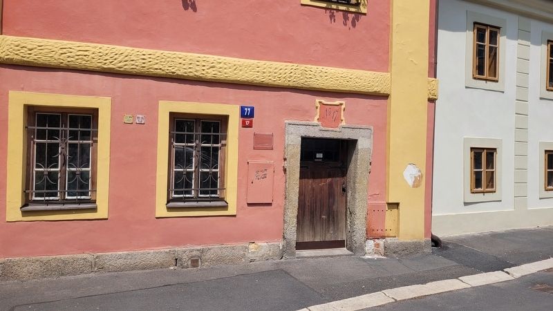
2. The entrance to the Town house no. 77 and Marker
Other nearby markers. At least 8 other markers are within walking distance of this marker: Historie Chebského hradu / Cheb Castle History (within shouting distance of this marker); Chebský Hrad / Cheb Castle (within shouting distance of this marker); Purkrabí a Zlovolný Duch / Burgrave and the Malevolent Ghost (about 90 meters away, measured in a direct line); Bombarda, 15. Století / Bombard, 15th Century (about 90 meters away); Městský dům č. p. 353 / Town house no. 353 (about 120 meters away); Městský dům č. p. 267 / Town house no. 267 (about 120 meters away); Městský dům č. p. 266 / Town house no. 266 (about 120 meters away); Městský dům č. p. 397 / Town house no. 397 (about 150 meters away). Touch for a list and map of all markers in Cheb.
Photographed by James Hulse, June 17, 2025
3. The view of the Town house no. 77 from the street
Credits. This page was last revised on October 26, 2025. It was originally submitted on October 6, 2025, by James Hulse of Medina, Texas. This page has been viewed 53 times since then and 16 times this year. Photos: 1, 2, 3. submitted on October 7, 2025, by James Hulse of Medina, Texas.
