Cheb, Karlovy Vary, Czechia — Central Europe (Bohemia)
Městský dům č. p. 111
⎯⎯⎯
Town house no. 111
Photographed by James Hulse, June 17, 2025
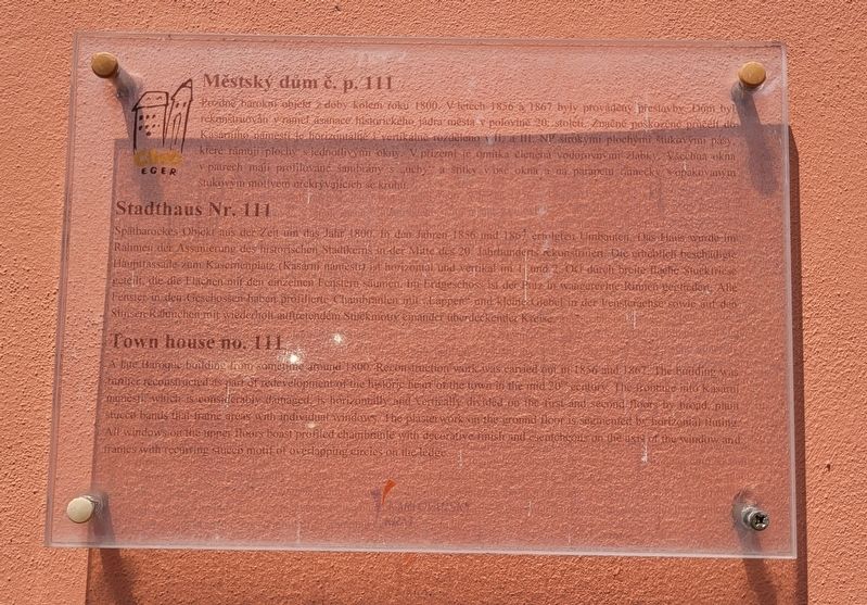
1. Městský dům č. p. 111 / Town house no. 111 Marker

Městský dům č. p. 111
Pozdně barokní objekt z doby kolem roku 1800. V letech 1836 a 1867 byly prováděny přestavby. Dům byl rekonstruován v rámci asanace historického jádra města v polovině 20. století. Značně poškozené průčelí do Kasárenského náměstí je horizontálně i vertikálně rozděleno v II. a III. NP širokými plochými štukovými pásy, které rámují plochy s jednotlivými okny. V přízemí je omítka členěná vodorovnými žlábky. Všechna okna v patrech mají profilované šambrány s uchy a štítky v ose okna a na parapetní rámečky opakovaným štukovým motivem překrývajících se kruhů.
Stadthaus Nr. 111
Spätbarockes Objekt aus der Zeit um das Jahr 1800. In den Jahren 1856 und 1867 erfolgten Umbauten. Das Haus wurde im Rahmen der Assanierung des historischen Stadtkerns in der Mitte des 20. Jahrhunderts rekonstruiert. Die erheblich beschädigte Hauptfassade zum Kasernenplatz (Kasární náměstí) ist horizontal und vertikal im 1. und 2. OG durch breite flache Stucktfriese geteilt, die die Flächen
this page online
Town house no. 111
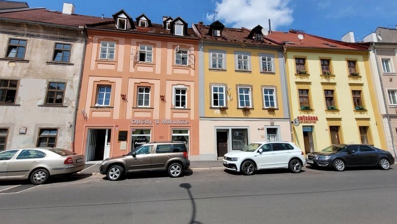
A late Baroque building from sometime around 1800. Reconstruction work was carried out in 1856 and 1867. The building was further reconstructed as part of redevelopment of the historic heart of the town in the mid 20" century. The frontage into Kasární naměstí, which is considerably damaged, is horizontally and vertically divided on the first and second floors by broad, plain stucco bands that frame areas with individual windows. The plasterwork on the ground floor is segmented by horizontal fluting. All windows on the upper floors boast profiled chambranle with decorative finish and escutcheons on the axis of the window and frames with recurring stucco motif of overlapping circles on the ledge.
Erected by Cheb Eger Karlovarský kraj.
Topics. This historical marker is listed in this
Photographed by James Hulse, June 17, 2025
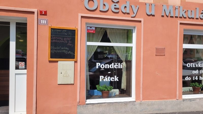
2. The entrance to the Town house no. 111 and Marker
Location. 50° 4.906′ N, 12° 22.222′ E. Marker is in Cheb, Karlovarský kraj ( Karlovy Vary). It is on Kasární námestí just east of Havlíčkova, on the right when traveling west. The marker is located at the entrance to the building. Touch for map. Marker is at or near this postal address: Kasární nám 111, Cheb, Karlovarský kraj 350 02, Czechia. Touch for directions.

Regionally, it is in Europe, the European Union, the Carpathian States, Central Europe, Eastern Europe, the Schengen Area, and the Western World. Historically, it finds itself in what was once the Holy Roman Empire.
Other nearby markers. At least 8 other markers are within walking distance of this marker: Městský dům č. p. 112 / Town house no. 112 (a few steps from this marker); Staré gymnázium č. p. 185 / Old grammar school no. 185 (about 150 meters away, measured in a direct line); Městský dům č. p. 189 / Town house no. 189 (about 150 meters away); Městský dům č. p. 241 / Town house no. 241 (about 150 meters away); Městský dům č. p. 505 / Town house no. 505
Photographed by James Hulse, June 17, 2025
3. Town house no. 111 Marker (middle left building)
Credits. This page was last revised on October 26, 2025. It was originally submitted on October 8, 2025, by James Hulse of Medina, Texas. This page has been viewed 45 times since then and 19 times this year. Photos: 1, 2, 3. submitted on October 10, 2025, by James Hulse of Medina, Texas.
