
Ferryland in CensusDiv 1 - Avalon Peninsula-St. John's, Newfoundland and Labrador — The Atlantic Provinces (North America)
Stakes Point Pass Battery
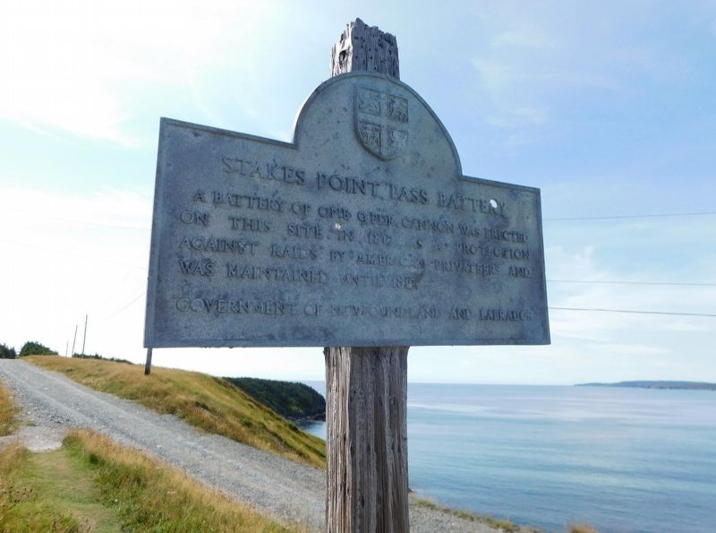
Photographed by Jimmy Emerson
1. Stakes Point Pass Battery Marker
Erected by Government of Newfound and Labrador.
Topics. This historical marker is listed in this topic list: Forts and Castles. A significant historical year for this entry is 1812.
Location. 47° 1.305′ N, 52° 51.861′ W. Marker is in Ferryland, Newfoundland and Labrador, in CensusDiv 1 - Avalon Peninsula-St. John's. It is on Newfoundland and Labrador Route 10. Located in the Ferryland Lighthouse Peninsula. Touch for map. Touch for directions.

Regionally, this marker is in Newfoundland and specifically Labrador’s Islands Trust Area, in Historic Winnipeg, in the Interlake Region, in Central Newfoundland, in Western Newfoundland, in Northern Newfoundland, on the Avalon Peninsula, in Southwest Newfoundland, and in Labrador. It is also in Atlantic Canada. Globally, it is in the North Atlantic Region, North America, the Western Hemisphere, the Western World, and the Anglosphere. Historically, it finds itself in what was once a British colony and also
this page online
Other nearby markers. At least 3 other markers are within walking distance of this marker: The French Attack Ferryland (approx. one kilometer away); Colony of Avalon (approx. 1.5 kilometers away); Ferryland (approx. 1.6 kilometers away).
Credits. This page was last revised on October 9, 2025. It was originally submitted on October 9, 2025, by Jimmy Emerson of Dalton, Georgia. This page has been viewed 119 times since then and 81 times this year. Photo 1. submitted on October 9, 2025, by Jimmy Emerson of Dalton, Georgia. • Andrew Ruppenstein was the editor who published this page.
