Beaulieu Township in Cavalier in Pembina County, North Dakota — The American Midwest (Upper Plains)
Oak Lawn Church
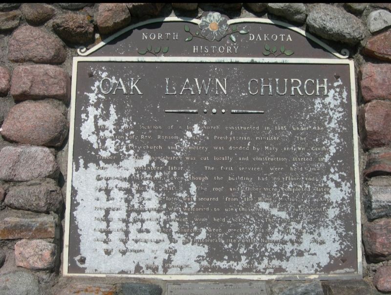
Photographed by Jimmy Emerson, 2012
1. Oak Lawn Church Marker
Inscription.
Oak Lawn Church. . This is the location of a log church constructed in 1885 under the direction of Rev. Ransom Waite, a Presbyterian minister. The land for the church and cemetery was deeded by Mary and Wm. Gavin. Timber for the log church was cut locally and construction started in July with volunteer labor. The first services were held immediately thereafter, even though the building had no floor and the roof and planks were used as seats. The roof and floor were completed later in the year after a loan was secured from the Home Mission. Any Protestant denomination was welcomed to use the church and subsequently Baptist and Methodist services were held here. The church was discontinued when other churches were erected near by but this church was maintained as an historical site until November 1954 when it was destroyed by a fire. State Historical Society of North Dakota
This is the location of a log church constructed in 1885 under the direction
of Rev. Ransom Waite, a Presbyterian minister. The land for the
church and cemetery was deeded by Mary and Wm. Gavin. Timber for the log
church was cut locally and construction started in July with volunteer labor. The first services were held immediately thereafter, even though the building had no floor and the roof and planks were used as seats. The roof and floor were completed later in the year after a loan was secured from the Home Mission. Any Protestant denomination was welcomed to use the church and
subsequently Baptist and Methodist services were held here. The church was discontinued when other churches were erected near by but this church was maintained as an historical site until November 1954 when it was destroyed by a fire.
State Historical Society of North Dakota
Marker is in Cavalier, North Dakota, in Pembina County. It is in Beaulieu Township. It is on County Road 6 (County Road 6), on the right when traveling south. Touch for map. Marker is at or near this postal address: 9299 County Road 6, Cavalier ND 58220, United States of America. Touch for directions.
Regionally, this marker is in North Dakota’s Red River Valley and in the Turtle Mountains. It is also in the American Lewis & Clark Corridor, on the prairies, and on the Northern Plains. Globally, it is in North America, the Western Hemisphere, the Western World, and the Anglosphere. Historically, it finds itself in what was once Ruperts Land and also the Louisiana Purchase.
Other nearby markers. At least 2 other markers are within 13 miles of this marker, measured as the crow flies: Kittson Trading Post (approx. 10.8 miles away); Gingras Trading Post (approx. 12.3 miles away).
Credits. This page was last revised on October 12, 2025. It was originally submitted on October 10, 2025, by Jimmy Emerson of Dalton, Georgia. This page has been viewed 61 times since then and 18 times this year. Photo1. submitted on October 10, 2025, by Jimmy Emerson of Dalton, Georgia. • Andrew Ruppenstein was the editor who published this page.
Editor’s want-list for this marker. photo of the marker within its surroundings • Can you help?

