Pembina in Pembina County, North Dakota — The American Midwest (Upper Plains)
Pembina State Park
Photographed by Jimmy Emerson, 2012
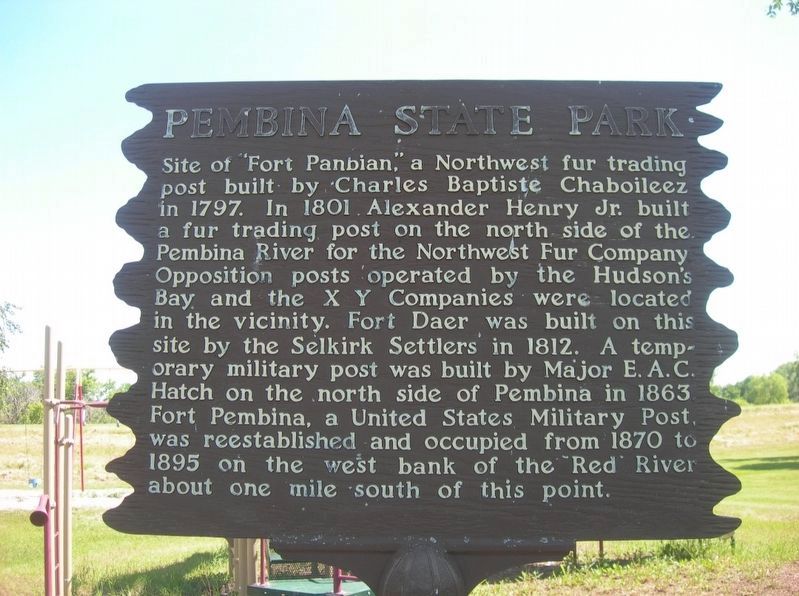
1. Pembina State Park Marker
Site of "Fort Panbian", a Northwest fur trading post built by Charles Baptiste Chaboileez in 1797. In 1801 Alexander Henry Jr. built a fur trading post on the north side of the Pembina River for the Northwest Fur Company Opposition posts operated by the Hudson's Bay, and the X Y Companies were located in the vicinity. Fort Daer was built on this site by the Selkirk Settlers in 1812. A temporary military post was built by Major E. A.C. Hatch on the north side of Pembina in 1863. Fort Pembina, a United States Military Post, was reestablished and occupied from 1870 to 1895 on the west bank of the Red River about one mile south of this point
Topics. This historical marker is listed in these topic lists: Forts and Castles • Industry & Commerce • Settlements & Settlers. A significant historical year for this entry is 1797.
Location. 48° 57.944′ N, 97° 14.453′ W. Marker is in Pembina, North Dakota, in Pembina County. It is on Stutsman Street, on the left when traveling east. The marker is adjacent to the children’s playground in Pembina State Park. Touch for map. Marker is at or near this postal address: 399 East Stutsman
this page online

Regionally, this marker is in the Red River Valley and in the Turtle Mountains. It is also in the American Lewis & Clark Corridor, on the prairies, and on the Northern Plains. Globally, it is in North America, the Western Hemisphere, the Western World, and the Anglosphere. Historically, it finds itself in what was once Rupert’s Land and also the Louisiana Purchase.
Other nearby markers. At least 8 other markers are within 21 kilometers of this marker, measured as the crow flies: Votes For Women (approx. 0.8 miles away); Walter Welford (approx. 0.8 miles away); Dumoulin Church (approx. 1.6 miles away); Pembina - Emerson Area (approx. 2.7 miles away in Canada); Emerson Court House and Town Hall (approx. 4.9 kilometers away in Canada); Fort Dufferin (approx. 7.8 kilometers away in Canada); First Railway in Western Canada / Le Premier Chemin de Fer de L'Ouest du Canada (approx. 20.6 kilometers away in Canada); The Fish (approx. 20.6 kilometers away in Canada). Touch for a list and map of all markers in Pembina.
Another marker is no longer nearby. The March West / La Marche Vers L'ouest (was approx. 7.8 kilometers away in Canada but has been permanently removed).
Credits. This page was last revised on November 6, 2025. It was originally submitted on October 11, 2025, by Jimmy Emerson of Dalton, Georgia. This page has been viewed 64 times since then and 36 times this year. Photo 1. submitted on October 11, 2025, by Jimmy Emerson of Dalton, Georgia. • Andrew Ruppenstein was the editor who published this page.
