Bigbee in Washington County, Alabama — The American South (East South Central)
Ellisville
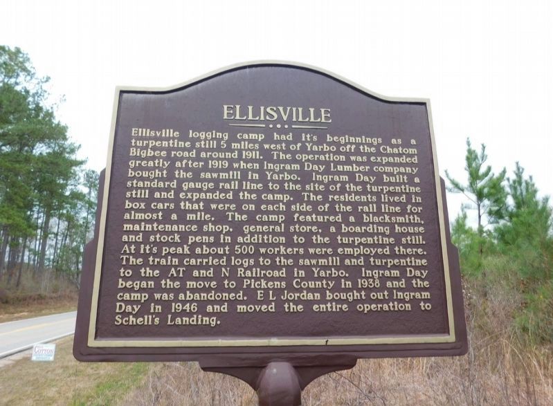
Photographed by Jimmy Emerson, 2022
1. Ellisville Marker
Topics. This historical marker is listed in these topic lists: Industry & Commerce • Railroads & Streetcars. A significant historical year for this entry is 1911.
Location. 31° 32.627′ N, 88° 12.012′ W. Marker is in Bigbee, Alabama, in Washington
this page online

Regionally, this marker is in the Mobile Bay area. It is also in the American South and specifically in the Deep South. Globally, it is in North America, a Gulf of Mexico state, the Western Hemisphere, the Western World, and the Anglosphere. Historically, it finds itself in what was once New Spain, the territory of the Mississippian Culture, one of the Confederate States of America, and the Antebellum South.
Other nearby markers. At least 8 other markers are within 9 miles of this marker, measured as the crow flies: Yarbo (approx. 4.3 miles away); German P.O.W. Camps from WW II (approx. 5.6 miles away); Washington County Veterans Memorial (approx. 6.3 miles away); Washington County (approx. 6.3 miles away); Washington County Courthouse (approx. 6.3 miles away); Washington County Confederate Memorial (approx. 6.4 miles away); Old St. Stephens Masonic Lodge No. 9 / St. Stephens Lodge (approx. 8.6 miles away); St. Stephens Courthouse and Masonic Lodge (approx. 8.6 miles away).
Credits. This page was last revised on October 12, 2025. It was originally submitted on October 12, 2025, by Jimmy Emerson of Dalton, Georgia. This page has been viewed 76 times since then and 36 times this year. Photo 1. submitted on October 12, 2025, by Jimmy Emerson of Dalton, Georgia. • James Hulse was the editor who published this page.
Editor’s want-list for this marker. A wide view photo of the marker and the surrounding area together in context. • Can you help?
