Citizen Involvement Committee in Oregon City in Clackamas County, Oregon — The American West (Northwest)
Historic Oregon City
Photographed by Ian Lefkowitz, October 19, 2023
1. Historic Oregon City Marker
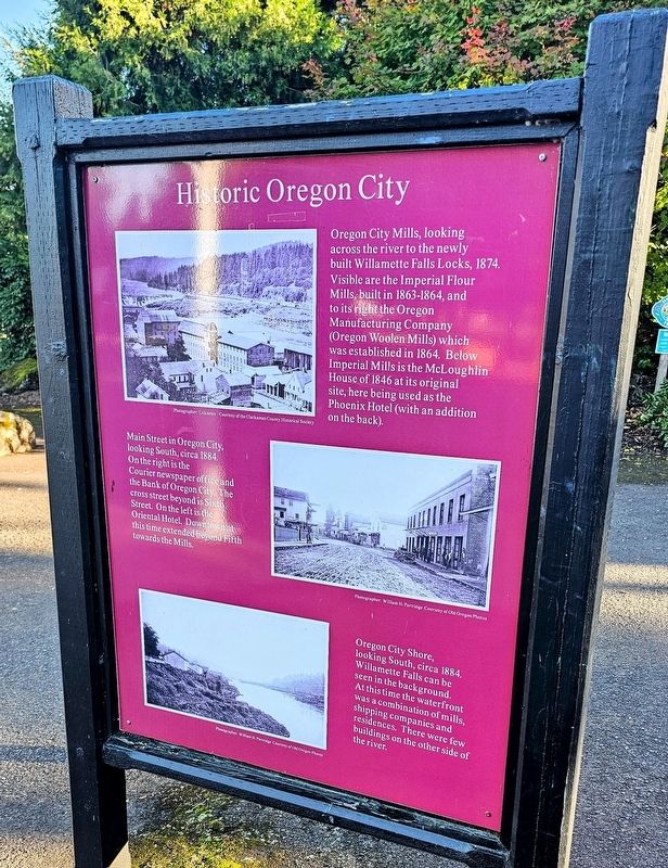
Oregon City Mills, looking across the river to the newly built Willamette Falls Locks, 1874. Visible are the Imperial Flour Mills, built in 1863-1864, and to its right the Oregon Manufacturing Company (Oregon Woolen Mills) which was established in 1864. Below Imperial Mills is the McLoughlin House of 1846 at its original site, here being used as the Phoenix Hotel (with an addition on the back).
Main Street in Oregon City, looking South, circa 1884. On the right is the Courier newspaper office and the Bank of Oregon City. The cross street beyond is Sixth Street. On the left is the Oriental Hotel. Downtown at this time extended beyond Fifth towards the Mills.
Oregon City Shore, looking South, circa 1884. Willamette Falls can be seen in the background. At this time the waterfront was a combination of mills, shipping companies and residences. There were few buildings on the other side of the river.
Topics. This historical marker is listed in these topic lists: Industry & Commerce • Notable Places • Settlements & Settlers. A significant historical year for this entry is 1884.
Location. 45° 21.883′ N, 122° 35.645′ W.
this page online

Regionally, this marker is in the Willamette Valley and in Greater Portland Area. It is also on the American Pacific Coast, in the Pacific Northwest, and in the Lewis & Clark Corridor. Globally, it is in North America, in the Cascade Range, on the Ring of Fire, on the Pacific Rim, in the Western Hemisphere, in the Western World, and in the Anglosphere.
Other nearby markers. At least 8 other markers are within walking distance of this marker: Willamette Falls, circa 1880 (here, next to this marker); Abernethy Green (within shouting distance of this marker); George Abernethy's Historical Significance (within shouting distance of this marker); Abigail Scott Duniway (within shouting distance of this marker); End of the Oregon Trail (within shouting distance of this marker); Fishing At Tumwater
Photographed by Ian Lefkowitz, October 19, 2023
2. Historic Oregon City Marker
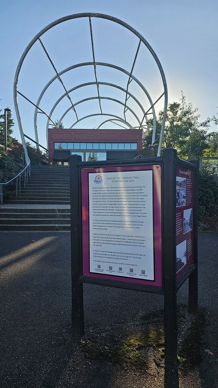
The rear of the marker introduces the amenities and experiences found at the End of the Oregon Trail Interpretive Site.

Photographed by Ian Lefkowitz, October 19, 2023
3. End of the Oregon Trail
A plaza nearby in the shape of a covered wagon marks the end of the Oregon Trail.
Credits. This page was last revised on October 13, 2025. It was originally submitted on April 10, 2025, by Ian Lefkowitz of New York, New York. This page has been viewed 263 times since then and 51 times this year. Last updated on October 12, 2025, by Douglass Halvorsen of Klamath Falls, Oregon. Photos: 1, 2, 3. submitted on April 10, 2025, by Ian Lefkowitz of New York, New York. • Devry Becker Jones was the editor who published this page.
