Milford Mine Memorial Park in Wolford in Crow Wing County, Minnesota — The American Midwest (Upper Plains)
Timber Shaft
| — | Milford Mine Memorial Park | — |
Photographed by McGhiever, June 27, 2025
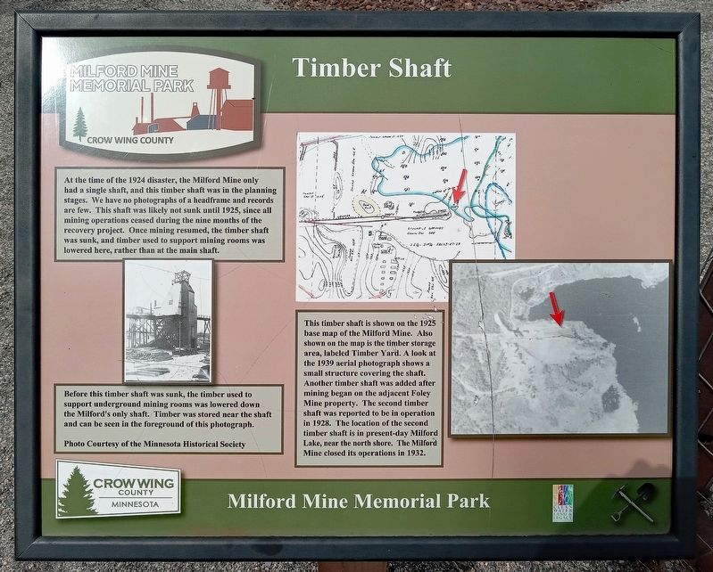
1. Timber Shaft Marker
At the time of the 1924 disaster, the Milford Mine only had a single shaft, and this timber shaft was in the planning stages. We have no photographs of a headframe and records are few. This shaft was likely not sunk until 1925, since all mining operations ceased during the nine months of the recovery project. Once mining resumed, the timber shaft was sunk, and timber used to support mining rooms was lowered here, rather than at the main shaft.
Before this timber shaft was sunk, the timber used to support underground mining rooms was lowered down the Milford's only shaft. Timber was stored near the shaft and can be seen in the foreground of this photograph.
Photo Courtesy of the Minnesota Historical Society
This timber shaft is shown on the 1925 base map of the Milford Mine. Also shown on the map is the timber storage area, labeled Timber Yard. A look at the 1930 aerial photograph shows a small structure covering the shaft. Another timber shaft was added after mining began on the adjacent Foley Mine property. The second timber shaft was reported to be in operation in 1928. The location of the second timber shaft
this page online
Erected by Crow Wing County.
Topics. This historical marker is listed in this topic list: Industry & Commerce. A significant historical year for this entry is 1925.
Location. 46° 32.112′ N, 93° 58.225′ W. Marker is in Wolford, Minnesota, in Crow Wing County. It is in Milford Mine Memorial Park. It can be reached from Milford Lake Drive. The marker is near the base of the pier on Milford Lake. Touch for map. Marker is in this post office area: Crosby MN 56441, United States of America. Touch for directions.

Regionally, this marker is in the Northland. It is also in the American Midwest, in the Corn Belt, and in the Great River Road Region. Globally, it is in North America, the Great North Woods, the Western Hemisphere, the Western World, and the Anglosphere. Historically, it finds itself in what was once Rupert’s Land, the territory of the Mississippian Culture, and the Northwest Territory.
Other nearby markers. At least 8 other markers are within walking distance of this marker: Milford Miners Memorial (within shouting

Photographed by McGhiever, June 27, 2025
2. Timber Shaft and Marker overlooking Milford Lake
Credits. This page was last revised on October 12, 2025. It was originally submitted on October 12, 2025, by McGhiever of Minneapolis, Minnesota. This page has been viewed 41 times since then and 11 times this year. Photos: 1, 2. submitted on October 12, 2025, by McGhiever of Minneapolis, Minnesota.
