Cloverport in Breckinridge County, Kentucky — The American South (East South Central)
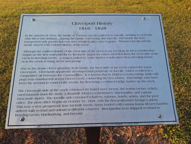
Cloverport History 1816-1828
Photographed by Jason Voigt, September 29, 2025
1. Cloverport History 1816-1828 Marker
In the autumn of 1816, the family of Thomas Lincoln pulled in to Joeville, seeking to cross the Ohio River into Indiana. Among the family was young Abe Lincoln. Previously the ferry transported only goods, but was now rebuilt to also carry wagons. Thomas Lincoln and his family stayed with Colonel Murray at his home.
Although the earliest history of the west side of the creek is not yet clear, in 1812 construction began on the first road paid for by Kentucky taxpayers which stretched from the west side of the creek to Bowling Green. A wagon pulled by white horses would arrive from Bowling Green near the creek to bring news and gossip.
Due to the dense clover growing on it banks, the West Side of the creek earned the name Cloverport. Cloverport apparently developed independently of Joeville, which resulted in a competitive air between the communities. It is known that in 1820 a wooden bridge built with pegs was constructed across Clover Creek, connecting the two towns. This bridge may have been the second to connect the towns, the first being a covered bridge further up the creek.
The Cloverport side of the creek
this page online
Topics. This historical marker is listed in these topic lists: Industry & Commerce • Settlements & Settlers. A significant historical date for this entry is October 16, 1828.
Location. 37° 50.263′ N, 86° 37.933′ W. Marker is in Cloverport, Kentucky, in Breckinridge County. It is on West Front Street west of Elm Street, on the right when traveling east. Touch for map. Marker is at or near this postal address: 207 W Main St, Cloverport KY 40111, United States of America. Touch for directions.

Regionally, this marker is in the Western Coal Field. It is also in the American South, specifically

Photographed by Jason Voigt, September 29, 2025
2. Cloverport History 1816-1828 Marker
Other nearby markers. At least 8 other markers are within walking distance of this marker: Cloverport History 1830-1860 (a few steps from this marker); Cloverport History 1803-1813 (a few steps from this marker); Cloverport History 1729-1802 (within shouting distance of this marker); Cloverport History 1873-1929 (about 300 feet away, measured in a direct line); Cloverport History 1901-1922 (about 400 feet away); Cloverport History - Late 1900's to Present (about 400 feet away); First Coal Oil (about 600 feet away); Lincoln Family Trail (about 700 feet away). Touch for a list and map of all markers in Cloverport.
Also see . . . Cloverport, Kentucky on Wikipedia. (Submitted on October 18, 2025, by Jason Voigt of Glen Carbon, Illinois.)
Credits. This page was last revised on October 18, 2025. It was originally submitted on October 18, 2025, by Jason Voigt of Glen Carbon, Illinois. This page has been viewed 92 times since then and 42 times this year. Photos: 1, 2. submitted on October 18, 2025, by Jason Voigt of Glen Carbon, Illinois.
