Fergus in Centre Wellington in Wellington County, Ontario — Central Canada (North America)
Weigh Scale Building
Photographed by Tim Boyd, October 18, 2025
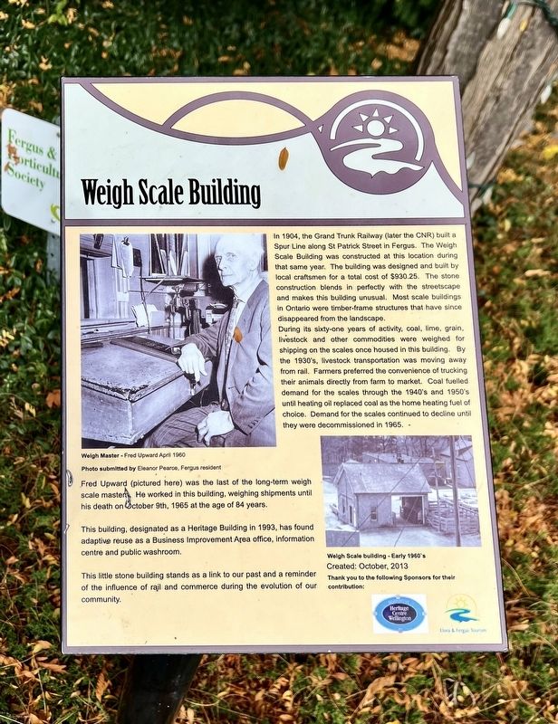
1. Weigh Scale Building Marker
In 1904, the Grand Trunk Railway (later the CNR) built a Spur Line along St Patrick Street in Fergus. The Weigh Scale Building was constructed at this location during that same year. The building was designed and built by local craftsmen for a total cost of $930.25. The stone construction blends in perfectly with the streetscape and makes this building unusual. Most scale buildings in Ontario were timber-frame structures that have since disappeared from the landscape.
During its sixty-one years of activity, coal, lime, grain, livestock and other commodities were weighed for shipping on the scales once housed in this building. By the 1930's, livestock transportation was moving away from rail. Farmers preferred the convenience of trucking their animals directly from farm to market. Coal fuelled demand for the scales through the 1940's and 1950's until heating oil replaced coal as the home heating fuel of choice. Demand for the scales continued to decline until they were decommissioned in 1965.
Fred Upward (pictured here) was the last of the long-term weigh scale masters. He worked in this building, weighing shipments
this page online
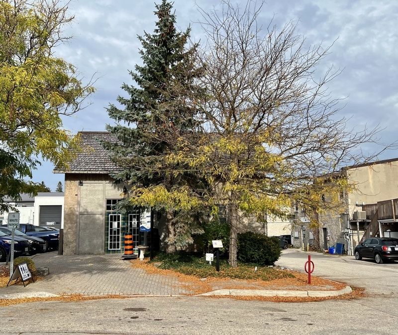
This building, designated as a Heritage Building in 1993, has found adaptive reuse as a Business Improvement Area office, information centre and public washroom.
This little stone building stands as a link to our past and a reminder of the influence of rail and commerce during the evolution of our community.
Erected 2013 by Heritage Centre Wellington.
Topics. This historical marker is listed in these topic lists: Industry & Commerce • Railroads & Streetcars. A significant historical year for this entry is 1904.
Location. 43° 42.3′ N, 80° 22.752′ W. Marker is in Centre Wellington, Ontario, in Wellington County. It is in Fergus. It is on Provost Lane 0.1 kilometers south of St. Patrick Street West when traveling north. Touch for map. Marker is at or near this postal address: 160 St Patrick Street W, Centre Wellington ON N1M 1L5, Canada. Touch for directions.

Regionally, this marker is in the Huron-Perth-Waterloo-Wellington Area and in Southwestern Ontario. It is also in Central Canada. Globally, it is in North America, the Western Hemisphere, the
Photographed by Tim Boyd, October 18, 2025
2. Former Weigh Scale Building and marker
Other nearby markers. At least 8 other markers are within walking distance of this marker: 212 St. Andrew Street W (within shouting distance of this marker); Templin Gardens (within shouting distance of this marker); The Founders of Fergus (about 120 meters away, measured in a direct line); The Fergus Curling Club / Club de Curling de Fergus (about 150 meters away); St. David Street Bridge (about 180 meters away); The Kissing Stane (about 180 meters away); Fergus Swimming Pool (about 240 meters away); St. Andrew’s Presbyterian Church (about 240 meters away). Touch for a list and map of all markers in Centre Wellington.
Credits. This page was last revised on October 22, 2025. It was originally submitted on October 20, 2025, by Tim Boyd of Hamilton, Ontario. This page has been viewed 51 times since then and 24 times this year. Photos: 1, 2. submitted on October 20, 2025, by Tim Boyd of Hamilton, Ontario. • Andrew Ruppenstein was the editor who published this page.
