Fergus in Centre Wellington in Wellington County, Ontario — Central Canada (North America)
212 St. Andrew Street W
Photographed by Tim Boyd, October 18, 2025
1. 212 St. Andrew Street. W Marker
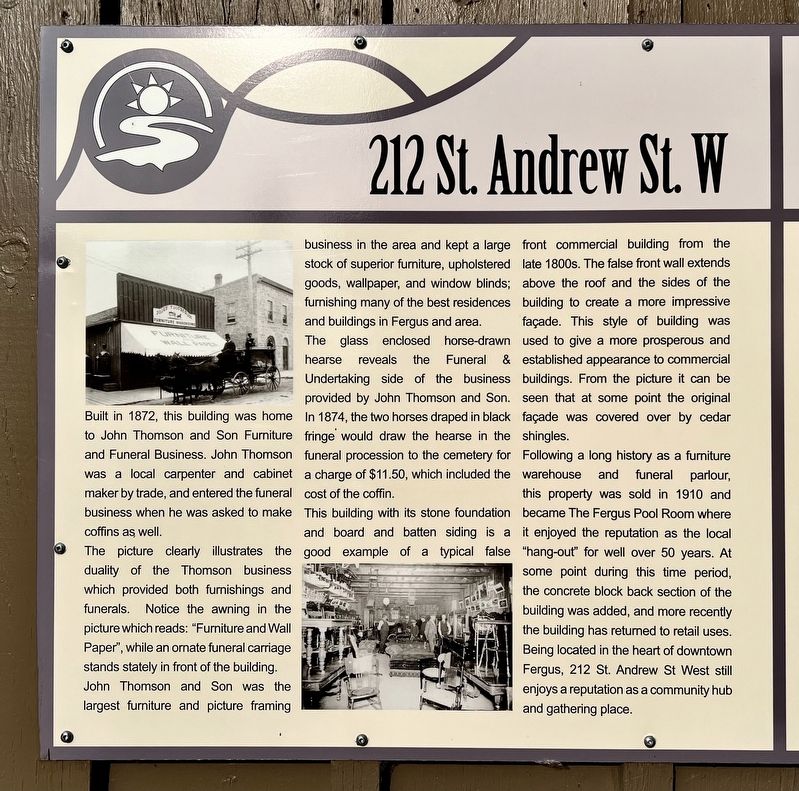
The picture clearly illustrates the duality of the Thomson business which provided both furnishings and funerals. Notice the awning in the picture which reads: "Furniture and Wall Paper", while an ornate funeral carriage stands stately in front of the building. John Thomson and Son was the largest furniture and picture framing business in the area and kept a large stock of superior furniture, upholstered goods, wallpaper, and window blinds; furnishing many of the best residences and buildings in Fergus and area.
The glass enclosed horse-drawn hearse reveals the Funeral & Undertaking side of the business provided by John Thomson and Son. In 1874, the two horses draped in black fringe would draw the hearse in the funeral procession to the cemetery for a charge of $11.50, which included the cost of the coffin.
This building with its stone foundation and board
this page online
Following a long history as a furniture warehouse and funeral parlour, this property was sold in 1910 and became The Fergus Pool Room where it enjoyed the reputation as the local "hang-out" for well over 50 years. At some point during this time period, the concrete block back section of the building was added, and more recently the building has returned to retail uses. Being located in the heart of downtown Fergus, 212 St. Andrew St West still enjoys a reputation as a community hub and gathering place.
Topics. This historical marker is listed in these topic lists: Architecture • Industry & Commerce. A significant historical year for this entry is 1872.
Location. 43° 42.274′ N, 80° 22.723′ W.

Photographed by Tim Boyd, October 18, 2025
2. 212 St. Andrew Street. W Marker
the marker (the left of the two) is attached to 212 St. Andrew St. W

Regionally, this marker is in the Huron-Perth-Waterloo-Wellington Area and in Southwestern Ontario. It is also in Central Canada. Globally, it is in North America, the Western Hemisphere, the Western World, and the Anglosphere. Historically, it finds itself in what was once a British colony, the Viceroyalty of New France, the Haudenosaunee (Iroquois) Confederacy, and Rupert’s Land.
Other nearby markers. At least 8 other markers are within walking distance of this marker: Templin Gardens (here, next to this marker); Weigh Scale Building (within shouting distance of this marker); The Founders of Fergus (within shouting distance of this marker); St. David Street Bridge (about 180 meters away, measured in a direct line); Fergus Swimming Pool (about 210 meters away); The Kissing Stane (about 210 meters away); The Fergus Curling Club / Club de Curling de Fergus (about 210 meters away); St. Andrew’s Presbyterian Church (approx. 0.3 kilometers away). Touch for a list and map of all markers in Centre Wellington.
Credits. This page was last revised on October 23, 2025. It was originally submitted on October 20, 2025, by Tim Boyd of Hamilton, Ontario. This page has been viewed 58 times since then and 20 times this year. Photos: 1, 2. submitted on October 20, 2025, by Tim Boyd of Hamilton, Ontario. • Andrew Ruppenstein was the editor who published this page.
