Near Richmond in Fort Bend County, Texas — The American South (West South Central)
John Foster Land Grant
Photographed by James Hulse, September 15, 2020
1. John Foster Land Grant Marker
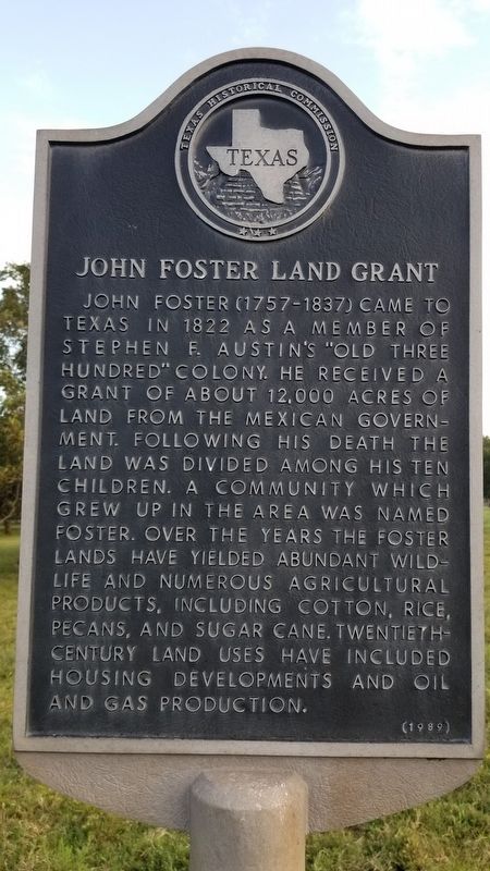
John Foster (1757-1837) came to Texas in 1822 as a member of Stephen F. Austin's "Old Three Hundred" Colony. He received a grant of about 12,000 acres of land from the Mexican Government. Following his death the land was divided among his ten children. A community which grew up in the area was named Foster. Over the years the Foster lands have yielded abundant wildlife and numerous agricultural products, including cotton, rice, pecans, and sugar cane. Twentieth century land uses have included housing developments and oil and gas production.
Erected 1989 by Texas Historical Commission. (Marker Number 8997.)
Topics. This historical marker is listed in these topic lists: Industry & Commerce • Settlements & Settlers. A significant historical year for this entry is 1822.
Location. 29° 39.204′ N, 95° 50.641′ W. Marker is near Richmond, Texas, in Fort Bend County. It is on Winner Foster Road one mile west of Farm to Market Road 359, on the left when traveling west. Touch for map. Marker is in this post office area: Richmond TX 77406, United States of America. Touch for directions.

Regionally, this marker is in the Houston Metropolitan Area. It is also on the American Gulf Coast. Globally, it is in North America, a Gulf of Mexico state, the Western Hemisphere, the Western World, and the Anglosphere. Historically, it finds itself in what was once New Spain, the Republic of Texas, one of the Confederate States of America, and the Antebellum South.
Other nearby markers. At least 8 other markers are within 5 miles of this marker, measured as the crow flies: Foster Community (approx. 1.3 miles away); Pleasant Hill Cemetery (approx. 2.3 miles away); Randon & Pennington Grant of 1824 (approx. 2½ miles away); John Foster (approx. 2.7 miles away); Randolph Foster (approx. 2.7 miles away); Town of Fulshear
this page online
Also see . . . John Foster. TSHA Texas State Historical Association (Submitted on October 11, 2020, by James Hulse of Medina, Texas.)
Photographed by James Hulse, September 15, 2020
2. John Foster Land Grant Marker
Credits. This page was last revised on October 22, 2025. It was originally submitted on October 11, 2020, by James Hulse of Medina, Texas. This page has been viewed 1,016 times since then and 93 times this year. Last updated on October 21, 2025, by Jeff Leichsenring of Garland, Texas. Photos: 1, 2. submitted on October 11, 2020, by James Hulse of Medina, Texas.
