
Near Winterset in Madison County, Iowa — The American Midwest (Upper Plains)
Roseman Covered Bridge
Photographed by William Fischer, Jr., February 18, 2014
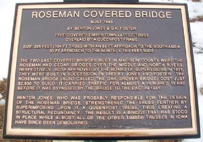
1. Roseman Covered Bridge Marker
Built: 1883
By: Benton Jones & G.K. Foster
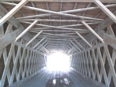
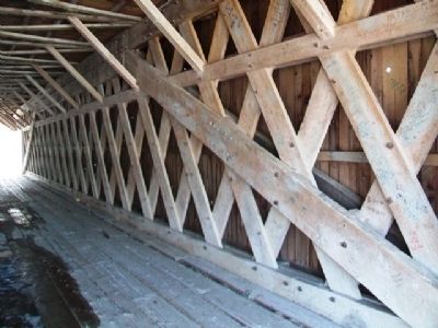
Type: Covered Timber Town Lattice Truss overlaid by a Queenpost Frame
Size: 225 feet (104 ft truss with an 88 ft approach to the south and a 33 ft approach to the north) x 15.4 feet wide
The two last covered bridges built in Madison County were the Roseman and Cedar Bridges over the Middle and North Rivers, respectively. Both approved by the Board of Supervisors in 1877, they were built in succession in 1883 by H.P. Jones and G.K. Foster. The Roseman Bridge (also called the Oak Grove Bridge)cost just $2,930 to build. It carried traffic for almost a hundred years before it was bypassed by the bridge to the east in 1981.
Harvey Pierce (H.P.) Jones, who was probably responsible for the design of the Roseman Bridge, strengthened the truss further by superimposing upon it a Queenpost truss, thus creating a structural redundancy. The result is a bridge that has stood in place while almost all of the other timber trusses in Iowa have since been demolished. (Though the marker states that Benton Jones was probably responsible for the design of the Roseman Bridge, he was mistakenly
this page online
Erected 2012 by Glenna Finney in honor of Thomas E. Smith Family.
Topics and series. This historical marker is listed in these topic lists: Architecture • Bridges & Viaducts • Landmarks • Notable Places. In addition, it is included in the Covered Bridges, and the National Register of Historic Places (NRHP) series lists. A significant historical year for this entry is 1883.
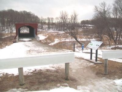
Location. 41° 17.585′ N, 94° 9′ W. Marker is near Winterset, Iowa, in Madison County. It is on Elderberry Avenue south of Roseman Bridge Road, on the right when traveling south. Marker is at the end of the road, at the northwest approach to the bridge, and about six miles WSW of Winterset. Touch for map. Marker is at or near this postal address: 2451 Elderberry Avenue, Winterset IA 50273, United States of America. Touch for directions.

Regionally, this marker is in Southern Iowa and in Greater Des Moines. It is also in the American Midwest and in the
Photographed by William Fischer, Jr., February 18, 2014
2. Roseman Covered Bridge and Marker
Other nearby markers. At least 8 other markers are within 8 miles of this marker, measured as the crow flies: Middle River Water Trail (here, next to this marker); Carnegie Building (approx. 7½ miles away); George Leslie Stout (approx. 7.6 miles away); 102 West Court Avenue (approx. 7.6 miles away); 102 North 1st Avenue (approx. 7.6 miles away); 106 North 1st Avenue (approx. 7.6 miles away); 108 North 1st Avenue (approx. 7.6 miles away); 52 Court Avenue (approx. 7.6 miles away). Touch for a list and map of all markers in Winterset.
Regarding Roseman Covered Bridge. National Register (76000792) Statement of Significance:
H.P. Jones constructed a number of covered bridges in the Winterset region. Although his structures were based upon the Town lattice plan popular in New England, Jones added details uniquely his own. Richard S. Allen (1970) writes (pp. 101-4): "For substructure he used caisson
Photographed by William Fischer, Jr., February 18, 2014
3. Roseman Covered Bridge Trusswork
Covered bridges are an endangered species throughout the United States, and merit preservation everywhere as examples of 19th century utilitarian concepts. A bridge by Jones, with its combination of tradition and innovation in engineering, is if possible even more deserving of protection.
Also see . . . Roseman Covered Bridge National Register Nomination Form. (Submitted on November 22, 2023, by William Fischer, Jr. of Reynoldsburg, Ohio.)
Photographed by William Fischer, Jr., February 18, 2014
4. Roseman Covered Bridge Trusswork Detail
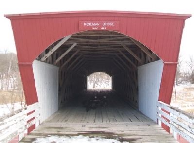
Photographed by William Fischer, Jr., February 18, 2014
5. Roseman Covered Bridge NW Entrance
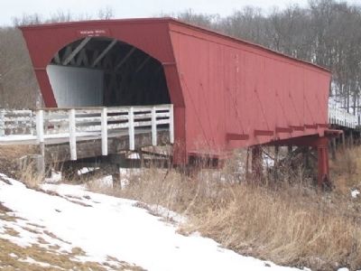
Photographed by William Fischer, Jr., February 18, 2014
6. Roseman Covered Bridge

Photographed by William Fischer, Jr., February 18, 2014
7. Roseman Covered Bridge Graffiti
"The Bridges of Madison County"
Click for more information.
Click for more information.
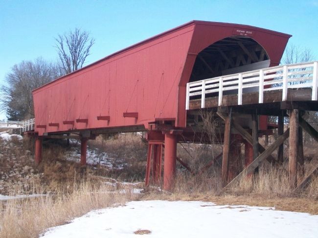
Photographed by William Fischer, Jr., February 18, 2014
8. Roseman Covered Bridge
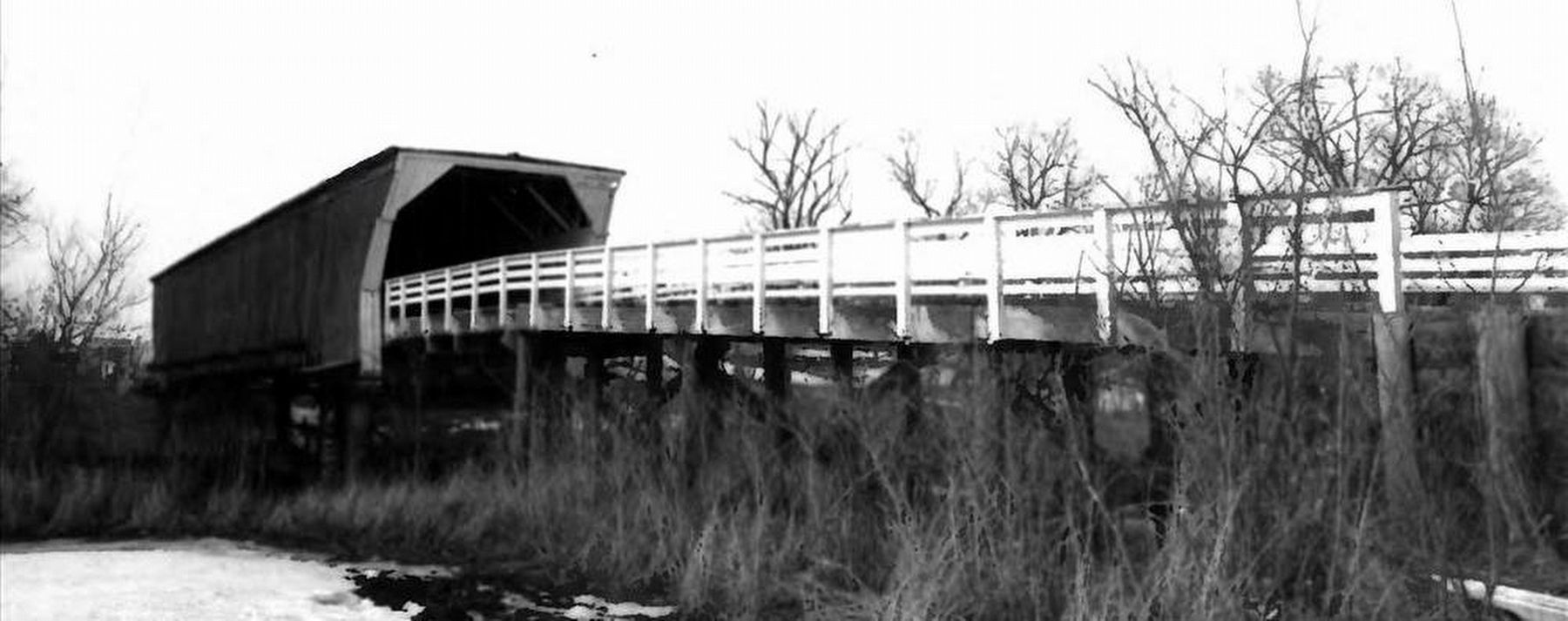
via NPS, unknown
9. Roseman Covered Bridge
National Register of Historic Places
Credits. This page was last revised on February 24, 2026. It was originally submitted on March 19, 2014, by William Fischer, Jr. of Reynoldsburg, Ohio. This page has been viewed 1,179 times since then and 86 times this year. Last updated on October 23, 2025, by Teddi Yaeger of Winterset, Iowa. Photos: 1, 2, 3, 4, 5, 6, 7, 8. submitted on March 19, 2014, by William Fischer, Jr. of Reynoldsburg, Ohio. 9. submitted on April 16, 2023, by Larry Gertner of New York, New York. • Devry Becker Jones was the editor who published this page.
