Near Abbott in Hill County, Texas — The American South (West South Central)
The Longest Garden
Photographed by James Hulse, October 22, 2025
1. The Longest Garden Marker
Inscription.
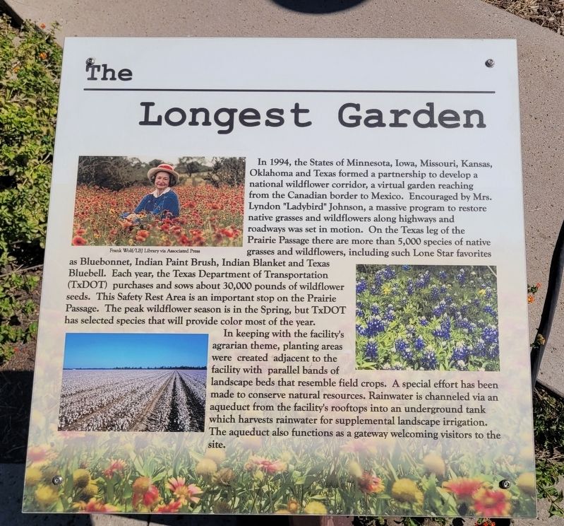
In 1994, the States of Minnesota, Iowa, Missouri, Kansas, Oklahoma and Texas formed a partnership to develop a national wildflower corridor, a virtual garden reaching from the Canadian border to Mexico. Encouraged by Mrs. Lyndon "Ladybird" Johnson, a massive program to restore native grasses and wildflowers along highways and roadways was set in motion. On the Texas leg of the Prairie Passage there are more than 5,000 species of native grasses and wildflowers, including such Lone Star favorites as Bluebonnet, Indian Paint Brush, Indian Blanket and Texas Bluebell. Each year, the Texas Department of Transportation (TxDOT) purchases and sows about 30,000 pounds of wildflower seeds. This Safety Rest Area is an important stop on the Prairie Passage. The peak wildflower season is in the Spring, but TxDOT has selected species that will provide color most of the year.
In keeping with the facility's agrarian theme, planting areas were created adjacent to the facility with parallel bands of landscape beds that resemble field crops. A special effort has been made to conserve natural resources. Rainwater is channeled via an aqueduct
Click or scan to see this page online
from the facility's rooftops into an underground tank which harvests rainwater for supplemental landscape irrigation. The aqueduct also functions as a gateway welcoming visitors to the site.
Captions (Photo #1) Frank Wolf/LBJ Library via Associated Press
Topics. This historical marker is listed in this topic list: Horticulture & Forestry. A significant historical year for this entry is 1994.
Location. 31° 55.028′ N, 97° 5.794′ W. Marker is near Abbott, Texas, in Hill County. It is on Interstate 35 1½ miles Pine Street, on the right when traveling north. The marker is located at the Hill County Northbound Safety Rest Area. Touch for map. Marker is at or near this postal address: 1538 I-35, Abbott TX 76621, United States of America. Touch for directions.
Regionally, this marker is in the Prairies & Lakes Region. Globally, it is in North America, a Gulf of Mexico state, the Western Hemisphere, the Western World, and the Anglosphere. Historically, it finds itself in what was once New Spain, the Republic of Texas, and one of the Confederate States of America.
Other nearby markers. At least 8 other markers are within 3 miles
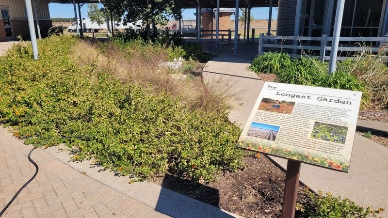
3. The view of the Longest Garden and Marker at the rest area
Credits. This page was last revised on October 24, 2025. It was originally submitted on October 23, 2025, by James Hulse of Medina, Texas. This page has been viewed 66 times since then and 15 times this year. Photos:1, 2, 3. submitted on October 24, 2025, by James Hulse of Medina, Texas.