Swope Parkway - Elmwood in Kansas City in Jackson County, Missouri — The American Midwest (Upper Plains)
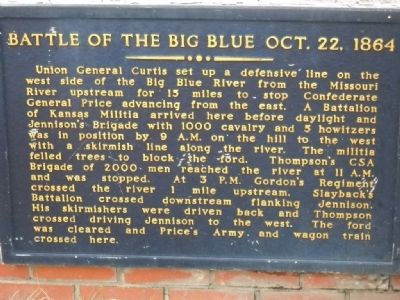
Battle of the Big Blue
Oct. 22, 1864
Union General Curtis set up a defensive line on the west side of the Big Blue River from the Missouri River upstream for 15 miles to stop Confederate General Price advancing from the east. A Battalion of Kansas Militia arrived here before daylight and Jennison’s Brigade with 1000 cavalry and 5 howitzers with a skirmish line along the river. The militia felled trees to block the ford. Thompson’s CSA Brigade of 2000 men reached the river at 11 A.M. and was stopped. At 3 P.M. Gordon’s Regiment crossed the river 1 mile upstream. Slayback’s Battalion crossed downstream flanking Jennison. His skirmishers were driven back and Thompson crossed driving Jennison to the west. The ford was cleared and Price’s Army and wagon train crossed here.
right marker
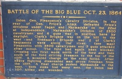
Oct. 23, 1864
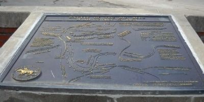
Union Gen. Pleasanton’s Cavalry Division, in the rear of Gen. Price’s Army, defeated Price’s divisions under Fagan and Marmaduke on the 22nd at Independence. Marmaduke’s Division of 2500 cavalrymen and 6 guns was in position here by daylight. Clark’s Brigade was on the hill to the west and Freeman’s Brigade and 2 of Clark’s Regiments were along the river. (see map) Pleasanton with 3500 cavalrymen and 3 guns attacked after sunup. The ford had again been blocked. Crossing was first made north of the ford and then south of the ford driving the Freeman to the top of the cliff. A mounted charge up the roar failed. After heavy fighting dismounted men drove Freeman from the cliff. A final charge pushed Marmaduke to the west. Both sides lost many men. The Union had 200 killed and wounded.
map of the Battle of the Big Blue
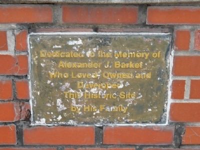
dedication plaque
Erected by Family of Alexander J. Barket. (Marker Number 17.)
Topics and series. This historical marker is listed in this topic list: War, US Civil. In addition, it is included in the Missouri – Battle of Westport series list. A significant historical year for this entry is 1864.
Location. 39° 0.924′ N, 94° 31.55′ W. Marker is in Kansas City, Missouri, in Jackson County. It is in Swope Parkway - Elmwood. Marker is at the intersection of Manchester Trafficway, on the left when traveling north on Manchester Trafficway. Touch for map. Marker is in this post office area: Kansas City MO 64132, United States of America. Touch for directions.
Other nearby markers. At least 8 other markers are within walking distance of this marker. Battle of the Big Blue, October 22, 1864 (about 300 feet away, measured in a direct line); Byram's Ford Battlefield (about 500 feet away); Byram's Ford Historic District (approx. ¼ mile away); Pratt's Artillery (approx. ¼ mile away); Log House and Defensive Line (approx. 0.3 miles away); Byram's Ford and the Battle of Westport (approx. 0.3 miles away); Storm of Lead (approx. 0.3 miles away); Contested Crossing (approx. 0.3 miles away). Touch for a list and map of all markers in Kansas City.
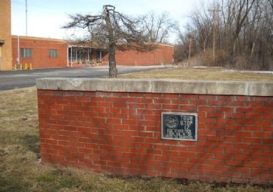
More about this marker. This marker is located at the corner where Manchester Trafficway turns towards the north after crossing the railroad tracks.
Also see . . .
1. Battle of Westport. Link from the Civil War Muse with further information on this tour stop. (Submitted on March 16, 2010, by Thomas Onions of Olathe, Kansas.)
2. John S Marmaduke. Wikipedia link on the life and career of Confederate division commander who fought here. (Submitted on March 16, 2010, by Thomas Onions of Olathe, Kansas.)
3. Alfred Pleasonton. Wikipedia Link to the life and career of the Commander of the Union Forces pursuing General Price across Missouri (Submitted on March 16, 2010, by Thomas Onions of Olathe, Kansas.)
Credits. This page was last revised on February 10, 2023. It was originally submitted on March 16, 2010, by Thomas Onions of Olathe, Kansas. This page has been viewed 1,798 times since then and 51 times this year. Photos: 1, 2, 3, 4, 5. submitted on March 16, 2010, by Thomas Onions of Olathe, Kansas.
