Wichita Falls in Wichita County, Texas — The American South (West South Central)
Mt. Pleasant Missionary Baptist Church

Photographed by James Hulse, October 26, 2025
1. Mt. Pleasant Missionary Baptist Church Marker
Founded in 1891 by the Rev. Mr. Thurston and twelve charter members, this congregation was the first to be organized on the east side of Wichita Falls. The fellowship met in the homes of the members until 1894, when a small frame building was erected. That structure and the one that subsequently was built on Pecan Street were destroyed by dynamite, but the congregation continued to worship together despite these setbacks and relocated to 401 Sullivan in 1912.
Mt. Pleasant Missionary Baptist Church experienced much growth in membership and expansion in programs and facilities during the 12-year pastorate of the Rev. E.J. McClendon (1876-1925). In 1928, under the leadership of the Rev. W.D. Davis, a new building was completed. It served the needs of the congregation until 1959, when the church moved to this site.
Throughout its history, Mt. Pleasant Missionary Baptist Church has played a vital role in providing service and leadership to Wichita Falls' Negro community. The congregation has produced a number of pastors from among its members and has been active in Christian education and missionary work.
Incise
The Rev. R.L. Castle, J.R., Pastor, 1942-1974, built this church.
Erected 1984 by Texas Historical Commission. (Marker Number 3520.)
Topics. This historical marker is listed in these topic lists: African Americans • Religion & Religious Structures. A significant historical year for this entry is 1891.
Location. 33° 54.82′ N, 98° 28.519′ W. Marker is in Wichita Falls, Texas, in Wichita County. It is at the intersection of Harding Street and Bailey Avenue, on the left when traveling west on Harding Street. The marker is located at the front of the church. Touch for map. Marker is at or near this postal address: 809 Harding Street, Wichita Falls TX 76301, United States of America. Touch for directions.

Regionally,
this page online
Other nearby markers. At least 8 other markers are within walking distance of this marker: Saint John Baptist Church (approx. 0.2 miles away); Site of Booker T. Washington High School (approx. 0.2 miles away); Booker T. Washington High School (approx. 0.2 miles away); Dr. Colonel Bertram (C.B.) Fuller (approx. 0.3 miles away); Dr. Anne Elizabeth Davis Roark (approx. 0.3 miles away); J. A. Kemp Wholesale Grocery Building (approx. 0.8 miles away); Wichita Falls Opera House (approx. 0.8 miles away); The Zale Legacy (approx. 0.8 miles away). Touch for a list and map of all markers in Wichita Falls.
Photographed by James Hulse, October 26, 2025
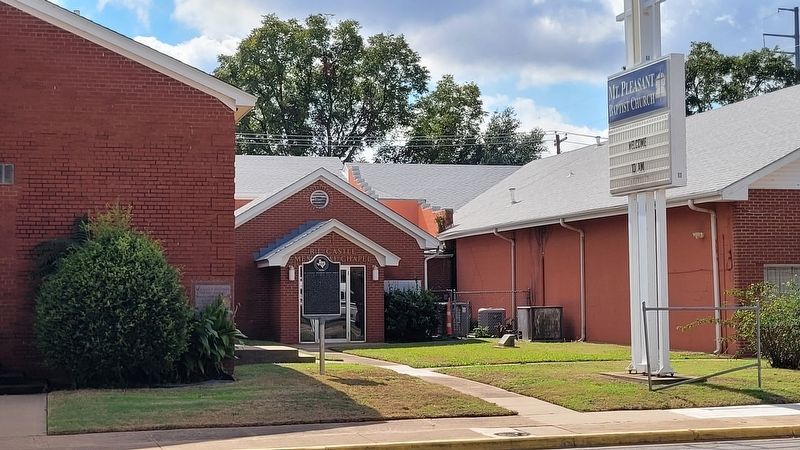
2. Mt. Pleasant Missionary Baptist Church and Marker

Photographed by James Hulse, October 26, 2025
3. Mt. Pleasant Missionary Baptist Church
Credits. This page was last revised on August 29, 2026. It was originally submitted on October 26, 2025, by James Hulse of Medina, Texas. This page has been viewed 57 times since then and 32 times this year. Photos: 1, 2, 3. submitted on October 26, 2025, by James Hulse of Medina, Texas.
