Black Hawk in Gilpin County, Colorado — The American Mountains (Southwest)
Black Hawk History - Railroad Trestles
Photographed by Leslie Eudy
1. Black Hawk History - Railroad Trestles Marker
Gilpin County, Colorado
Black Hawk History
Railroad Trestles
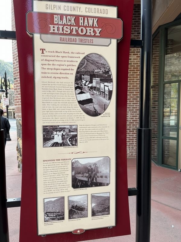
To reach Black Hawk, the railroad constructed the open framework of diagonal braces or trestles to span the region’s gulches. The steep slopes required the train to reverse direction on switched, zig-zag tracks.
Edward Berthoud, who had surveyed the original line up Clear Creek Canyon, planned the new Colorado Central Railroad Spur Extension from Black Hawk to Central City route in May, 1877. Though little more than a mile up Gregory Gulch along the city streets, the reduced grade necessary for the train required that Berthoud plan a route that included two switchbacks–one at either end of Black Hawk–on a spur that eventually measured 4 ½ miles. After making the switchback at the north end of town, the road came back along the eastern flank at Bates Hill, and crossed Gregory Street at a post right next to–practically on top of– the new City Hall property. In fact, work on the track was going on at the same time as the City Hall construction, and just a month after the dedication, the Register reported on January 7, 1878 that the “northerly pier of the
this page online
With the obstacle of Gregory and Selak Streets surmounted, work continued on the remainder of the spur. Two other trestles were needed, at Running Gulch on the south end of Black Hawk, and across Packard Gulch in Mountain City. Work continued into Central City–at a cost for the segment of about $25,000 a mile–and reached the town on the fourth anniversary of the great fire, May 21, 1878.
Spanning the Terrain
A trestle over 200 feet long and 20 feet in the air spanned the street…The 150 foot bridge that formed the greater part of this span was fabricated in Chicago and shipped to Black Hawk: it arrived in late January, as the Register breathlessly reported [January 7, 1878]: “The bridge is here, and is being removed from the depot to the place of erection…three spans, the northerly and middle spans being each 65 feet in length, and the southerly span 45 feet. The bridge proper cost $4,500; the bridge and masonry work about $6,000…the bridge will be ready for the passage of trains in about ten days.”
Topics. This historical marker

Photographed by Leslie Eudy, October 23, 2025
2. Black Hawk History - Railroad Trestles Marker wide view
Location. 39° 47.915′ N, 105° 29.102′ W. Marker is in Black Hawk, Colorado, in Gilpin County. It is at the intersection of Main Street and Miners Mesa Road, on the left when traveling west on Main Street. Marker is on the south end of Black Hawk on Main Street at the corner of Main Street and Miners Mesa Road. When heading north on Highway 119, take a left on Main Street. Marker is on the left. Touch for map. Marker is at or near this postal address: 333 Main Street, Black Hawk CO 80422, United States of America. Touch for directions.

Regionally, this marker is in the Colorado High Rockies. It is also in the American Mountain West. Globally, it is in North America, the Rocky Mountains, the Western Hemisphere, the Western World, and the Anglosphere.
Other nearby markers. At least 8 other markers are within walking distance of this marker: Colorado Central Railroad (about 400 feet away, measured in a direct line); Black Hawk History - Fire Department (about 400 feet away); Black Hawk History - Public School (about 500 feet away); Black Hawk History - Transportation (approx. 0.2 miles away); Black Hawk History - Mining (approx. ¼ mile away); Black Hawk History - Main Street (approx. 0.4 miles away); Black Hawk History - Business (approx. 0.4 miles away); Gilpin Hotel (approx. half a mile away). Touch for a list and map of all markers in Black Hawk.
Credits. This page was last revised on November 2, 2025. It was originally submitted on October 29, 2025, by Leslie Eudy of Golden, Colorado. This page has been viewed 55 times since then and 28 times this year. Photos: 1, 2. submitted on October 29, 2025, by Leslie Eudy of Golden, Colorado. • Andrew Ruppenstein was the editor who published this page.
