
Black Hawk in Gilpin County, Colorado — The American Mountains (Southwest)
Black Hawk History - Fire Department

Photographed by Leslie Eudy
1. Black Hawk History - Fire Department Marker
Gilpin County, Colorado
Black Hawk History
Fire Department
Miraculously, the town of Black Hawk was spared the devastating fires that destroyed many early mining camps.
“As we go to press (2 a.m.) a terrible fire is raging on the mountains north and east of Black Hawk. At one time it was thought the lower portion of the city of Black Hawk was in danger and hundreds of men turned out to render all the aid in their power, but fortunately there was no need of their services in that quarter. From appearances the fire commenced near the Sensenderfer mill on North Clear Creek and swept rapidly up the mountain toward Dora Hill, soon enveloping the whole mountain top in a sheet of flame unless the wind abates, the whole country north of Clear Creek will be devastated.”
The Register, February 21, 1873
“Through the efficiency of the Black Hawk Fire Department, the main thoroughfare of that city was well sprinkled today, it having become quite dusty.”
The Register, April 16, 1880
Fireman’s Ball
“The grand annual ball of the Black Hawk fire department, which took place last night, was in every respect what everybody
this page online
The Register, December 30, 1881
Fire!
“…a fire alarm was given, which brought out the fire department of that place. Some person not fearing God, man or the devil, maliciously and feloniously set fire to the saloon building on the opposite side of the street from the Black Hawk bakery, which was entirely consumed. It is quite evident that it had to be burned, since this is the fifth attempt to burn it.”
The Register, February 13, 1880
Topics. This historical marker is listed in these topic lists: Disasters • Settlements & Settlers.
Location. 39° 47.918′ N, 105° 29.192′ W. Marker is in Black Hawk, Colorado, in Gilpin County. It is on Main Street, on the right when traveling west. Marker is on the south end of Black Hawk on Main Street at the bus stop for the Lady Luck Casino. When heading north on Highway 119, take a left on Main Street. Marker is on the right attached to the

Photographed by Leslie Eudy, October 24, 2025
2. Black Hawk History - Fire Department Marker wide area

Regionally, this marker is in the Colorado High Rockies. It is also in the American Mountain West. Globally, it is in North America, the Rocky Mountains, the Western Hemisphere, the Western World, and the Anglosphere.
Other nearby markers. At least 8 other markers are within walking distance of this marker: Colorado Central Railroad (a few steps from this marker); Black Hawk History - Railroad Trestles (about 400 feet away, measured in a direct line); Black Hawk History - Transportation (about 600 feet away); Black Hawk History - Mining (approx. 0.2 miles away); Black Hawk History - Public School (approx. 0.2 miles away); Black Hawk History - Main Street (approx. 0.3 miles away); Black Hawk History - Business (approx. 0.4 miles away); Gilpin Hotel (approx. 0.4 miles away). Touch for a list and map of all markers in Black Hawk.
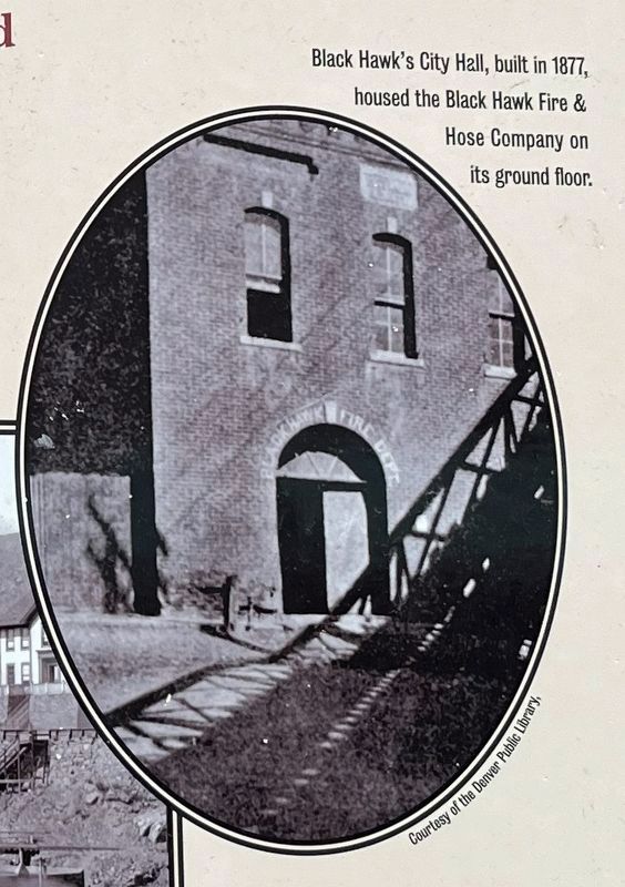
3. Upper Photo on Marker
Black Hawk’s City Hall, built in 1877, housed the Black Hawk Fire & Hose Company on its ground floor.

4. Map in detail
Detail of an 1886 fire insurance map created by the Sanborn Map & Publishing Co. Ltd. which shows notations of the materials and operations of structures for use by insurance companies in assessing building and environmental risks.
Credits. This page was last revised on November 2, 2025. It was originally submitted on October 29, 2025, by Leslie Eudy of Golden, Colorado. This page has been viewed 55 times since then and 27 times this year. Photos: 1, 2, 3, 4. submitted on October 29, 2025, by Leslie Eudy of Golden, Colorado. • Andrew Ruppenstein was the editor who published this page.
