Milford Mine Memorial Park near Wolford in Crow Wing County, Minnesota — The American Midwest (Upper Plains)
The Cuyuna Iron Range
| — | Milford Mine Memorial Park | — |
Photographed by McGhiever, June 27, 2025
1. The Cuyuna Iron Range Marker
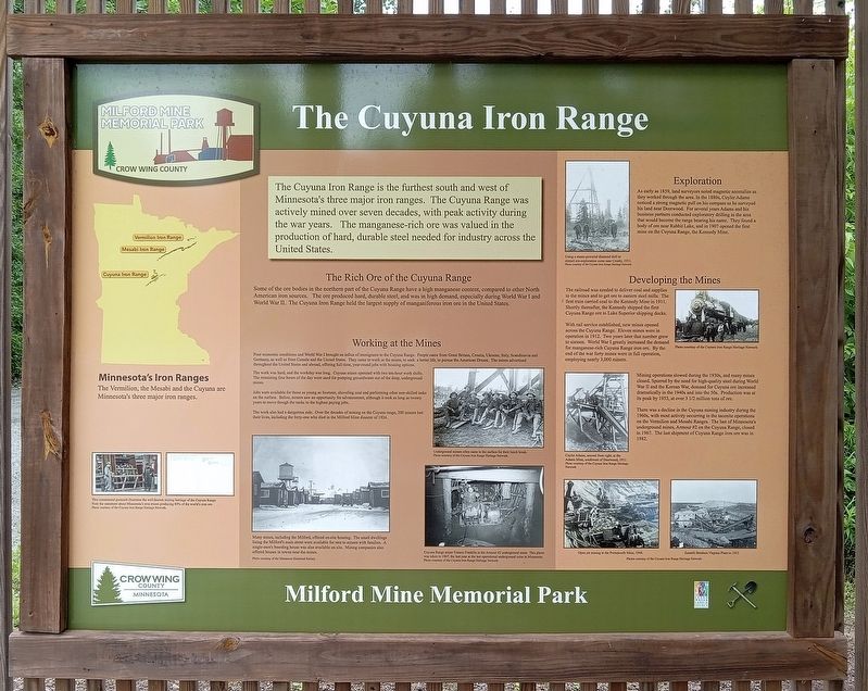
Minnesota's Iron Ranges
The Vermilion, the Mesabi and the Cuyuna are Minnesota's three major iron ranges.
This commercial postcard illustrates the well-known mining heritage of the Cuyuna Range. Note the statement about Minnesota's iron mines producing 80% of the world's iron ore.
Photo courtesy of the Cuyuna Iron Range Heritage Network.
The Cuyuna Iron Range is the furthest south and west of Minnesota's three major iron ranges. The Cuyuna Range was actively mined over seven decades, with peak activity during the war years. The manganese-rich ore was valued in the production of hard, durable steel needed for industry across the United States.
this page online
The work was hard, and the workday was long. Cuyuna mines operated with two ten-hour work shifts. The remaining four hours of the day were used for pumping groundwater out of the deep, underground mines.
Jobs were available for those as young as fourteen, shoveling coal and performing other non-skilled tasks on the surface. Below, miners saw an opportunity for advancement, although it took as long as twenty years to move through the ranks to the highest paying jobs.
The work also had a dangerous side. Over the decades of mining on the Cuyuna range, 200 miners lost their lives, including the forty-one who died in the Milford Mine disaster of 1924.
Many mines, including the Milford, offered on-site housing. The small dwellings lining the Milford's main street were available for rent to miners with families. A single-men's boarding house was also available on site. Mining companies also offered houses in towns near the mines.
Photo courtesy of the Minnesota Historical Society
Underground miners often came to the surface for their lunch break.
Photo courtesy of the Cuyuna Iron Range Heritage Network.
Cuyuna Range miner Francis Franklin in the Armour #2 underground mine. This photo was taken in 1967, the last year at the last operational underground mine in Minnesota.
Photo courtesy of the Cuyuna Iron Range Heritage Network
Photographed by McGhiever, June 27, 2025
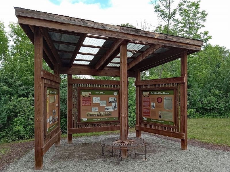
2. The Cuyuna Iron Range Marker (left)
Using a steam-powered diamond drill to extract ore-exploration cores near Crosby, 1911.
Photo courtesy of the Cuyuna Iron Range Heritage Network
With rail service established, new mines opened across the Cuyuna Range. Eleven mines were in operation in 1912. Two years later that number grew to sixteen. World War I greatly increased the demand for manganese-rich Cuyuna Range iron ore. By the end of the war forty mines were in full operation, employing nearly 3,000 miners.
Photo courtesy of the Cuyuna Iron Range Heritage Network
Mining operations slowed during the 1930s, and many mines closed. Spurred by the need for high-quality steel during World War II and the Korean War, demand for Cuyuna ore increased dramatically in the 1940s and into the 50s. Production was at its peak by 1953, at over 3 1/2 million tons of ore.
There was a decline in the Cuyuna mining industry during the 1960s, with most activity occurring in the taconite operations on the Vermilion and Mesabi Ranges. The last of Minnesota's underground mines, Armour #2 on the Cuyuna Range, closed in 1967. The last shipment of Cuyuna Range iron ore was in 1982.
Cuyler Adams, second from right, at the Adams Mine, southwest of Deerwood, 1911
Photo courtesy of the Cuyuna Iron Range Heritage Network
Open pit mining at the Portsmouth Mine, 1948.
Zoetrill Brothers Virgina Plan in 1953
Photos courtesy of the Cuyuna Iron Range Heritage Network
Erected by Crow Wing County.
Topics. This historical marker is listed in these topic lists: Industry & Commerce • Railroads & Streetcars • War, World I • War, World II. A significant historical year for this entry is 1907.
Location. 46° 32.11′ N, 93° 58.338′ W. Marker is near Wolford, Minnesota, in Crow Wing County. It is in Milford Mine Memorial Park. It is on Milford Lake Drive. The marker is on a kiosk shelter near trail intersection 2. Touch for map. Marker is in this post office area: Crosby MN 56441, United States of America. Touch for directions.

Regionally, this marker is in the Northland. It is also in the American Midwest, in the Corn Belt, and in the Great River Road Region. Globally, it is in North America, the Great North Woods, the Western Hemisphere, the Western World, and the Anglosphere. Historically, it finds itself in what was once Rupert’s Land, the territory of the Mississippian Culture, and the Northwest Territory.
Other nearby markers. At least 8 other markers are within walking distance of this marker: Milford Mine (here, next to this marker); The Milford Mine Disaster (here, next to this marker); The Mine Shaft (a few steps from this marker); Mine Shaft Entrance (a few steps from this marker); Repair Shop (within shouting distance of this marker); Milford Miners (within shouting distance of this marker); Example of Timberwork Along the Main Shaft (within shouting distance of this marker); Exploratory Drill Hole (within shouting distance of this marker). Touch for a list and map of all markers in Wolford.
Credits. This page was last revised on October 30, 2025. It was originally submitted on October 30, 2025, by McGhiever of Minneapolis, Minnesota. This page has been viewed 71 times since then and 36 times this year. Photos: 1. submitted on October 30, 2025, by McGhiever of Minneapolis, Minnesota. 2. submitted on October 19, 2025, by McGhiever of Minneapolis, Minnesota.
