Ricardo in Kleberg County, Texas — The American South (West South Central)
First Producing Gas Well in Kleberg County
(3.3 Miles East)
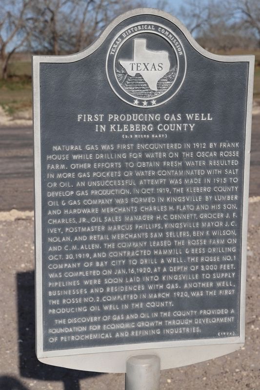
Photographed by Dave W, March 19, 2022
1. First Producing Gas Well in Kleberg County Marker
The discovery of gas and oil in the county provided a foundation for economic growth through development of petrochemical and refining industries.
Erected 1974 by Texas Historical Commission. (Marker Number 2111.)
Topics. This historical marker is listed in this topic list: Natural Resources. A significant historical year for this entry is 1912.
Location. 27° 26.664′ N, 97° 51.448′ W. Marker is in Ricardo, Texas, in Kleberg County. It is at the intersection of U.S. 77 and County Road 2130, on the right when traveling north on U.S. 77. Touch for map. Marker is at or near this postal address: 120 US-77, Kingsville TX 78363, United States of America. Touch for directions.

Regionally, this marker is on the American Gulf Coast. Globally, it is in North America, a Gulf of Mexico state, the Western Hemisphere,
this page online
Other nearby markers. At least 8 other markers are within 5 miles of this marker, measured as the crow flies: Presbyterian Pan American School (approx. 0.7 miles away); Taylor Camp Site, 1846 (approx. 3.1 miles away); U.S. Naval Auxiliary Air Station - Kingsville (approx. 3.6 miles away); First Christian Church (Disciples of Christ) (approx. 3.7 miles away); Dawson Richard Murchison (approx. 4.4 miles away); Chamberlain Cemetery (approx. 4.4 miles away); St. Paul Lutheran Church (approx. 4½ miles away); King Star Baptist Church (approx. 4.7 miles away).

Photographed by Dave W, March 19, 2022
2. First Producing Gas Well in Kleberg County Marker
Credits. This page was last revised on November 8, 2025. It was originally submitted on November 4, 2025, by Dave W of Co, Colorado. This page has been viewed 130 times since then and 83 times this year. Photos: 1, 2. submitted on November 4, 2025, by Dave W of Co, Colorado. • James Hulse was the editor who published this page.
