Brampton in Peel Region, Ontario — Central Canada (North America)
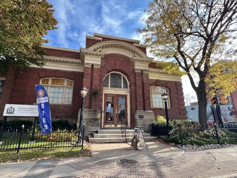
Carnegie Library
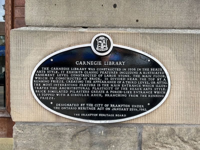
Photographed by Tim Boyd, November 2, 2025
1. Carnegie Library Marker
Erected 1982 by The Brampton Heritage Board.
Topics and series. This historical marker is listed in these topic lists: Architecture • Education. In addition, it is included in the Carnegie Libraries series list. A significant historical year for this entry is 1906.
Location. 43° 41.224′ N, 79° 45.507′ W. Marker is in Brampton, Ontario, in Peel Region. It is at the intersection of Queen Street East and Chapel Street, on the right when traveling east on Queen Street East. Touch for map. Marker is at or near this postal address: 55A Queen Street E, Brampton ON L6W 2A8,
this page online

Regionally, this marker is in Greater Toronto, specifically on the Golden Horseshoe, and in the Toronto Metropolitan Area. It is also in Central Canada. Globally, it is in North America, on the Great Lakes, in the Western Hemisphere, in the Western World, and in the Anglosphere. Historically, it finds itself in what was once a British colony, the Viceroyalty of New France, the Haudenosaunee (Iroquois) Confederacy, and Rupert’s Land.
Other nearby markers. At least 8 other markers are within walking distance of this marker: The Old Fire Hall (a few steps from this marker); 20th Regiment Halton Rifles/ 36th Peel Regiment (within shouting distance of this marker); The Armstrong House (about 90 meters away, measured in a direct line); William Perkins Bull, K.C., LL.D. / William Perkins Bull, C.R., LL.D. (about 210 meters away); St. Paul’s United Church (about 210 meters away); Brampton Cenotaph (approx. 0.3 kilometers away); The Etobicoke Creek (approx. 0.3 kilometers away); Sir William James Gage (approx. 0.3 kilometers away). Touch for a list and map of all markers in Brampton.
Another
Photographed by Tim Boyd, November 2, 2025
2. Carnegie Library Marker

Photographed by Tim Boyd, November 2, 2025
3. Former Carnegie Library, 2025
Marker is visible at the centre of the photo
Credits. This page was last revised on November 7, 2025. It was originally submitted on November 5, 2025, by Tim Boyd of Hamilton, Ontario. This page has been viewed 63 times since then and 25 times this year. Photos: 1, 2, 3. submitted on November 5, 2025, by Tim Boyd of Hamilton, Ontario. • Andrew Ruppenstein was the editor who published this page.
